Estimated Value: $378,750 - $466,000
4
Beds
3
Baths
2,233
Sq Ft
$191/Sq Ft
Est. Value
About This Home
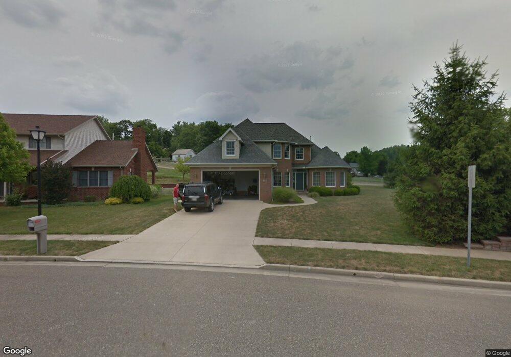
This home is located at 101 Howard Dr, Dover, OH 44622 and is currently estimated at $427,438, approximately $191 per square foot. 101 Howard Dr is a home located in Tuscarawas County with nearby schools including Dover High School and Tuscarawas Central Catholic Elementary School.
Ownership History
Date
Name
Owned For
Owner Type
Purchase Details
Closed on
Aug 26, 2010
Sold by
Maurer Robin and Griesen Robin
Bought by
Griesen Robin and Griesen Michael A
Current Estimated Value
Home Financials for this Owner
Home Financials are based on the most recent Mortgage that was taken out on this home.
Original Mortgage
$208,500
Outstanding Balance
$138,793
Interest Rate
4.6%
Mortgage Type
New Conventional
Estimated Equity
$288,645
Purchase Details
Closed on
Dec 17, 2003
Sold by
Miller Roy W and Miller Leanna E
Bought by
Maurer Robin
Home Financials for this Owner
Home Financials are based on the most recent Mortgage that was taken out on this home.
Original Mortgage
$215,650
Interest Rate
6.03%
Mortgage Type
Credit Line Revolving
Purchase Details
Closed on
Apr 25, 2002
Sold by
M & P Development Llc
Bought by
Miller Roy W
Home Financials for this Owner
Home Financials are based on the most recent Mortgage that was taken out on this home.
Original Mortgage
$35,000
Interest Rate
7.13%
Mortgage Type
New Conventional
Create a Home Valuation Report for This Property
The Home Valuation Report is an in-depth analysis detailing your home's value as well as a comparison with similar homes in the area
Home Values in the Area
Average Home Value in this Area
Purchase History
| Date | Buyer | Sale Price | Title Company |
|---|---|---|---|
| Griesen Robin | -- | Patriot Title Agency Inc | |
| Maurer Robin | $227,000 | Titlesource | |
| Miller Roy W | $35,000 | -- |
Source: Public Records
Mortgage History
| Date | Status | Borrower | Loan Amount |
|---|---|---|---|
| Open | Griesen Robin | $208,500 | |
| Closed | Maurer Robin | $215,650 | |
| Previous Owner | Miller Roy W | $35,000 |
Source: Public Records
Tax History
| Year | Tax Paid | Tax Assessment Tax Assessment Total Assessment is a certain percentage of the fair market value that is determined by local assessors to be the total taxable value of land and additions on the property. | Land | Improvement |
|---|---|---|---|---|
| 2024 | $4,375 | $292,080 | $57,880 | $234,200 |
| 2023 | $4,375 | $292,080 | $57,880 | $234,200 |
| 2022 | $4,417 | $102,228 | $20,258 | $81,970 |
| 2021 | $3,629 | $78,866 | $15,194 | $63,672 |
| 2020 | $3,630 | $78,866 | $15,194 | $63,672 |
| 2019 | $3,656 | $78,866 | $15,194 | $63,672 |
| 2018 | $3,865 | $78,860 | $15,190 | $63,670 |
| 2017 | $3,865 | $78,860 | $15,190 | $63,670 |
| 2016 | $3,865 | $78,860 | $15,190 | $63,670 |
| 2014 | $3,340 | $74,030 | $15,190 | $58,840 |
| 2013 | $3,371 | $74,030 | $15,190 | $58,840 |
Source: Public Records
Map
Nearby Homes
- 401 E 18th St
- 806 Forrest Ridge Dr
- 312 E 21st St
- 3030 N Wooster Ave
- 201 E 12th St
- 107 W 21st St
- 1202 N Wooster Ave
- 209 Aspen Dr Unit 209
- 213 E 27th St
- 111 Crimson Cir
- 2815 Race St
- 1220 Chestnut St
- 601 E 4th St
- 0 Ohio Ave Unit 5188259
- 715 N Walnut St
- 1109 E Front St
- 3689 Reichman Dr NW
- 214 Poplar St
- 835 Chelsea Dr
- 0 W Ohio Ave
- 105 Howard Dr
- 113 Howard Dr
- 104 Howard Dr
- 1244 Deis Ln NW
- 112 Howard Dr
- 121 Howard Dr
- 1249 Deis Ln NW
- 1250 Deis Ln NW
- 1549 N Crater Ave
- 120 Howard Dr
- 1537 N Crater Ave
- 129 Howard Dr
- 1572 N Crater Ave
- 128 Howard Dr
- 137 Howard Dr
- 1264 Deis Ln NW
- 1576 N Crater Ave
- 1268 Deis Ln NW
- 136 Howard Dr
- 1267 Deis Ln NW
Your Personal Tour Guide
Ask me questions while you tour the home.