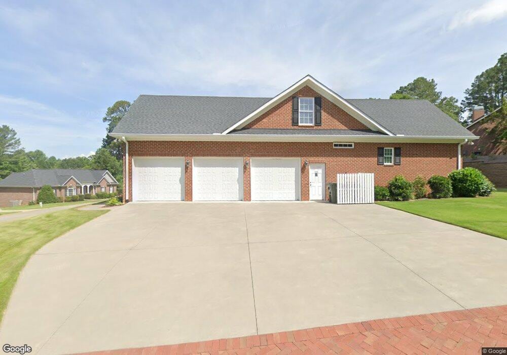
101 Jennings Dr Easley, SC 29642
Estimated Value: $400,000 - $441,000
3
Beds
2
Baths
2,335
Sq Ft
$181/Sq Ft
Est. Value
About This Home
This home is located at 101 Jennings Dr, Easley, SC 29642 and is currently estimated at $423,350, approximately $181 per square foot. 101 Jennings Dr is a home with nearby schools including Forest Acres Elementary School, Richard H. Gettys Middle School, and Easley High School.
Ownership History
Date
Name
Owned For
Owner Type
Purchase Details
Closed on
Nov 1, 2024
Sold by
Buffington Joan H
Bought by
Deborah Joan Hendricks Buffington Revocable T and Buffington
Current Estimated Value
Purchase Details
Closed on
Jan 23, 2015
Sold by
King #5 Prickens Acreage Llc
Bought by
Buffington Joan H
Purchase Details
Closed on
Jun 21, 2011
Sold by
King Property Associates Lp
Bought by
King #5 Pickens Acreage Llc
Purchase Details
Closed on
Jun 20, 2011
Sold by
King Randal L
Bought by
King Judy P
Create a Home Valuation Report for This Property
The Home Valuation Report is an in-depth analysis detailing your home's value as well as a comparison with similar homes in the area
Home Values in the Area
Average Home Value in this Area
Purchase History
| Date | Buyer | Sale Price | Title Company |
|---|---|---|---|
| Deborah Joan Hendricks Buffington Revocable T | -- | None Listed On Document | |
| Deborah Joan Hendricks Buffington Revocable T | -- | None Listed On Document | |
| Buffington Joan H | $27,000 | -- | |
| King #5 Pickens Acreage Llc | -- | -- | |
| King Property Associates Lp | -- | -- | |
| King Judy P | -- | -- |
Source: Public Records
Tax History Compared to Growth
Tax History
| Year | Tax Paid | Tax Assessment Tax Assessment Total Assessment is a certain percentage of the fair market value that is determined by local assessors to be the total taxable value of land and additions on the property. | Land | Improvement |
|---|---|---|---|---|
| 2024 | $2,829 | $10,910 | $1,320 | $9,590 |
| 2023 | $1,033 | $10,910 | $1,320 | $9,590 |
| 2022 | $0 | $10,910 | $1,320 | $9,590 |
| 2021 | $1,076 | $10,910 | $1,320 | $9,590 |
| 2020 | $1,076 | $10,908 | $1,320 | $9,588 |
| 2019 | $1,076 | $10,910 | $1,320 | $9,590 |
| 2018 | $1,076 | $10,620 | $1,080 | $9,540 |
| 2017 | $999 | $10,620 | $1,080 | $9,540 |
| 2015 | $479 | $1,620 | $0 | $0 |
| 2008 | -- | $1,740 | $1,740 | $0 |
Source: Public Records
Map
Nearby Homes
- 108 Commons Dr
- 303 Robinall Dr
- 313 Haverhill Cir
- 406 Huntington Rd
- 110 Baldwin Place
- 101 Robinall Dr
- 203 Evergreen St
- 100 Eisenhower St
- 102 Julian Ct
- 250 Chickadee Trail
- 249 Chickadee Trail
- 116 Kennedy St
- 120 Indigo Cir
- 260 Audubon Acres Dr
- 116 Indigo Cir
- 114 Indigo Cir
- 123 Indigo Cir
- 301 Indigo Cir
- 208 Spring Dr
- 203 Crescent St
- 3 Mcalister Trace
- 103 Mcalister Trace
- 103 Jennings Dr
- 104 Mcalister Trace
- 100 Jennings Dr
- 200 Mcalister Trace
- 200 Mcalister Trace
- 102 Mcalister Trace
- 104 Bridgewater Dr
- 104 Jennings Dr
- 202 Mcalister Rd
- 203 Mcalister Trace
- 202 Mcalister Trace
- 910 Mcalister Rd
- 106 Jennings Dr
- 924 Mcalister Rd
- 906 Mcalister Rd
- 105 Beachwood St
- 116 Commons Dr
- 106 Bridgewater Dr