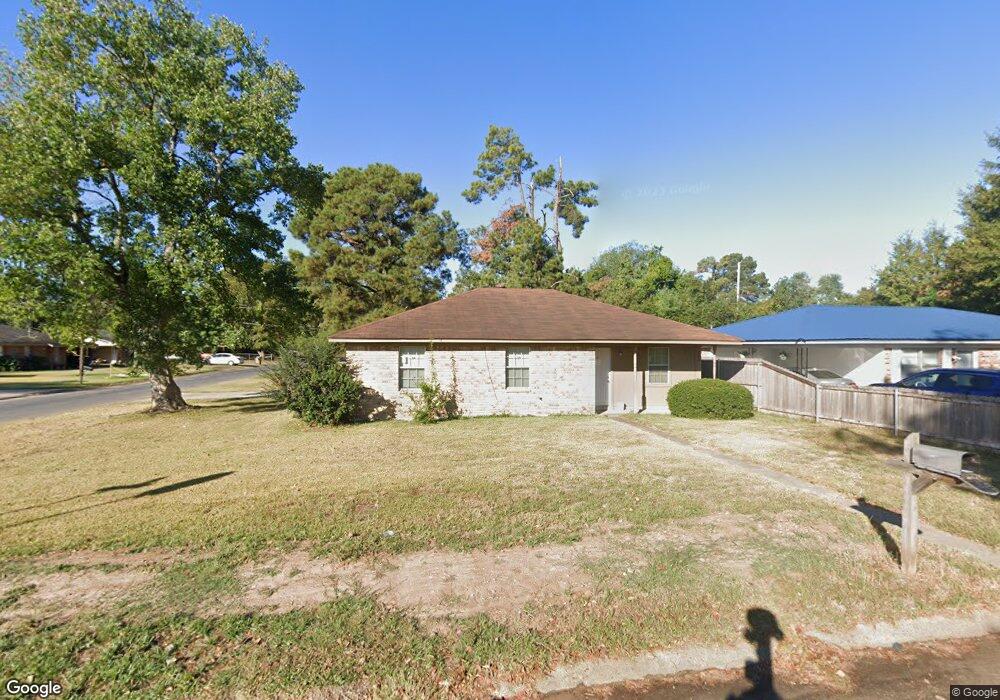
101 Jerald Dr Monroe, LA 71203
Estimated Value: $78,000 - $131,000
3
Beds
2
Baths
1,424
Sq Ft
$70/Sq Ft
Est. Value
About This Home
This home is located at 101 Jerald Dr, Monroe, LA 71203 and is currently estimated at $99,667, approximately $69 per square foot. 101 Jerald Dr is a home located in Ouachita Parish with nearby schools including Swartz Lower Elementary School, Swartz Upper Elementary School, and Ouachita Junior High School.
Ownership History
Date
Name
Owned For
Owner Type
Purchase Details
Closed on
Jun 29, 2021
Sold by
Skg Investment Group Llc
Bought by
Sebastian Rent Llc
Current Estimated Value
Home Financials for this Owner
Home Financials are based on the most recent Mortgage that was taken out on this home.
Original Mortgage
$775,287
Outstanding Balance
$695,781
Interest Rate
2.9%
Mortgage Type
Purchase Money Mortgage
Estimated Equity
-$596,114
Purchase Details
Closed on
Oct 30, 2008
Sold by
Mcdowell Melvin Bernard and Mcdowell Julia Brown
Bought by
Skg Investment Group Llc
Home Financials for this Owner
Home Financials are based on the most recent Mortgage that was taken out on this home.
Original Mortgage
$111,751
Interest Rate
5.83%
Mortgage Type
Purchase Money Mortgage
Create a Home Valuation Report for This Property
The Home Valuation Report is an in-depth analysis detailing your home's value as well as a comparison with similar homes in the area
Purchase History
| Date | Buyer | Sale Price | Title Company |
|---|---|---|---|
| Sebastian Rent Llc | $950,000 | None Available | |
| Skg Investment Group Llc | $35,000 | None Available |
Source: Public Records
Mortgage History
| Date | Status | Borrower | Loan Amount |
|---|---|---|---|
| Open | Sebastian Rent Llc | $775,287 | |
| Previous Owner | Skg Investment Group Llc | $111,751 |
Source: Public Records
Tax History
| Year | Tax Paid | Tax Assessment Tax Assessment Total Assessment is a certain percentage of the fair market value that is determined by local assessors to be the total taxable value of land and additions on the property. | Land | Improvement |
|---|---|---|---|---|
| 2025 | $480 | $3,400 | $544 | $2,856 |
| 2024 | $480 | $3,400 | $544 | $2,856 |
| 2023 | $483 | $3,400 | $544 | $2,856 |
| 2022 | $465 | $3,400 | $544 | $2,856 |
| 2021 | $469 | $3,400 | $544 | $2,856 |
| 2020 | $469 | $3,400 | $544 | $2,856 |
| 2019 | $463 | $3,400 | $544 | $2,856 |
| 2018 | $442 | $3,400 | $544 | $2,856 |
| 2017 | $453 | $3,400 | $544 | $2,856 |
| 2016 | $442 | $3,400 | $544 | $2,856 |
| 2015 | $441 | $3,400 | $544 | $2,856 |
| 2014 | $441 | $3,400 | $544 | $2,856 |
| 2013 | $440 | $3,400 | $544 | $2,856 |
Source: Public Records
Map
Nearby Homes
- 306 Taylor Dr
- 158 Barbara Dr
- 228 Eisenhower Dr
- 338 Bower Rd
- 285 Stubbs Vinson Rd
- 0 Braebend Dr
- 200 Bennett Lake Dr
- 374 Stubbs Vinson Rd
- 1141 Rowland Rd
- 0 Rowland Rd
- 2210 Highway 594
- 2238 Highway 594
- 318 Monarch Dr
- 142 Dallas Dr
- 138 Dallas Dr
- 148 Dallas Dr
- 22 Southlake Dr
- 142 Jesse Ln
- 102 Patrick Place
- 101 Timber Ln
Your Personal Tour Guide
Ask me questions while you tour the home.