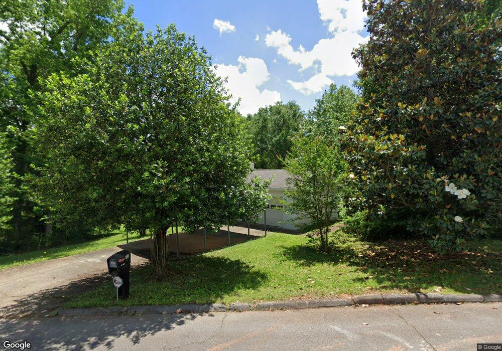
101 Kay Ln Carrollton, GA 30117
Estimated Value: $265,618 - $320,000
3
Beds
2
Baths
1,635
Sq Ft
$185/Sq Ft
Est. Value
About This Home
This home is located at 101 Kay Ln, Carrollton, GA 30117 and is currently estimated at $302,405, approximately $184 per square foot. 101 Kay Ln is a home located in Carroll County with nearby schools including Carrollton Elementary School, Carrollton Upper Elementary School, and Carrollton Middle School.
Ownership History
Date
Name
Owned For
Owner Type
Purchase Details
Closed on
Dec 29, 2016
Sold by
Ivey Cindy Michelle
Bought by
Land Margaret Donald
Current Estimated Value
Purchase Details
Closed on
Feb 20, 2012
Sold by
May William E
Bought by
May Dana Christopher
Purchase Details
Closed on
Oct 19, 2000
Sold by
Tyler Marla
Bought by
May William E and May Mary F
Purchase Details
Closed on
Jan 2, 1998
Sold by
Williams Karen E
Bought by
Tyler Marla
Purchase Details
Closed on
Jul 31, 1992
Sold by
Johnson Roland D
Bought by
Williams Karen E
Purchase Details
Closed on
Jun 1, 1980
Sold by
Johnson Roland D and Johnson Phyllis A
Bought by
Johnson Roland D
Purchase Details
Closed on
Mar 22, 1974
Sold by
H & S Developers
Bought by
Johnson Roland D and Johnson Phyllis A
Purchase Details
Closed on
Feb 1, 1973
Sold by
Wilson Chester L
Bought by
H & S Developers
Create a Home Valuation Report for This Property
The Home Valuation Report is an in-depth analysis detailing your home's value as well as a comparison with similar homes in the area
Home Values in the Area
Average Home Value in this Area
Purchase History
| Date | Buyer | Sale Price | Title Company |
|---|---|---|---|
| Land Margaret Donald | $125,000 | -- | |
| May Dana Christopher | -- | -- | |
| May William E | $108,000 | -- | |
| Tyler Marla | $88,000 | -- | |
| Williams Karen E | $66,800 | -- | |
| Johnson Roland D | -- | -- | |
| Johnson Roland D | $16,000 | -- | |
| H & S Developers | $5,000 | -- |
Source: Public Records
Tax History Compared to Growth
Tax History
| Year | Tax Paid | Tax Assessment Tax Assessment Total Assessment is a certain percentage of the fair market value that is determined by local assessors to be the total taxable value of land and additions on the property. | Land | Improvement |
|---|---|---|---|---|
| 2024 | $595 | $100,488 | $10,000 | $90,488 |
| 2023 | $578 | $92,437 | $10,000 | $82,437 |
| 2022 | $554 | $75,854 | $10,000 | $65,854 |
| 2021 | $512 | $66,535 | $10,000 | $56,535 |
| 2020 | $483 | $59,808 | $10,000 | $49,808 |
| 2019 | $480 | $56,548 | $10,000 | $46,548 |
| 2018 | $445 | $45,331 | $10,000 | $35,331 |
| 2017 | $451 | $45,331 | $10,000 | $35,331 |
| 2016 | $1,371 | $45,331 | $10,000 | $35,331 |
| 2015 | $1,053 | $34,095 | $6,000 | $28,095 |
| 2014 | $1,058 | $34,095 | $6,000 | $28,095 |
Source: Public Records
Map
Nearby Homes
- 121 Wilson Cir
- 816 Stewart St
- 115 N Lake Dr
- 111 Lakeview Dr
- 2580 Shady Grove Rd
- 325 Almon Rd
- 231 N Lakeshore Dr
- 131 Hunter Way
- 223 N Lakeshore Dr
- 123 Autumn Glen Dr
- 114 Green Point Way
- 123 Cedar Park Way
- 105 Providence Ct
- 221 Turtle Cove
- 2930 Highway 113
- 3 Burns Rd
- 2 Burns Rd
- 255 Morgan Rd
- 777 College St
- The McGinnis Plan at Morgan Landing
- 0 Wilson Dr Unit 9010206
- 0 Wilson Dr Unit 9017602
- 295 Wilson Dr
- 0 Wilson Dr Unit 8844146
- 0 Wilson Dr
- 203 Wilson Dr
- 203 Wilson Dr
- 105 Kay Ln
- 129 Wilson Cir
- 204 Wilson Dr
- 104 Kay Ln
- 108 Lumpkin Dr
- 202 Wilson Dr
- 107 Kay Ln
- 112 Lumpkin Dr
- 106 Kay Ln
- 127 Wilson Cir
- 126 Wilson Cir
- 103 Wilson Cir
- 114 Lumpkin Dr