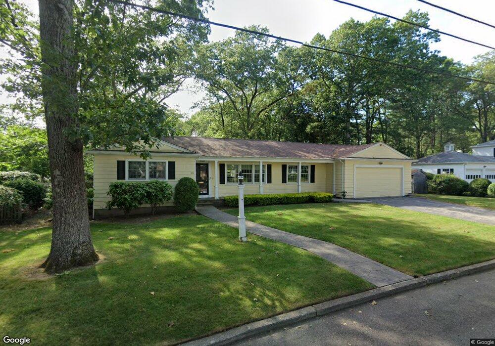
101 King Philip Rd Pawtucket, RI 02861
Darlington NeighborhoodEstimated Value: $617,000 - $746,000
2
Beds
2
Baths
2,219
Sq Ft
$306/Sq Ft
Est. Value
About This Home
This home is located at 101 King Philip Rd, Pawtucket, RI 02861 and is currently estimated at $679,401, approximately $306 per square foot. 101 King Philip Rd is a home located in Providence County with nearby schools including St Cecilia School and Saint Teresa Catholic Elementary School.
Ownership History
Date
Name
Owned For
Owner Type
Purchase Details
Closed on
Jan 20, 2009
Sold by
Haines Scott and Haines Gretchen B
Bought by
Bellows Allan R and Tobman Lois M
Current Estimated Value
Purchase Details
Closed on
Dec 2, 2004
Sold by
Berard Irmagard P
Bought by
Haines Scott and Haines Gretchen B
Home Financials for this Owner
Home Financials are based on the most recent Mortgage that was taken out on this home.
Original Mortgage
$415,000
Interest Rate
5.69%
Mortgage Type
Purchase Money Mortgage
Create a Home Valuation Report for This Property
The Home Valuation Report is an in-depth analysis detailing your home's value as well as a comparison with similar homes in the area
Home Values in the Area
Average Home Value in this Area
Purchase History
| Date | Buyer | Sale Price | Title Company |
|---|---|---|---|
| Bellows Allan R | $250,000 | -- | |
| Haines Scott | $416,500 | -- |
Source: Public Records
Mortgage History
| Date | Status | Borrower | Loan Amount |
|---|---|---|---|
| Previous Owner | Haines Scott | $415,000 |
Source: Public Records
Tax History Compared to Growth
Tax History
| Year | Tax Paid | Tax Assessment Tax Assessment Total Assessment is a certain percentage of the fair market value that is determined by local assessors to be the total taxable value of land and additions on the property. | Land | Improvement |
|---|---|---|---|---|
| 2024 | $6,682 | $541,500 | $156,700 | $384,800 |
| 2023 | $7,106 | $419,500 | $119,700 | $299,800 |
| 2022 | $6,955 | $419,500 | $119,700 | $299,800 |
| 2021 | $6,955 | $419,500 | $119,700 | $299,800 |
| 2020 | $6,624 | $317,100 | $112,300 | $204,800 |
| 2019 | $6,624 | $317,100 | $112,300 | $204,800 |
| 2018 | $6,383 | $317,100 | $112,300 | $204,800 |
| 2017 | $6,755 | $297,300 | $109,700 | $187,600 |
| 2016 | $6,508 | $297,300 | $109,700 | $187,600 |
| 2015 | $6,508 | $297,300 | $109,700 | $187,600 |
| 2014 | $5,894 | $255,600 | $96,000 | $159,600 |
Source: Public Records
Map
Nearby Homes
- 245 Manton St
- 245 Manton St Unit 83
- 242 St
- 242 Manton #41 St
- 91 Seabiscuit Place
- 1150 Newman Ave
- 87 Baker St
- 63 Whirlaway Place
- 618 Armistice Blvd
- 400 Newport Ave
- 104 Crescent Rd
- 95 Federal St
- 728 Beverage Hill Ave Unit 24
- 66 1st St
- 724 Beverage Hill Ave Unit 302
- 329 Pullen Ave
- 252 Williston Way
- 38 Lowell Ave
- 24 State St
- 16 Edgemere Rd
- 85 King Philip Rd
- 96 Alexander Mcgregor Rd
- 107 King Philip Rd
- 96 King Philip Rd
- 110 Alexander Mcgregor Rd
- 90 King Philip Rd
- 100 King Philip Rd
- 90 Alexander Mcgregor Rd
- 84 King Philip Rd
- 77 King Philip Rd
- 34 Narragansett Ave
- 80 Alexander Mcgregor Rd
- 85 Anawan Rd
- 78 King Philip Rd
- 00 Narragansett Ave
- 15 Narragansett Ave
- 120 Alexander Mcgregor Rd
- 81 Anawan Rd
- 72 King Philip Rd
- 67 King Philip Rd