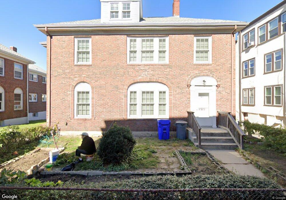
101 Lanark Rd Unit 103 Brighton, MA 02135
Commonwealth NeighborhoodEstimated Value: $1,293,000 - $1,851,000
6
Beds
4
Baths
3,136
Sq Ft
$500/Sq Ft
Est. Value
About This Home
This home is located at 101 Lanark Rd Unit 103, Brighton, MA 02135 and is currently estimated at $1,566,434, approximately $499 per square foot. 101 Lanark Rd Unit 103 is a home located in Suffolk County with nearby schools including Shaloh House Jewish Day School, St Columbkille Partnership School, and Bais Yaakov Of Boston High School.
Ownership History
Date
Name
Owned For
Owner Type
Purchase Details
Closed on
Mar 3, 2015
Sold by
Wong David G
Bought by
Wong Ret
Current Estimated Value
Create a Home Valuation Report for This Property
The Home Valuation Report is an in-depth analysis detailing your home's value as well as a comparison with similar homes in the area
Home Values in the Area
Average Home Value in this Area
Purchase History
| Date | Buyer | Sale Price | Title Company |
|---|---|---|---|
| Wong Ret | -- | -- |
Source: Public Records
Tax History
| Year | Tax Paid | Tax Assessment Tax Assessment Total Assessment is a certain percentage of the fair market value that is determined by local assessors to be the total taxable value of land and additions on the property. | Land | Improvement |
|---|---|---|---|---|
| 2025 | $16,437 | $1,419,400 | $474,400 | $945,000 |
| 2024 | $15,459 | $1,418,300 | $501,900 | $916,400 |
| 2023 | $15,233 | $1,418,300 | $501,900 | $916,400 |
| 2022 | $14,982 | $1,377,000 | $487,300 | $889,700 |
| 2021 | $14,693 | $1,377,000 | $487,300 | $889,700 |
| 2020 | $13,963 | $1,322,300 | $438,000 | $884,300 |
| 2019 | $13,027 | $1,236,000 | $347,800 | $888,200 |
| 2018 | $12,701 | $1,211,900 | $347,800 | $864,100 |
| 2017 | $10,064 | $950,300 | $347,800 | $602,500 |
| 2016 | $10,396 | $945,100 | $347,800 | $597,300 |
| 2015 | $9,076 | $749,500 | $236,800 | $512,700 |
| 2014 | $7,700 | $612,100 | $236,800 | $375,300 |
Source: Public Records
Map
Nearby Homes
- 100 Lanark Rd Unit A
- 100 Lanark Rd Unit 8
- 30 Kinross Rd Unit 1
- 24 Selkirk Rd Unit 24-4
- 8 Kinross Rd Unit 2
- 140 Kilsyth Rd Unit 8
- 1754 Commonwealth Ave Unit B
- 56-58 Selkirk Rd
- 15 Colliston Rd Unit 6
- 1691 Commonwealth Ave Unit 31
- 65 Strathmore Rd Unit 49
- 47 Englewood Ave
- 60 Sutherland Rd Unit 4
- 36 Cummings Rd Unit 1
- 38 Ransom Rd Unit 12
- 38 Ransom Rd Unit 3
- 26 Chiswick Rd Unit 6
- 32 Ransom Rd Unit 4
- 114 Strathmore Rd Unit 102
- 1641 Commonwealth Ave Unit 16
- 103 Lanark Rd Unit 4
- 103 Lanark Rd
- 103 Lanark Rd Unit 1
- 101 Lanark Rd Unit 1
- 103 Lanark Rd
- 101 Lanark Rd Unit 101
- 105 Lanark Rd Unit 107
- 105 Lanark Rd Unit 1
- 105 Lanark Rd
- 136 Sutherland Rd Unit 3
- 136 Sutherland Rd Unit 5
- 136 Sutherland Rd
- 107 Lanark Rd Unit 1
- 134 Sutherland Rd
- 134 Sutherland Rd Unit I
- 134 Sutherland Rd Unit M
- 134 Sutherland Rd Unit E
- 134 Sutherland Rd Unit 3
- 138 Sutherland Rd Unit 1
- 130 Sutherland Rd Unit 14
Your Personal Tour Guide
Ask me questions while you tour the home.