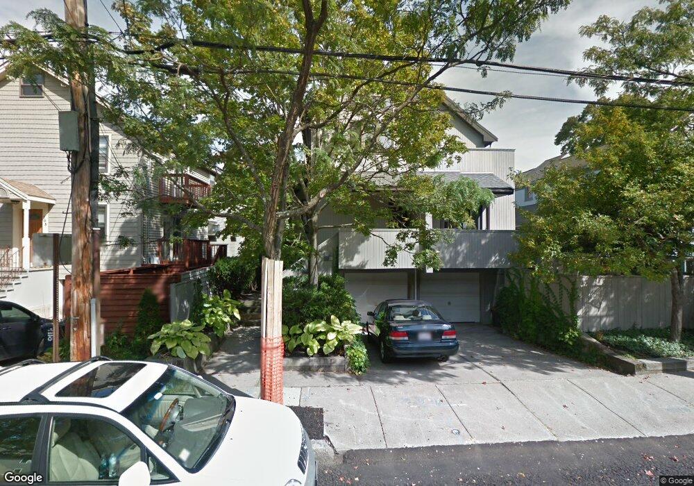
101 Larch Rd Cambridge, MA 02138
West Cambridge NeighborhoodEstimated Value: $1,319,000 - $2,251,551
3
Beds
4
Baths
2,300
Sq Ft
$733/Sq Ft
Est. Value
About This Home
This home is located at 101 Larch Rd, Cambridge, MA 02138 and is currently estimated at $1,686,888, approximately $733 per square foot. 101 Larch Rd is a home located in Middlesex County with nearby schools including Buckingham Browne & Nichols School, Shady Hill School, and Cambridge Friends School.
Ownership History
Date
Name
Owned For
Owner Type
Purchase Details
Closed on
Mar 27, 2013
Sold by
Hopkins Elizabeth W
Bought by
Ottinger Leslie W and Ottinger Joan S
Current Estimated Value
Create a Home Valuation Report for This Property
The Home Valuation Report is an in-depth analysis detailing your home's value as well as a comparison with similar homes in the area
Home Values in the Area
Average Home Value in this Area
Purchase History
| Date | Buyer | Sale Price | Title Company |
|---|---|---|---|
| Ottinger Leslie W | $751,000 | -- | |
| Ottinger Leslie W | $751,000 | -- | |
| Ottinger Leslie W | $751,000 | -- |
Source: Public Records
Mortgage History
| Date | Status | Borrower | Loan Amount |
|---|---|---|---|
| Previous Owner | Ottinger Leslie W | $100,000 |
Source: Public Records
Tax History
| Year | Tax Paid | Tax Assessment Tax Assessment Total Assessment is a certain percentage of the fair market value that is determined by local assessors to be the total taxable value of land and additions on the property. | Land | Improvement |
|---|---|---|---|---|
| 2025 | $13,403 | $2,110,700 | $0 | $2,110,700 |
| 2024 | $13,408 | $2,264,800 | $0 | $2,264,800 |
| 2023 | $11,906 | $2,031,800 | $0 | $2,031,800 |
| 2022 | $11,726 | $1,980,700 | $0 | $1,980,700 |
| 2021 | $11,239 | $1,921,200 | $0 | $1,921,200 |
| 2020 | $10,409 | $1,810,200 | $0 | $1,810,200 |
| 2019 | $10,087 | $1,698,100 | $0 | $1,698,100 |
| 2018 | $9,914 | $1,576,200 | $0 | $1,576,200 |
| 2017 | $9,927 | $1,529,600 | $0 | $1,529,600 |
| 2016 | $9,646 | $1,380,000 | $0 | $1,380,000 |
| 2015 | $9,569 | $1,223,600 | $0 | $1,223,600 |
| 2014 | $9,907 | $1,182,200 | $0 | $1,182,200 |
Source: Public Records
Map
Nearby Homes
- 65 Fresh Pond Pkwy
- 180 Larch Rd
- 497 Mount Auburn St
- 1 Aberdeen Way Unit 102
- 252 Lexington Ave Unit 2
- 252 Lexington Ave Unit 4
- 252 Lexington Ave Unit 1
- 252 Lexington Ave Unit 3
- 35 Homer Ave Unit 7
- 87 Holworthy St
- 59-61 Reservoir St Unit 2
- 172 Brattle St
- 66 Holworthy St
- 4-6 Spruce Ave Unit 3
- 161 Cushing St
- 119 Appleton St
- 159 Brattle St
- 133 Fayerweather St Unit 133
- 157 Brattle St
- 10 Fresh Pond Place Unit 10
- 109 Larch Rd Unit 109
- 103 Larch Rd Unit 1
- 103 Larch Rd Unit 105
- 103 Larch Rd
- 103 Larch Rd Unit 103
- 99 Larch Rd
- 95 Larch Rd Unit 97
- 107 Larch Rd Unit 109
- 91 Larch Rd
- 91 Larch Rd
- 91 Larch Rd Unit 1
- 104 Larch Rd
- 108 Larch Rd
- 112 Larch Rd
- 102 Larch Rd
- 102 Larch Rd Unit 102
- 118 Larch Rd
- 50 Grozier Rd
- 52 Grozier Rd
- 89 Larch Rd Unit 2
Your Personal Tour Guide
Ask me questions while you tour the home.