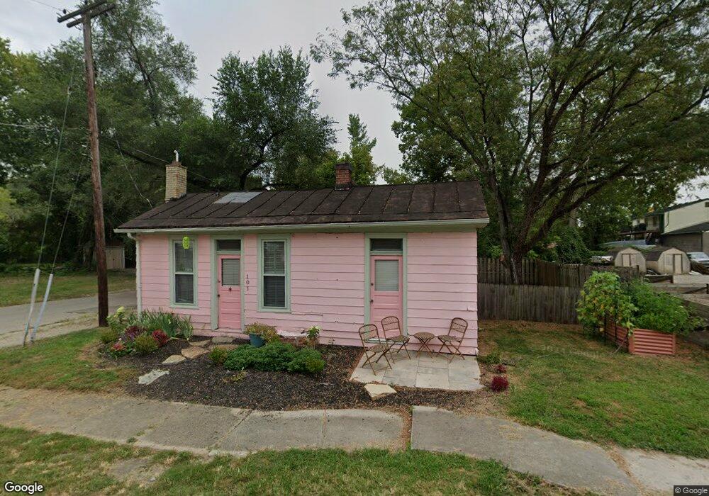
101 Locust St Milford, OH 45150
Estimated Value: $91,787 - $225,000
2
Beds
1
Bath
720
Sq Ft
$222/Sq Ft
Est. Value
About This Home
This home is located at 101 Locust St, Milford, OH 45150 and is currently estimated at $160,197, approximately $222 per square foot. 101 Locust St is a home located in Clermont County with nearby schools including Milford Senior High School and Cincinnati Country Day School.
Ownership History
Date
Name
Owned For
Owner Type
Purchase Details
Closed on
Mar 3, 2022
Sold by
Mcnay Thomas O
Bought by
Dumont Noelle M
Current Estimated Value
Home Financials for this Owner
Home Financials are based on the most recent Mortgage that was taken out on this home.
Original Mortgage
$67,500
Outstanding Balance
$62,901
Interest Rate
3.69%
Mortgage Type
New Conventional
Estimated Equity
$97,296
Purchase Details
Closed on
Dec 2, 1996
Sold by
Lanner Gerald C
Bought by
Mcnay Thomas O and Mcnay Kathleen
Home Financials for this Owner
Home Financials are based on the most recent Mortgage that was taken out on this home.
Original Mortgage
$32,000
Interest Rate
7.94%
Mortgage Type
New Conventional
Create a Home Valuation Report for This Property
The Home Valuation Report is an in-depth analysis detailing your home's value as well as a comparison with similar homes in the area
Home Values in the Area
Average Home Value in this Area
Purchase History
| Date | Buyer | Sale Price | Title Company |
|---|---|---|---|
| Dumont Noelle M | $75,000 | None Listed On Document | |
| Mcnay Thomas O | $40,000 | -- |
Source: Public Records
Mortgage History
| Date | Status | Borrower | Loan Amount |
|---|---|---|---|
| Open | Dumont Noelle M | $67,500 | |
| Previous Owner | Mcnay Thomas O | $32,000 |
Source: Public Records
Tax History Compared to Growth
Tax History
| Year | Tax Paid | Tax Assessment Tax Assessment Total Assessment is a certain percentage of the fair market value that is determined by local assessors to be the total taxable value of land and additions on the property. | Land | Improvement |
|---|---|---|---|---|
| 2024 | $1,269 | $25,690 | $10,010 | $15,680 |
| 2023 | $1,281 | $25,690 | $10,010 | $15,680 |
| 2022 | $1,250 | $18,770 | $7,250 | $11,520 |
| 2021 | $1,194 | $18,770 | $7,250 | $11,520 |
| 2020 | $1,146 | $18,770 | $7,250 | $11,520 |
| 2019 | $449 | $7,460 | $6,060 | $1,400 |
| 2018 | $449 | $7,460 | $6,060 | $1,400 |
| 2017 | $419 | $7,460 | $6,060 | $1,400 |
| 2016 | $399 | $5,950 | $4,830 | $1,120 |
| 2015 | $387 | $5,950 | $4,830 | $1,120 |
| 2014 | $387 | $5,950 | $4,830 | $1,120 |
| 2013 | $598 | $9,210 | $4,830 | $4,380 |
Source: Public Records
Map
Nearby Homes
- The Paxton Plan at Terrace Ridge
- The Jackson Plan at Terrace Ridge
- The Alder Plan at Terrace Ridge
- The Norris Plan at Terrace Ridge
- The Arrowhead Plan at Terrace Ridge
- The Wyoming Plan at Terrace Ridge
- The Mead Plan at Terrace Ridge
- The Laurel Plan at Terrace Ridge
- The Sycamore Plan at Terrace Ridge
- The Nantucket Plan at Terrace Ridge
- The Kennedy Plan at Terrace Ridge
- The Shawnee Plan at Terrace Ridge
- The Reily Plan at Terrace Ridge
- The Rockport Plan at Terrace Ridge
- The Springfield Plan at Terrace Ridge
- 603 Garfield Ave
- 574 Main St
- 34 Laurel Ave
- 63 Gatch St
- 101 Eagle View