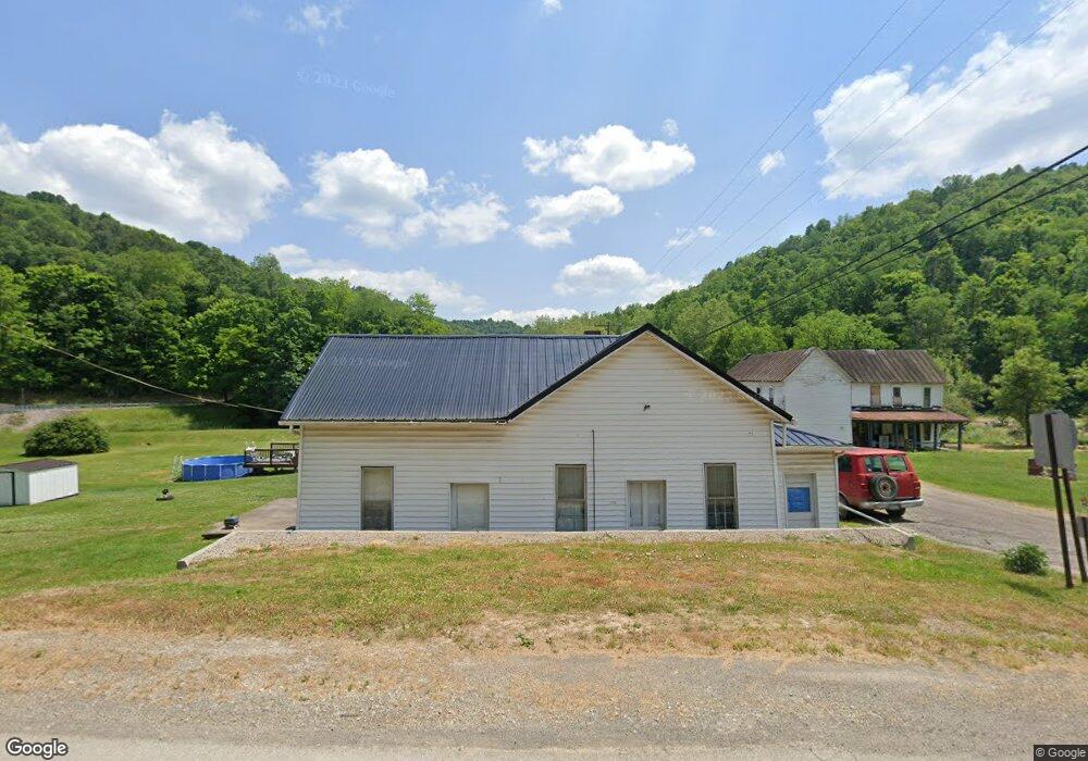
101 Main St New Freeport, PA 15352
Estimated Value: $34,515 - $160,000
3
Beds
1
Bath
1,750
Sq Ft
$49/Sq Ft
Est. Value
About This Home
This home is located at 101 Main St, New Freeport, PA 15352 and is currently estimated at $86,129, approximately $49 per square foot. 101 Main St is a home with nearby schools including West Greene High School.
Ownership History
Date
Name
Owned For
Owner Type
Purchase Details
Closed on
Feb 21, 2023
Sold by
Cross Evelyn R
Bought by
Wise Nancy L and Wise Harley H
Current Estimated Value
Purchase Details
Closed on
Oct 5, 2020
Sold by
Cross Alvin and Cross Evelyn R
Bought by
Wise Nancy L and Wise Harley H
Home Financials for this Owner
Home Financials are based on the most recent Mortgage that was taken out on this home.
Original Mortgage
$20,000
Interest Rate
2.9%
Mortgage Type
Land Contract Argmt. Of Sale
Create a Home Valuation Report for This Property
The Home Valuation Report is an in-depth analysis detailing your home's value as well as a comparison with similar homes in the area
Purchase History
| Date | Buyer | Sale Price | Title Company |
|---|---|---|---|
| Wise Nancy L | $25,000 | -- | |
| Wise Nancy L | $25,000 | None Listed On Document | |
| Wise Nancy L | $25,000 | None Available |
Source: Public Records
Mortgage History
| Date | Status | Borrower | Loan Amount |
|---|---|---|---|
| Previous Owner | Wise Nancy L | $20,000 |
Source: Public Records
Tax History
| Year | Tax Paid | Tax Assessment Tax Assessment Total Assessment is a certain percentage of the fair market value that is determined by local assessors to be the total taxable value of land and additions on the property. | Land | Improvement |
|---|---|---|---|---|
| 2025 | $936 | $28,820 | $3,310 | $25,510 |
| 2024 | $936 | $28,820 | $3,310 | $25,510 |
| 2023 | $936 | $28,820 | $3,310 | $25,510 |
| 2022 | $936 | $28,820 | $3,310 | $25,510 |
| 2021 | $9 | $28,820 | $3,310 | $25,510 |
| 2020 | $893 | $28,820 | $3,310 | $25,510 |
| 2019 | $893 | $28,820 | $3,310 | $25,510 |
| 2018 | $9 | $28,820 | $3,310 | $25,510 |
| 2017 | $883 | $28,820 | $3,310 | $25,510 |
| 2016 | -- | $28,820 | $3,310 | $25,510 |
| 2015 | -- | $28,820 | $3,310 | $25,510 |
| 2014 | -- | $28,820 | $3,310 | $25,510 |
| 2013 | -- | $28,820 | $3,310 | $25,510 |
Source: Public Records
Map
Nearby Homes
- 101 Kirby Driveway
- 104 Renner Creek Rd
- 0 Golden Oaks Rd Unit 26400158
- 0 Golden Oaks Rd Unit 11659446
- 0 Knob Run Rd
- 191 Mount Carmel Ridge Rd
- 0 Fall Run Rd
- 1964 Toms Run Rd
- 256 Browns Run Rd
- 8698 Hornet Hwy
- 808 Rush Run Rd
- 1742 Rush Run Rd
- 962 Reid Ridge
- 112 Pennsylvania Ave
- Lot 1 Low Gap Run Rd
- 10 Church St
- 1931 Saint Leo Rd
- 7817 Mason Dixon Hwy
- 474 Iron Rock Rd
- Lot 1 Miracle Run Rd
- 102 Main St
- 105 Vine St
- 104 Vine St
- 830 Golden Oaks Rd
- 128 Main St
- 153 Main St
- 154 Main St
- 547 Fox Hill Rd
- 549 Fox Hill Rd
- 542 Fox Hill Rd
- 731 Golden Oaks Rd
- 650 Windy Gap Rd
- 875 Golden Oaks Rd
- 187 Main St
- 699 Golden Oaks Rd
- 197 Main St
- 201 Main St
- 175 Herrods Run Rd
- 631 Golden Oaks Rd
- 126 Jollytown Rd
Your Personal Tour Guide
Ask me questions while you tour the home.