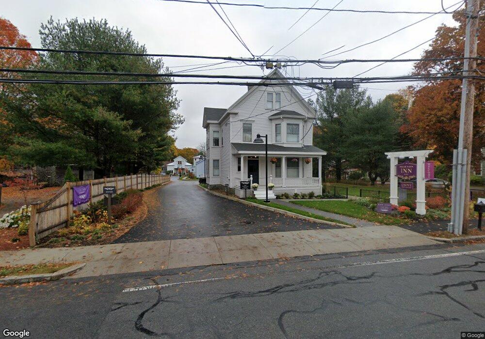
101 Main St Unit 1 Rowley, MA 01969
3
Beds
3
Baths
2,800
Sq Ft
3.82
Acres
About This Home
This home is located at 101 Main St Unit 1, Rowley, MA 01969. 101 Main St Unit 1 is a home located in Essex County with nearby schools including Triton Regional High School, North Shore Montessori School, and Clark School.
Ownership History
Date
Name
Owned For
Owner Type
Purchase Details
Closed on
Mar 3, 2020
Sold by
Firehouse Inn Llc
Bought by
Rowley Main Street Llc
Purchase Details
Closed on
Mar 21, 2017
Sold by
101 Main St and Audette
Bought by
Firehouse Inn Llc
Purchase Details
Closed on
Jan 8, 2009
Sold by
Country Garden Mahar T and Mahar
Bought by
101 Main Street Rt and Audette
Purchase Details
Closed on
Jul 2, 1998
Sold by
Bryant Dale E and Bryant Dale E
Bought by
Audette Richard and Audette Suane
Create a Home Valuation Report for This Property
The Home Valuation Report is an in-depth analysis detailing your home's value as well as a comparison with similar homes in the area
Home Values in the Area
Average Home Value in this Area
Purchase History
| Date | Buyer | Sale Price | Title Company |
|---|---|---|---|
| Rowley Main Street Llc | -- | None Available | |
| Firehouse Inn Llc | $1,400,000 | -- | |
| 101 Main Street Rt | $2,080,200 | -- | |
| 101 Main Street Rt | $2,080,200 | -- | |
| Audette Richard | $35,000 | -- | |
| Audette Richard | $35,000 | -- |
Source: Public Records
Mortgage History
| Date | Status | Borrower | Loan Amount |
|---|---|---|---|
| Previous Owner | Audette Richard | $1,000,000 | |
| Previous Owner | Audette Richard | $172,500 |
Source: Public Records
Tax History Compared to Growth
Tax History
| Year | Tax Paid | Tax Assessment Tax Assessment Total Assessment is a certain percentage of the fair market value that is determined by local assessors to be the total taxable value of land and additions on the property. | Land | Improvement |
|---|---|---|---|---|
| 2025 | $52,185 | $4,433,700 | $990,000 | $3,443,700 |
| 2024 | $51,585 | $4,263,200 | $794,200 | $3,469,000 |
| 2023 | $55,073 | $4,229,900 | $728,600 | $3,501,300 |
| 2022 | $62,208 | $4,255,000 | $682,200 | $3,572,800 |
| 2021 | $65,807 | $4,223,800 | $594,400 | $3,629,400 |
| 2020 | $65,215 | $4,185,800 | $566,500 | $3,619,300 |
| 2019 | $29,778 | $2,028,500 | $566,500 | $1,462,000 |
| 2018 | $22,516 | $1,544,300 | $552,100 | $992,200 |
| 2017 | $21,718 | $1,535,900 | $552,100 | $983,800 |
| 2016 | $19,436 | $1,353,500 | $479,600 | $873,900 |
| 2015 | $19,534 | $1,371,800 | $479,600 | $892,200 |
Source: Public Records
Map
Nearby Homes
- 21 Hammond St
- 19 Morphew Ln Unit 2
- 78 Wethersfield St
- 47 Prospect St
- 79 Spencer Knowles Rd
- 8 Longmeadow Dr Unit 14
- 480 Newburyport Turnpike
- 460-472 Newburyport Turnpike
- 117 Kittery Ave
- 196 Country Club Way
- 3 Choate Ln
- 304 & 480 Wethersfield St & Nbpt Tnpk
- 1 Court Ln
- 75 Country Club Way
- Lot 4 Osprey Ct
- Lot 3 Osprey Ct
- 1 Osprey Ct
- 4 Sheppards Way
- 147 Linebrook Rd
- 601 Newburyport Turnpike