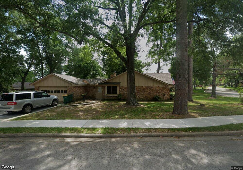
101 Maple St Conroe, TX 77301
Estimated Value: $233,916 - $282,000
3
Beds
3
Baths
2,097
Sq Ft
$126/Sq Ft
Est. Value
About This Home
This home is located at 101 Maple St, Conroe, TX 77301 and is currently estimated at $265,229, approximately $126 per square foot. 101 Maple St is a home located in Montgomery County with nearby schools including Houston Elementary School, Travis Intermediate School, and Peet Junior High School.
Ownership History
Date
Name
Owned For
Owner Type
Purchase Details
Closed on
Feb 5, 2014
Sold by
Schmid Mary L and Meyer Sharon K
Bought by
Weathersby Dale
Current Estimated Value
Purchase Details
Closed on
Sep 9, 2013
Sold by
The Randle D Crow Revocable Living Trust and Crow Randle D
Bought by
Crow Randle D
Purchase Details
Closed on
Mar 11, 2005
Sold by
Crow Randle D
Bought by
The Randle D Crow Revocable Living Trust
Purchase Details
Closed on
Mar 21, 2003
Sold by
Durham John S and Durham Elizabeth
Bought by
Crow Randle Dale and Crow Betty Jo
Home Financials for this Owner
Home Financials are based on the most recent Mortgage that was taken out on this home.
Original Mortgage
$104,000
Interest Rate
5.83%
Purchase Details
Closed on
Sep 1, 1982
Bought by
Weathersby Dale
Create a Home Valuation Report for This Property
The Home Valuation Report is an in-depth analysis detailing your home's value as well as a comparison with similar homes in the area
Home Values in the Area
Average Home Value in this Area
Purchase History
| Date | Buyer | Sale Price | Title Company |
|---|---|---|---|
| Weathersby Dale | -- | Chicago Title Conroe | |
| Crow Randle D | -- | None Available | |
| The Randle D Crow Revocable Living Trust | -- | -- | |
| Crow Randle Dale | -- | First Surety Title Company | |
| Weathersby Dale | -- | -- |
Source: Public Records
Mortgage History
| Date | Status | Borrower | Loan Amount |
|---|---|---|---|
| Previous Owner | Crow Randle Dale | $104,000 |
Source: Public Records
Tax History
| Year | Tax Paid | Tax Assessment Tax Assessment Total Assessment is a certain percentage of the fair market value that is determined by local assessors to be the total taxable value of land and additions on the property. | Land | Improvement |
|---|---|---|---|---|
| 2025 | $4,496 | $213,880 | $58,850 | $155,030 |
| 2024 | $4,230 | $235,000 | $58,850 | $176,150 |
| 2023 | $4,230 | $220,760 | $58,860 | $161,900 |
| 2022 | $4,683 | $225,800 | $58,860 | $166,940 |
| 2021 | $4,307 | $197,000 | $23,540 | $173,460 |
| 2020 | $4,260 | $186,720 | $23,540 | $163,180 |
| 2019 | $4,214 | $180,710 | $7,710 | $173,000 |
| 2018 | $4,431 | $190,000 | $7,710 | $182,290 |
| 2017 | $4,448 | $190,000 | $7,710 | $182,290 |
| 2016 | $3,596 | $153,610 | $7,710 | $145,900 |
| 2015 | $1,119 | $128,700 | $7,710 | $120,990 |
| 2014 | $1,119 | $101,830 | $7,710 | $94,120 |
Source: Public Records
Map
Nearby Homes
- 1015 Stevens Ave
- 1013 Stevens Ave
- 1506 King Ranch Rd
- 0 W Semands Ave
- 915 W Lewis St
- 1020 Houston St
- 412 Waco St
- 1202 N Roberson St
- 1620 Odd Fellow St
- 417 W Lewis St
- 407 W Semands St
- TBD Texas 105
- 0 N Roberson St
- 317 W Lewis St
- 1806 N Frazier St
- 1522 N Thompson St
- 204 W Dallas St
- 1304 & 1306 N Frazier St
- 1609 N Pacific St
- 18718 Wild Stripes Ct
- 105 Maple St
- 200 Oak Hollow St
- 202 Oak Hollow St
- 1017 Stevens Ave
- 204 Oak Hollow St
- 100 Maple St
- 206 Oak Hollow St
- 122 Oak Hollow St
- 107 Maple St
- 102 Maple St
- 203 Oak Hollow St
- 208 Oak Hollow St
- 201 Oak Hollow St
- 205 Oak Hollow St
- 1200 Bettes St
- 120 Oak Hollow St
- 1201 Bettes St
- 1016 Stevens Ave
- 1011 Stevens Ave
- 210 Oak Hollow St