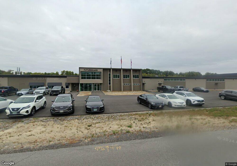
101 Merrow Rd Auburn, ME 04210
--
Bed
--
Bath
278,946
Sq Ft
10
Acres
About This Home
This home is located at 101 Merrow Rd, Auburn, ME 04210. 101 Merrow Rd is a home located in Androscoggin County with nearby schools including Fairview School, Auburn Middle School, and Edward Little High School.
Ownership History
Date
Name
Owned For
Owner Type
Purchase Details
Closed on
Jan 25, 2021
Sold by
Futureguard Holdings Llc
Bought by
Management Controls Llc
Purchase Details
Closed on
Jan 5, 2007
Sold by
101 Merrow Road Llc
Bought by
Futureguard Holdings Llc
Create a Home Valuation Report for This Property
The Home Valuation Report is an in-depth analysis detailing your home's value as well as a comparison with similar homes in the area
Home Values in the Area
Average Home Value in this Area
Purchase History
| Date | Buyer | Sale Price | Title Company |
|---|---|---|---|
| Management Controls Llc | -- | None Available | |
| Management Controls Llc | -- | None Available | |
| Futureguard Holdings Llc | -- | -- |
Source: Public Records
Mortgage History
| Date | Status | Borrower | Loan Amount |
|---|---|---|---|
| Previous Owner | Futureguard Holdings Llc | $1,304,000 | |
| Previous Owner | Futureguard Holdings Llc | $2,700,000 | |
| Previous Owner | Futureguard Holdings Llc | $1,587,500 |
Source: Public Records
Tax History Compared to Growth
Tax History
| Year | Tax Paid | Tax Assessment Tax Assessment Total Assessment is a certain percentage of the fair market value that is determined by local assessors to be the total taxable value of land and additions on the property. | Land | Improvement |
|---|---|---|---|---|
| 2024 | $152,050 | $6,833,700 | $266,200 | $6,567,500 |
| 2023 | $155,467 | $6,833,700 | $266,200 | $6,567,500 |
| 2022 | $155,467 | $6,833,700 | $266,200 | $6,567,500 |
| 2021 | $98,074 | $4,117,300 | $266,200 | $3,851,100 |
| 2020 | $98,534 | $4,148,800 | $297,700 | $3,851,100 |
| 2019 | $91,169 | $3,838,700 | $297,700 | $3,541,000 |
| 2018 | $90,853 | $3,836,700 | $297,700 | $3,539,000 |
| 2017 | $88,224 | $3,837,500 | $297,700 | $3,539,800 |
| 2016 | $87,538 | $3,916,700 | $297,700 | $3,619,000 |
| 2015 | $83,230 | $3,916,700 | $297,700 | $3,619,000 |
| 2013 | $72,927 | $3,569,600 | $297,700 | $3,271,900 |
Source: Public Records
Map
Nearby Homes
- 139 Fletcher Rd
- 46 Club House Ln Unit 9
- 1711 Hotel Rd
- lot 11 Minot Ave
- 867 Minot Ave
- 863 Minot Ave
- 4 Carson St
- 730 Beech Hill Rd
- 20 Brandywine Cir
- 521 Stevens Mill Rd
- 14 Mckinnon St
- 15 Country Club Dr
- 4 Arbania St
- 1154 Hotel Rd
- 18 Concord Place Unit 24
- 3 Freedom Farm Rd Unit 4
- 3 Freedom Farm Rd Unit 3
- 0 Baxter Ave
- 69 Dawes Ave
- 13 Allen Ave