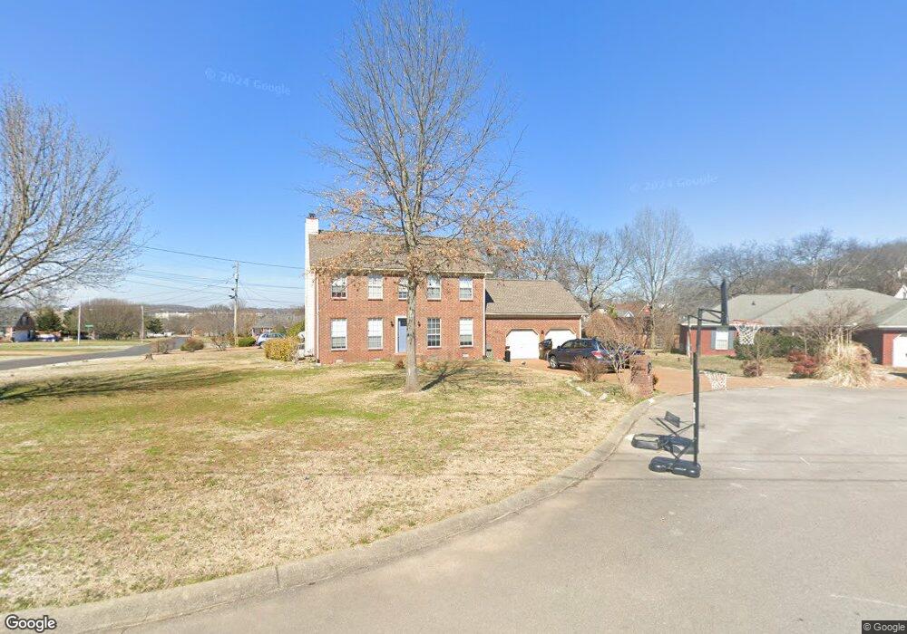
101 Michael Cir Smyrna, TN 37167
Estimated Value: $365,739 - $473,000
Studio
3
Baths
1,947
Sq Ft
$215/Sq Ft
Est. Value
About This Home
This home is located at 101 Michael Cir, Smyrna, TN 37167 and is currently estimated at $417,685, approximately $214 per square foot. 101 Michael Cir is a home located in Rutherford County with nearby schools including Rocky Fork Elementary School, Rocky Fork Middle School, and Smyrna High School.
Ownership History
Date
Name
Owned For
Owner Type
Purchase Details
Closed on
Aug 15, 2006
Sold by
Binkley Tracey A
Bought by
Noel Todd R
Current Estimated Value
Home Financials for this Owner
Home Financials are based on the most recent Mortgage that was taken out on this home.
Original Mortgage
$150,000
Outstanding Balance
$88,503
Interest Rate
6.73%
Mortgage Type
Purchase Money Mortgage
Estimated Equity
$329,182
Purchase Details
Closed on
May 20, 1999
Sold by
Windrow Vincent L
Bought by
Binkley Tracy A and Binkley Elizabet
Home Financials for this Owner
Home Financials are based on the most recent Mortgage that was taken out on this home.
Original Mortgage
$110,000
Interest Rate
6.84%
Purchase Details
Closed on
Apr 3, 1996
Sold by
Gaines Home Building
Bought by
Windrow and Stacy
Purchase Details
Closed on
Oct 2, 1995
Bought by
Gaines Home Building Corp
Create a Home Valuation Report for This Property
The Home Valuation Report is an in-depth analysis detailing your home's value as well as a comparison with similar homes in the area
Home Values in the Area
Average Home Value in this Area
Purchase History
| Date | Buyer | Sale Price | Title Company |
|---|---|---|---|
| Noel Todd R | $179,000 | -- | |
| Binkley Tracy A | $145,900 | -- | |
| Windrow | $128,950 | -- | |
| Gaines Home Building Corp | $54,000 | -- |
Source: Public Records
Mortgage History
| Date | Status | Borrower | Loan Amount |
|---|---|---|---|
| Open | Gaines Home Building Corp | $150,000 | |
| Previous Owner | Gaines Home Building Corp | $110,000 |
Source: Public Records
Tax History
| Year | Tax Paid | Tax Assessment Tax Assessment Total Assessment is a certain percentage of the fair market value that is determined by local assessors to be the total taxable value of land and additions on the property. | Land | Improvement |
|---|---|---|---|---|
| 2025 | $2,025 | $84,325 | $13,750 | $70,575 |
| 2024 | $2,025 | $84,325 | $13,750 | $70,575 |
| 2023 | $2,025 | $84,325 | $13,750 | $70,575 |
| 2022 | $1,806 | $84,325 | $13,750 | $70,575 |
| 2021 | $1,771 | $60,650 | $10,500 | $50,150 |
| 2020 | $1,771 | $60,650 | $10,500 | $50,150 |
| 2019 | $1,771 | $60,650 | $10,500 | $50,150 |
| 2018 | $1,698 | $60,650 | $0 | $0 |
| 2017 | $1,612 | $45,225 | $0 | $0 |
| 2016 | $1,612 | $45,225 | $0 | $0 |
| 2015 | $1,612 | $45,225 | $0 | $0 |
| 2014 | $1,125 | $45,225 | $0 | $0 |
| 2013 | -- | $46,725 | $0 | $0 |
Source: Public Records
Map
Nearby Homes
- 405 Williamsport Dr
- 507 Saint Francis Ave
- 625 Spring Hill Dr
- 630 Spring Hill Dr
- 638 Spring Hill Dr
- 502 Johnstown Dr
- 635 Shetland Dr
- 421 Saint Francis Ave
- 510 Williamsport Dr
- 804 Bromley Ct
- 502 Finsbury Ct
- 425 Westwood Dr
- 432 Westwood Dr
- 600 High Ridge Dr
- 508 Spinnaker Ct
- 424 Westwood Dr
- 533 Johnstown Dr
- 708 Summerline Rd
- 208 Saint Pauls Ln
- 733 Lipizanner Ln
- 508 Decherd Ln
- 103 Michael Cir
- 310 Megan Dr
- 100 Michael Cir
- 104 Michael Cir
- 510 Decherd Ln
- 506 Decherd Ln
- 312 Megan Dr
- 102 Michael Cir
- 509 Decherd Ln
- 512 Decherd Ln
- 314 Megan Dr
- 504 Decherd Ln
- 414 Williamsport Dr
- 416 Williamsport Dr
- 412 Williamsport Dr
- 511 Decherd Ln
- 103 Andrea Cir
- 104 Andrea Cir
- 507 Decherd Ln
Your Personal Tour Guide
Ask me questions while you tour the home.