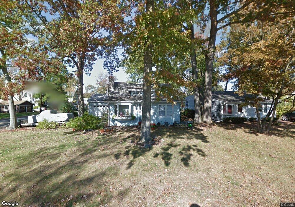
101 Minnehaha Blvd Lake Hiawatha, NJ 07034
Estimated Value: $459,501 - $557,000
--
Bed
--
Bath
1,212
Sq Ft
$420/Sq Ft
Est. Value
About This Home
This home is located at 101 Minnehaha Blvd, Lake Hiawatha, NJ 07034 and is currently estimated at $508,625, approximately $419 per square foot. 101 Minnehaha Blvd is a home located in Morris County with nearby schools including Lake Hiawatha Elementary School, Central Middle School, and Parsippany High School.
Ownership History
Date
Name
Owned For
Owner Type
Purchase Details
Closed on
Dec 27, 2002
Sold by
Brown Chris
Bought by
Kaiser Richard and Kaiser Paula
Current Estimated Value
Home Financials for this Owner
Home Financials are based on the most recent Mortgage that was taken out on this home.
Original Mortgage
$182,400
Outstanding Balance
$78,324
Interest Rate
6.11%
Estimated Equity
$430,301
Purchase Details
Closed on
Feb 24, 1996
Sold by
Werdann Henry and Werdann Margaret
Bought by
Brown Christopher J and Brown Eileen L
Home Financials for this Owner
Home Financials are based on the most recent Mortgage that was taken out on this home.
Original Mortgage
$118,350
Interest Rate
7.78%
Create a Home Valuation Report for This Property
The Home Valuation Report is an in-depth analysis detailing your home's value as well as a comparison with similar homes in the area
Home Values in the Area
Average Home Value in this Area
Purchase History
| Date | Buyer | Sale Price | Title Company |
|---|---|---|---|
| Kaiser Richard | $228,000 | -- | |
| Brown Christopher J | $131,500 | -- |
Source: Public Records
Mortgage History
| Date | Status | Borrower | Loan Amount |
|---|---|---|---|
| Open | Kaiser Richard | $182,400 | |
| Previous Owner | Brown Christopher J | $118,350 |
Source: Public Records
Tax History Compared to Growth
Tax History
| Year | Tax Paid | Tax Assessment Tax Assessment Total Assessment is a certain percentage of the fair market value that is determined by local assessors to be the total taxable value of land and additions on the property. | Land | Improvement |
|---|---|---|---|---|
| 2025 | $7,956 | $230,800 | $126,700 | $104,100 |
| 2024 | $7,806 | $230,800 | $126,700 | $104,100 |
| 2023 | $7,806 | $230,800 | $126,700 | $104,100 |
| 2022 | $7,303 | $230,800 | $126,700 | $104,100 |
| 2021 | $7,303 | $230,800 | $126,700 | $104,100 |
| 2020 | $7,148 | $230,800 | $126,700 | $104,100 |
| 2019 | $6,956 | $230,800 | $126,700 | $104,100 |
| 2018 | $6,804 | $230,800 | $126,700 | $104,100 |
| 2017 | $6,696 | $230,800 | $126,700 | $104,100 |
| 2016 | $6,534 | $230,800 | $126,700 | $104,100 |
| 2015 | $6,372 | $230,800 | $126,700 | $104,100 |
| 2014 | $6,287 | $230,800 | $126,700 | $104,100 |
Source: Public Records
Map
Nearby Homes
- 17 Madison Ave
- 31.5 Roosevelt Ave
- 30 Madison Ave
- 104 N Beverwyck Rd Unit 7
- 61 Minnehaha Blvd
- 21 Nokomis Ave
- 74 Longview Ave
- 4 New Hampshire Ct
- 191 N Beverwyck Rd Unit 1
- 122 Lake Shore Dr
- 8 New England Dr
- 2 Buckingham Rd
- 255 Knoll Rd
- 12 Cherokee Ave
- 14 Katherine Dr
- 203 N Beverwyck Rd Unit 1
- 203 1 N Beverwyck Rd Unit 1
- 2 Colony Ct
- 490 Knoll Rd
- 3 Woodhaven Rd
- 99 Minnehaha Blvd
- 24 Lincoln Ave Unit 24
- 97 Minnehaha Blvd
- 103 Minnehaha Blvd
- 26 Lincoln Ave
- 47 Lincoln Ave
- 93 Minnehaha Blvd
- 107 Minnehaha Blvd
- 51 Lincoln Ave
- 98 Minnehaha Blvd
- 49 Lincoln Ave
- 96 Minnehaha Blvd
- 28 Lincoln Ave
- 94 Minnehaha Blvd
- 100 Minnehaha Blvd
- 27 Madison Ave
- 29 Madison Ave
- 102 Minnehaha Blvd
- 92 Minnehaha Blvd
- 30 Lincoln Ave