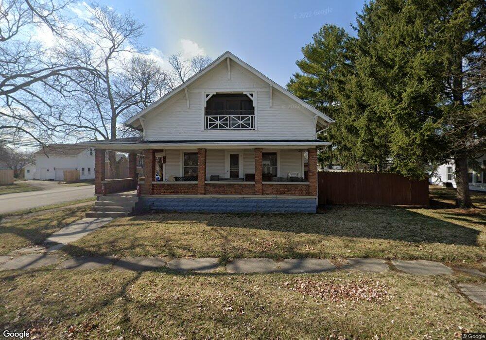
101 N Scott St New Carlisle, OH 45344
Estimated Value: $136,000 - $190,000
3
Beds
2
Baths
1,530
Sq Ft
$112/Sq Ft
Est. Value
About This Home
This home is located at 101 N Scott St, New Carlisle, OH 45344 and is currently estimated at $171,032, approximately $111 per square foot. 101 N Scott St is a home located in Clark County with nearby schools including New Carlisle Elementary School, Park Layne Elementary School, and Donnelsville Elementary School.
Ownership History
Date
Name
Owned For
Owner Type
Purchase Details
Closed on
Jun 10, 2010
Sold by
Morris Gerald L
Bought by
High Marcy D
Current Estimated Value
Purchase Details
Closed on
Oct 12, 2009
Sold by
Cheney Family Properties Llc
Bought by
Morris Gerald L
Purchase Details
Closed on
Jul 10, 2007
Sold by
Porter Kimberly Sue and Blahnik Candice Ann
Bought by
Cheney Family Properties Llc
Create a Home Valuation Report for This Property
The Home Valuation Report is an in-depth analysis detailing your home's value as well as a comparison with similar homes in the area
Home Values in the Area
Average Home Value in this Area
Purchase History
| Date | Buyer | Sale Price | Title Company |
|---|---|---|---|
| High Marcy D | -- | Attorney | |
| Morris Gerald L | $52,000 | Safemark Title | |
| Cheney Family Properties Llc | -- | None Available | |
| Cheney Family Properties Llc | -- | None Available |
Source: Public Records
Tax History Compared to Growth
Tax History
| Year | Tax Paid | Tax Assessment Tax Assessment Total Assessment is a certain percentage of the fair market value that is determined by local assessors to be the total taxable value of land and additions on the property. | Land | Improvement |
|---|---|---|---|---|
| 2024 | $2,098 | $40,810 | $8,400 | $32,410 |
| 2023 | $2,098 | $40,810 | $8,400 | $32,410 |
| 2022 | $2,101 | $40,810 | $8,400 | $32,410 |
| 2021 | $1,835 | $31,490 | $7,120 | $24,370 |
| 2020 | $1,839 | $31,490 | $7,120 | $24,370 |
| 2019 | $1,869 | $31,490 | $7,120 | $24,370 |
| 2018 | $1,315 | $20,400 | $6,740 | $13,660 |
| 2017 | $1,227 | $20,843 | $6,738 | $14,105 |
| 2016 | $1,220 | $20,843 | $6,738 | $14,105 |
| 2015 | $743 | $21,414 | $6,738 | $14,676 |
| 2014 | $1,474 | $21,414 | $6,738 | $14,676 |
| 2013 | $739 | $21,414 | $6,738 | $14,676 |
Source: Public Records
Map
Nearby Homes
- 211 N Clay St
- 315 N Main St
- 210 Zimmerman St
- 202 Fenwick Dr
- 906 N Scott St
- 315 Fenwick Dr
- 805 Brookfield Dr
- 1204 N Scott St
- 201 Lightfoot Ct
- 216 Lightfoot Ct
- 209 Lightfoot Ct
- 213 Lightfoot Ct
- 519 Brubaker Dr
- 203 Monroe Way
- 609 Brubaker Dr
- 1212 N Scott St
- 1206 N Scott St
- 1205 N Scott St
- 1209 N Scott St
- 1210 N Scott St
- 105 N Scott St
- 415 W Washington St
- 107 N Scott St
- 101 S Scott St
- 325 W Washington St
- 425 W Washington St
- 100 S Clay St
- 111 N Scott St
- 112 N Clay St
- 104 S Clay St Unit 106
- 306 W Washington St
- 105 S Scott St
- 105 S Scott St
- 315 W Washington St
- 108 N Scott St
- 118 N Clay St
- 115 N Scott St
- 304 W Washington St
- 110 N Scott St
- 107 S Scott St