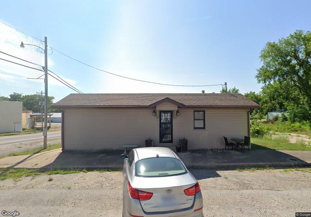
101 N Spruce St Conway, MO 65632
Estimated Value: $52,538 - $275,000
Studio
--
Bath
480
Sq Ft
$346/Sq Ft
Est. Value
About This Home
This home is located at 101 N Spruce St, Conway, MO 65632 and is currently estimated at $165,885, approximately $345 per square foot. 101 N Spruce St is a home located in Laclede County with nearby schools including Ezard Elementary School and Conway High Schools.
Ownership History
Date
Name
Owned For
Owner Type
Purchase Details
Closed on
Apr 22, 2022
Sold by
Mcclanahan and Candace
Bought by
Vestal Jakob and Higbee Alexa
Current Estimated Value
Home Financials for this Owner
Home Financials are based on the most recent Mortgage that was taken out on this home.
Original Mortgage
$44,000
Outstanding Balance
$35,541
Interest Rate
4.38%
Mortgage Type
New Conventional
Estimated Equity
$130,344
Purchase Details
Closed on
Jun 3, 2021
Sold by
Shover Kris and Shover Lucinda
Bought by
Mcclanahan Matthew and Mcclanahan Candace
Home Financials for this Owner
Home Financials are based on the most recent Mortgage that was taken out on this home.
Original Mortgage
$44,000
Interest Rate
2.9%
Mortgage Type
Future Advance Clause Open End Mortgage
Purchase Details
Closed on
Aug 31, 2012
Sold by
Honeycutt Luther and Honeycutt Margaret A
Bought by
Shover Kris and Shover Lacinda
Create a Home Valuation Report for This Property
The Home Valuation Report is an in-depth analysis detailing your home's value as well as a comparison with similar homes in the area
Purchase History
| Date | Buyer | Sale Price | Title Company |
|---|---|---|---|
| Vestal Jakob | -- | None Listed On Document | |
| Mcclanahan Matthew | -- | None Available | |
| Shover Kris | -- | None Available |
Source: Public Records
Mortgage History
| Date | Status | Borrower | Loan Amount |
|---|---|---|---|
| Open | Vestal Jakob | $44,000 | |
| Previous Owner | Mcclanahan Matthew | $44,000 |
Source: Public Records
Tax History
| Year | Tax Paid | Tax Assessment Tax Assessment Total Assessment is a certain percentage of the fair market value that is determined by local assessors to be the total taxable value of land and additions on the property. | Land | Improvement |
|---|---|---|---|---|
| 2025 | $180 | $4,500 | $0 | $0 |
| 2024 | $180 | $4,240 | $0 | $0 |
| 2023 | $179 | $4,240 | $0 | $0 |
| 2022 | $182 | $3,460 | $0 | $0 |
| 2021 | $185 | $3,456 | $192 | $3,264 |
| 2020 | $186 | $10,800 | $600 | $10,200 |
| 2019 | $187 | $3,450 | $190 | $3,260 |
| 2018 | $80 | $1,500 | $190 | $1,310 |
| 2017 | $74 | $1,500 | $0 | $0 |
| 2016 | $74 | $1,500 | $0 | $0 |
| 2015 | $74 | $1,500 | $0 | $0 |
| 2014 | $74 | $1,500 | $0 | $0 |
| 2013 | -- | $1,500 | $0 | $0 |
Source: Public Records
Map
Nearby Homes
- 103 S Main St
- 411 W Nelson
- 207 N Porter Ave
- 210 W Oak St
- 411 S Myrtle St
- 13449 State Highway J Unit 13449
- 407 N Newport Ave
- 13449 Highway J
- 236 Lace Loop
- State Road Y
- 000 Rd
- 9753 State Highway Cc
- 29 Owl Trail
- 3 Owl Trail
- 1 Owl Trail
- 2 Owl Trail
- 217 Victory Ln
- 000 Victory Ln
- 800 A Country Trails Rd
- 000 Country Trails Rd
- 107 W Jefferson Ave
- 107 N Spruce St
- 101 S Main St
- 109 N Spruce St
- 311 W Jefferson Ave
- 101 S Myrtle St
- 109 S Spruce St
- 107 S Spruce St
- 0 S Spruce St
- 111 N Spruce St
- 108 N Elm St
- 107 N Main St
- 107 S Myrtle St
- 111 N Main St
- 110 N Elm St
- 109 S Myrtle St
- 411 W Jefferson Ave
- 121 S Main St
- 107 N Elm St
- 410 W Jefferson Ave
Your Personal Tour Guide
Ask me questions while you tour the home.