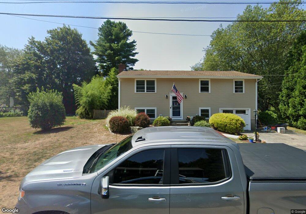
101 Paul Ave Wakefield, RI 02879
Estimated Value: $479,471 - $632,000
3
Beds
2
Baths
2,086
Sq Ft
$267/Sq Ft
Est. Value
About This Home
This home is located at 101 Paul Ave, Wakefield, RI 02879 and is currently estimated at $557,118, approximately $267 per square foot. 101 Paul Ave is a home located in Washington County with nearby schools including South Kingstown High School, The Compass School, and South Shore School.
Ownership History
Date
Name
Owned For
Owner Type
Purchase Details
Closed on
Aug 26, 2004
Sold by
Foley Matthew R and Foley Melissa M
Bought by
Sullivan Terence S and Sullivan Jyl M
Current Estimated Value
Purchase Details
Closed on
Aug 9, 2002
Sold by
Holland Steven W and Holland Catherine M
Bought by
Manni Melissa M and Foley Matthew R
Purchase Details
Closed on
Sep 30, 1994
Sold by
Nippo Murn M and Nippo Joan
Bought by
Holland Steven W and Mckenna Catherine A
Create a Home Valuation Report for This Property
The Home Valuation Report is an in-depth analysis detailing your home's value as well as a comparison with similar homes in the area
Home Values in the Area
Average Home Value in this Area
Purchase History
| Date | Buyer | Sale Price | Title Company |
|---|---|---|---|
| Sullivan Terence S | $327,500 | -- | |
| Manni Melissa M | $209,000 | -- | |
| Holland Steven W | $117,000 | -- |
Source: Public Records
Mortgage History
| Date | Status | Borrower | Loan Amount |
|---|---|---|---|
| Open | Holland Steven W | $275,000 | |
| Closed | Holland Steven W | $284,000 |
Source: Public Records
Tax History
| Year | Tax Paid | Tax Assessment Tax Assessment Total Assessment is a certain percentage of the fair market value that is determined by local assessors to be the total taxable value of land and additions on the property. | Land | Improvement |
|---|---|---|---|---|
| 2025 | $3,752 | $419,700 | $164,500 | $255,200 |
| 2024 | $3,587 | $324,600 | $126,600 | $198,000 |
| 2023 | $3,587 | $324,600 | $126,600 | $198,000 |
| 2022 | $3,554 | $324,600 | $126,600 | $198,000 |
| 2021 | $3,718 | $257,300 | $110,000 | $147,300 |
| 2020 | $3,718 | $257,300 | $110,000 | $147,300 |
| 2019 | $3,718 | $257,300 | $110,000 | $147,300 |
| 2018 | $3,508 | $223,700 | $102,300 | $121,400 |
| 2017 | $3,425 | $223,700 | $102,300 | $121,400 |
| 2016 | $3,376 | $223,700 | $102,300 | $121,400 |
| 2015 | $3,424 | $220,600 | $100,000 | $120,600 |
| 2014 | $3,415 | $220,600 | $100,000 | $120,600 |
Source: Public Records
Map
Nearby Homes
- 56 Vespia Ln
- 44 Vespia Ln
- 1808 Kingstown Rd
- 1255 South Rd
- 0 South Rd Unit 1400966
- 79 Linden Dr
- 28 N Pasture Ln
- 507 Curtis Corner Rd
- 8 Lookout Ln
- 5 Lookout Ln
- 24 Ridge Crest Ln
- 260 Sweet Allen Farm Rd Unit 3
- 1724 South Rd
- 221 Kings Ridge Rd
- 128 Rodman St
- 81 Old Rd N
- 3 Larkin St
- 39 Secluded Dr
- 48 Stone Bridge Dr
- 95 S Woods Dr
Your Personal Tour Guide
Ask me questions while you tour the home.