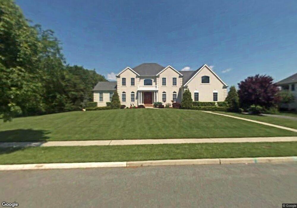
101 Pheasant Field Ln Moorestown, NJ 08057
Estimated Value: $1,297,775 - $1,541,000
--
Bed
--
Bath
3,757
Sq Ft
$377/Sq Ft
Est. Value
About This Home
This home is located at 101 Pheasant Field Ln, Moorestown, NJ 08057 and is currently estimated at $1,417,592, approximately $377 per square foot. 101 Pheasant Field Ln is a home located in Burlington County with nearby schools including George C. Baker Elementary School, Moorestown Upper Elementary School, and William Allen Middle School.
Ownership History
Date
Name
Owned For
Owner Type
Purchase Details
Closed on
Jun 6, 2002
Sold by
Duco Corp
Bought by
Miyamoto Curtis T and Amparo Miyamoto M
Current Estimated Value
Home Financials for this Owner
Home Financials are based on the most recent Mortgage that was taken out on this home.
Original Mortgage
$187,000
Outstanding Balance
$79,012
Interest Rate
6.8%
Mortgage Type
Credit Line Revolving
Estimated Equity
$1,338,580
Create a Home Valuation Report for This Property
The Home Valuation Report is an in-depth analysis detailing your home's value as well as a comparison with similar homes in the area
Home Values in the Area
Average Home Value in this Area
Purchase History
| Date | Buyer | Sale Price | Title Company |
|---|---|---|---|
| Miyamoto Curtis T | $647,677 | Commonwealth Land Title Ins | |
| -- | $647,700 | -- |
Source: Public Records
Mortgage History
| Date | Status | Borrower | Loan Amount |
|---|---|---|---|
| Open | -- | $187,000 | |
| Closed | -- | $273,360 |
Source: Public Records
Tax History Compared to Growth
Tax History
| Year | Tax Paid | Tax Assessment Tax Assessment Total Assessment is a certain percentage of the fair market value that is determined by local assessors to be the total taxable value of land and additions on the property. | Land | Improvement |
|---|---|---|---|---|
| 2025 | $21,173 | $746,300 | $245,800 | $500,500 |
| 2024 | $20,531 | $746,300 | $245,800 | $500,500 |
| 2023 | $20,531 | $746,300 | $245,800 | $500,500 |
| 2022 | $20,322 | $746,300 | $245,800 | $500,500 |
| 2021 | $20,053 | $746,300 | $245,800 | $500,500 |
| 2020 | $19,926 | $746,300 | $245,800 | $500,500 |
| 2019 | $19,575 | $746,300 | $245,800 | $500,500 |
| 2018 | $19,046 | $746,300 | $245,800 | $500,500 |
| 2017 | $19,210 | $746,300 | $245,800 | $500,500 |
| 2016 | $19,143 | $746,300 | $245,800 | $500,500 |
| 2015 | $18,911 | $746,300 | $245,800 | $500,500 |
| 2014 | $17,956 | $746,300 | $245,800 | $500,500 |
Source: Public Records
Map
Nearby Homes
- 863 Golf View Rd
- 343 Tom Brown Rd
- 347 Tom Brown Rd
- 744 Signal Light Rd
- 2801 Riverton Rd
- 25 Oriole Way
- 543 Bethel Ave
- 205 E Central Ave
- 142 Fox Chase Dr
- 7 Whitetail Ct
- 493 N Church St
- 415 Bridgeboro Rd
- 628 Windsock Way
- 308 Farmdale Rd
- 50 E 3rd St
- 66 E 3rd St
- 82 E 3rd St
- 80 E 3rd St
- 316 Farmdale Rd
- 133 Plum St Unit 6
- 105 Pheasant Field Ln
- 100 Pheasant Field Ln
- 762 Riverton Rd
- 104 Pheasant Field Ln
- 109 Pheasant Field Ln
- 758 Riverton Rd
- 764 Riverton Rd
- 766 Riverton Rd
- 751 Riverton Rd
- 770 Riverton Rd
- 756 Riverton Rd
- 737 Lippincott Ave
- 774 Allison Ct
- 735 Lippincott Ave
- 113 Pheasant Field Ln
- 141 Pheasant Field Ln
- 570 Bartram Rd
- 774 Riverton Rd
- 137 Pheasant Field Ln