Estimated Value: $5,563,837 - $7,186,000
5
Beds
4
Baths
5,123
Sq Ft
$1,250/Sq Ft
Est. Value
About This Home
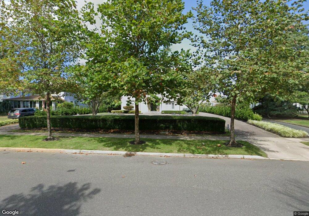
This home is located at 101 Phillips Ave, Deal, NJ 07723 and is currently estimated at $6,403,959, approximately $1,250 per square foot. 101 Phillips Ave is a home located in Monmouth County with nearby schools including Deal Elementary School, Hope Academy Charter School, and St. Mary of the Assumption School.
Ownership History
Date
Name
Owned For
Owner Type
Purchase Details
Closed on
Jan 25, 2013
Sold by
Franco Laurie and Franco Jack
Bought by
Franco Jack
Current Estimated Value
Home Financials for this Owner
Home Financials are based on the most recent Mortgage that was taken out on this home.
Original Mortgage
$1,000,000
Outstanding Balance
$668,946
Interest Rate
2.5%
Mortgage Type
Adjustable Rate Mortgage/ARM
Estimated Equity
$5,735,013
Purchase Details
Closed on
Jun 25, 1996
Sold by
Menashe Ronald
Bought by
Franco Jack and Franco Laurie
Create a Home Valuation Report for This Property
The Home Valuation Report is an in-depth analysis detailing your home's value as well as a comparison with similar homes in the area
Home Values in the Area
Average Home Value in this Area
Purchase History
| Date | Buyer | Sale Price | Title Company |
|---|---|---|---|
| Franco Jack | -- | Chicago Title Insurance Comp | |
| Franco Jack | $360,000 | -- |
Source: Public Records
Mortgage History
| Date | Status | Borrower | Loan Amount |
|---|---|---|---|
| Open | Franco Jack | $1,000,000 |
Source: Public Records
Tax History Compared to Growth
Tax History
| Year | Tax Paid | Tax Assessment Tax Assessment Total Assessment is a certain percentage of the fair market value that is determined by local assessors to be the total taxable value of land and additions on the property. | Land | Improvement |
|---|---|---|---|---|
| 2025 | $24,899 | $6,520,000 | $4,200,000 | $2,320,000 |
| 2024 | $23,986 | $5,831,100 | $3,750,000 | $2,081,100 |
| 2023 | $23,986 | $5,214,300 | $3,183,800 | $2,030,500 |
| 2022 | $22,940 | $3,892,700 | $2,467,000 | $1,425,700 |
| 2021 | $27,814 | $3,529,300 | $2,190,000 | $1,339,300 |
| 2020 | $29,130 | $4,079,800 | $2,622,800 | $1,457,000 |
| 2019 | $27,814 | $3,923,000 | $2,474,400 | $1,448,600 |
| 2018 | $25,526 | $3,678,100 | $2,330,600 | $1,347,500 |
| 2017 | $25,447 | $3,651,000 | $2,330,600 | $1,320,400 |
| 2016 | $24,035 | $3,438,500 | $2,178,100 | $1,260,400 |
| 2015 | $24,178 | $3,381,500 | $2,178,100 | $1,203,400 |
| 2014 | $21,985 | $3,079,100 | $2,125,000 | $954,100 |
Source: Public Records
Map
Nearby Homes
- 116 Phillips Ave
- 10 Campbell Ct
- 103 Poplar Ave
- 328 Elberon Blvd
- 0 Overbrook Ave
- 160 Ocean Ave
- 267 Roosevelt Ave
- 1 Country Club Dr
- 271 Jerome Ave
- 306 Roosevelt Ave
- 296 Garfield Ave
- 24 Berger Ave
- 210 Larchwood Ave
- 206 S Lincoln Ave
- 1039 Norwood Ave
- 404 Brookside Ave
- 101 Lincoln Ave
- 460 Runyan Ave
- 1001 Norwood Ave Unit 5
- 1001 Norwood Ave Unit 6
- 105 Phillips Ave
- 107 Phillips Ave
- 99 Phillips Ave
- 109 Phillips Ave
- 70 Poplar Ave
- 68 Poplar Ave
- 72 Poplar Ave
- 91 Norwood Ave
- 91 Norwood Ave Unit A
- 89 Norwood Ave
- 74 Poplar Ave
- 74 Poplar Ave
- 74 Poplar Ave Unit WINTER
- 66 Poplar Ave
- 85 Norwood Ave
- 91 Phillips Ave
- 76 Poplar Ave
- 102 Phillips Ave
- 78 Poplar Ave
- 78 Poplar Ave Unit WINTER