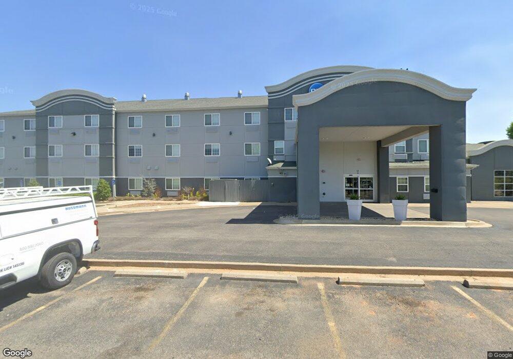
101 Reasor St Tahlequah, OK 74464
Estimated Value: $2,898,843
--
Bed
--
Bath
14,902
Sq Ft
$195/Sq Ft
Est. Value
About This Home
This home is located at 101 Reasor St, Tahlequah, OK 74464 and is currently estimated at $2,898,843, approximately $194 per square foot. 101 Reasor St is a home located in Cherokee County with nearby schools including Heritage Elementary School, Tahlequah Middle School, and Tahlequah High School.
Ownership History
Date
Name
Owned For
Owner Type
Purchase Details
Closed on
Dec 4, 2019
Sold by
Manav Hospitality Inc
Bought by
Jai Kuber Llc
Current Estimated Value
Home Financials for this Owner
Home Financials are based on the most recent Mortgage that was taken out on this home.
Original Mortgage
$1,680,000
Outstanding Balance
$1,482,353
Interest Rate
3.75%
Mortgage Type
Commercial
Estimated Equity
$1,416,490
Create a Home Valuation Report for This Property
The Home Valuation Report is an in-depth analysis detailing your home's value as well as a comparison with similar homes in the area
Home Values in the Area
Average Home Value in this Area
Purchase History
| Date | Buyer | Sale Price | Title Company |
|---|---|---|---|
| Jai Kuber Llc | $1,900,000 | Green Country Abstract & Ttl |
Source: Public Records
Mortgage History
| Date | Status | Borrower | Loan Amount |
|---|---|---|---|
| Open | Jai Kuber Llc | $1,680,000 |
Source: Public Records
Tax History Compared to Growth
Tax History
| Year | Tax Paid | Tax Assessment Tax Assessment Total Assessment is a certain percentage of the fair market value that is determined by local assessors to be the total taxable value of land and additions on the property. | Land | Improvement |
|---|---|---|---|---|
| 2025 | $23,854 | $266,743 | $26,266 | $240,477 |
| 2024 | $23,854 | $254,040 | $25,015 | $229,025 |
| 2023 | $22,718 | $241,944 | $14,761 | $227,183 |
| 2022 | $21,379 | $230,423 | $14,761 | $215,662 |
| 2021 | $20,435 | $219,450 | $14,761 | $204,689 |
| 2020 | $19,813 | $209,001 | $14,761 | $194,240 |
| 2019 | $29,356 | $312,429 | $14,761 | $297,668 |
| 2018 | $28,285 | $297,552 | $14,761 | $282,791 |
| 2017 | $26,890 | $283,383 | $14,761 | $268,622 |
| 2016 | $26,630 | $278,932 | $14,529 | $264,403 |
| 2015 | $23,815 | $265,650 | $13,285 | $252,365 |
| 2014 | $23,815 | $253,000 | $29,150 | $223,850 |
Source: Public Records
Map
Nearby Homes
- 4733 S Muskogee Ave
- 4731 S Muskogee Ave
- 4723 S Muskogee Ave
- 4717 S Muskogee Ave
- 4721 S Muskogee Ave
- 4729 S Muskogee Ave
- 4725 S Muskogee Ave
- 4727 S Muskogee Ave
- 4719 S Muskogee Ave
- 2626 S Muskogee Ave
- 2463 S Park Hill Rd
- 710 Jeffrey St
- 1500 Stickross Mountain Rd
- 14351 U S Highway 62
- 16133 U S Highway 62
- 824 E Harlan Dr
- 2920 Mountain
- 768 E Harlan Dr
- 2583 Ambers Way
- 3050 S Muskogee Ave
- 781 Blue Heron Cir
- 2010 S Muskogee Ave
- 2051 Mahaney Ave
- 2487 S Muskogee Ave
- 1930 S Muskogee Ave
- 214 E Rayne St
- 200 Rayne St
- 2029 Mahaney Ave
- 1912 S Muskogee Ave
- 1920 S Muskogee Ave
- 1920 S Muskogee Ave
- 1910 S Muskogee Ave
- 2108 White Ave
- 1920 White Ave
- 2112 White Ave
- 1924 White Ave
- 1588 Echota Ave
- 2106 White Ave
- 107 Mimosa Ln
- 2501 S Muskogee Ave