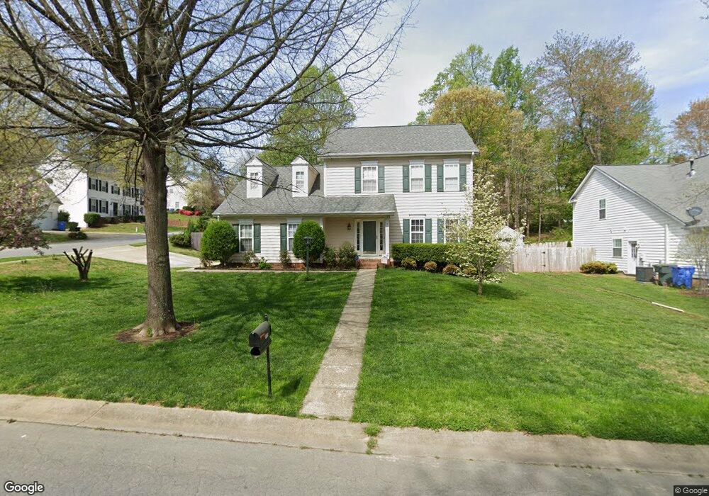
101 Red Tip Ln Mooresville, NC 28117
Estimated Value: $353,000 - $429,000
4
Beds
3
Baths
2,140
Sq Ft
$185/Sq Ft
Est. Value
About This Home
This home is located at 101 Red Tip Ln, Mooresville, NC 28117 and is currently estimated at $396,702, approximately $185 per square foot. 101 Red Tip Ln is a home located in Iredell County with nearby schools including South Elementary School, Mooresville Intermediate School, and Mooresville Middle.
Ownership History
Date
Name
Owned For
Owner Type
Purchase Details
Closed on
Apr 15, 2016
Sold by
Gilliam Jason L and Gilliam Patricia R
Bought by
Connell Andrew and Connell Amy
Current Estimated Value
Home Financials for this Owner
Home Financials are based on the most recent Mortgage that was taken out on this home.
Original Mortgage
$199,500
Outstanding Balance
$158,282
Interest Rate
3.64%
Mortgage Type
New Conventional
Estimated Equity
$238,420
Purchase Details
Closed on
Feb 29, 2012
Sold by
Smith John W and Smith Nancy M
Bought by
Gilliam Jason L
Purchase Details
Closed on
Nov 1, 1996
Purchase Details
Closed on
Oct 1, 1996
Purchase Details
Closed on
Dec 1, 1994
Create a Home Valuation Report for This Property
The Home Valuation Report is an in-depth analysis detailing your home's value as well as a comparison with similar homes in the area
Home Values in the Area
Average Home Value in this Area
Purchase History
| Date | Buyer | Sale Price | Title Company |
|---|---|---|---|
| Connell Andrew | $210,000 | None Available | |
| Gilliam Jason L | $167,000 | -- | |
| -- | $140,000 | -- | |
| -- | $78,000 | -- | |
| -- | -- | -- |
Source: Public Records
Mortgage History
| Date | Status | Borrower | Loan Amount |
|---|---|---|---|
| Open | Connell Andrew | $199,500 |
Source: Public Records
Tax History Compared to Growth
Tax History
| Year | Tax Paid | Tax Assessment Tax Assessment Total Assessment is a certain percentage of the fair market value that is determined by local assessors to be the total taxable value of land and additions on the property. | Land | Improvement |
|---|---|---|---|---|
| 2024 | $4,298 | $354,270 | $59,000 | $295,270 |
| 2023 | $4,238 | $354,270 | $59,000 | $295,270 |
| 2022 | $2,935 | $211,480 | $36,000 | $175,480 |
| 2021 | $2,931 | $211,480 | $36,000 | $175,480 |
| 2020 | $2,931 | $211,480 | $36,000 | $175,480 |
| 2019 | $2,909 | $211,480 | $36,000 | $175,480 |
| 2018 | $2,532 | $182,560 | $35,000 | $147,560 |
| 2017 | $2,393 | $176,510 | $35,000 | $141,510 |
| 2016 | $2,393 | $176,510 | $35,000 | $141,510 |
| 2015 | $2,393 | $176,510 | $35,000 | $141,510 |
| 2014 | $2,462 | $188,010 | $25,000 | $163,010 |
Source: Public Records
Map
Nearby Homes
- 157 Talbert Town Loop
- 245 Rose St
- 128 Talbert Town Loop
- 121 Talbert Town Loop
- 129 Easy St
- 131 Diamond Dr
- 110 Perrin Park Loop
- 161 Dry Dock Loop
- 159 Dry Dock Loop
- 155 Mcadam Ln
- 115 Sunridge Dr
- 136 Mangum Cir
- 124 Clipper Ln
- 105 Delargy Cir
- 131 Delargy Cir
- 167 N Arcadian Way
- 140 N Arcadian Way
- 111 Beverly Chase Ln
- 131 Misty Arbor Ln
- 141 Cypress Landing Dr
- 105 Red Tip Ln
- 103 Meadow Pond Ln
- 110 Meadow Pond Ln
- 361 Talbert Rd
- 119 Meadow Pond Ln
- 114 Meadow Pond Ln
- 106 Meadow Pond Ln
- 109 Red Tip Ln
- 118 Meadow Pond Ln
- 110 Red Tip Ln
- 102 Meadow Pond Ln
- 201 Meadow Pond Ln
- 123 Meadow Pond Ln
- 122 Meadow Pond Ln
- 233 Blackberry Ln
- 111 Red Tip Ln
- 118 Red Tip Ln
- 371 Talbert Rd
- 225 Blackberry Ln
- 127 Meadow Pond Ln