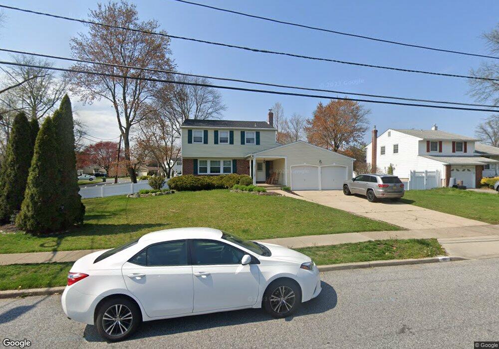
101 Roanoke Rd Cherry Hill, NJ 08003
Estimated Value: $501,195 - $564,000
--
Bed
--
Bath
2,102
Sq Ft
$254/Sq Ft
Est. Value
About This Home
This home is located at 101 Roanoke Rd, Cherry Hill, NJ 08003 and is currently estimated at $533,549, approximately $253 per square foot. 101 Roanoke Rd is a home located in Camden County with nearby schools including Joseph D. Sharp Elementary School, Henry C. Beck Middle School, and Cherry Hill High-East High School.
Ownership History
Date
Name
Owned For
Owner Type
Purchase Details
Closed on
Jun 17, 2022
Sold by
Bishop and Tracy
Bought by
Mezzy Lauren and Mezzy Caleb
Current Estimated Value
Home Financials for this Owner
Home Financials are based on the most recent Mortgage that was taken out on this home.
Original Mortgage
$348,500
Outstanding Balance
$331,484
Interest Rate
5.23%
Mortgage Type
New Conventional
Estimated Equity
$202,065
Purchase Details
Closed on
May 21, 1999
Sold by
Vlad Judith A
Bought by
Bishop Richard and Bishop Tracy
Home Financials for this Owner
Home Financials are based on the most recent Mortgage that was taken out on this home.
Original Mortgage
$93,950
Interest Rate
6.85%
Create a Home Valuation Report for This Property
The Home Valuation Report is an in-depth analysis detailing your home's value as well as a comparison with similar homes in the area
Home Values in the Area
Average Home Value in this Area
Purchase History
| Date | Buyer | Sale Price | Title Company |
|---|---|---|---|
| Mezzy Lauren | $410,000 | Surety Title | |
| Mezzy Lauren | $410,000 | Surety Title | |
| Bishop Richard | $168,000 | -- |
Source: Public Records
Mortgage History
| Date | Status | Borrower | Loan Amount |
|---|---|---|---|
| Open | Mezzy Lauren | $348,500 | |
| Closed | Mezzy Lauren | $348,500 | |
| Previous Owner | Bishop Richard | $93,950 |
Source: Public Records
Tax History Compared to Growth
Tax History
| Year | Tax Paid | Tax Assessment Tax Assessment Total Assessment is a certain percentage of the fair market value that is determined by local assessors to be the total taxable value of land and additions on the property. | Land | Improvement |
|---|---|---|---|---|
| 2025 | $10,559 | $236,800 | $71,200 | $165,600 |
| 2024 | $9,950 | $236,800 | $71,200 | $165,600 |
| 2023 | $9,950 | $236,800 | $71,200 | $165,600 |
| 2022 | $9,676 | $236,800 | $71,200 | $165,600 |
| 2021 | $9,706 | $236,800 | $71,200 | $165,600 |
| 2020 | $9,588 | $236,800 | $71,200 | $165,600 |
| 2019 | $9,583 | $236,800 | $71,200 | $165,600 |
| 2018 | $9,557 | $236,800 | $71,200 | $165,600 |
| 2017 | $9,427 | $236,800 | $71,200 | $165,600 |
| 2016 | $9,302 | $236,800 | $71,200 | $165,600 |
| 2015 | $9,155 | $236,800 | $71,200 | $165,600 |
| 2014 | $9,053 | $236,800 | $71,200 | $165,600 |
Source: Public Records
Map
Nearby Homes
- 16 Gatehouse Ln
- 100 E Eagle Ln
- 8 Elbow Ln
- 309 Highgate Ln
- 26 Regent Rd
- 103 Aspen Ct
- 220 Deerpark Ct
- 360 Juniper St
- 145 Kilburn Dr
- 100 Old Colony Ln
- 112 Champlain Rd
- 219 Conestoga Dr
- 213 Balfield Terrace
- 2 W High Ridge Rd
- 800 Marlowe Rd
- 102 Partree Rd
- 209 Henfield Ave
- 22 Hawk Ln
- 110 Partree Rd
- 63 Banner Ct Unit 63
- 103 Roanoke Rd
- 19 Firethorne Rd
- 102 Roanoke Rd
- 7 Roanoke Rd
- 28 Candlewyck Way
- 17 Firethorne Rd
- 26 Candlewyck Way
- 14 Firethorne Rd
- 100 Roanoke Rd
- 24 Candlewyck Way
- 200 Roanoke Rd
- 4 Locust Grove Rd
- 15 Firethorne Rd
- 12 Firethorne Rd
- 5 Roanoke Rd
- 3 Waverly Rd
- 22 Candlewyck Way
- 202 Roanoke Rd
- 13 Firethorne Rd
- 6 Locust Grove Rd