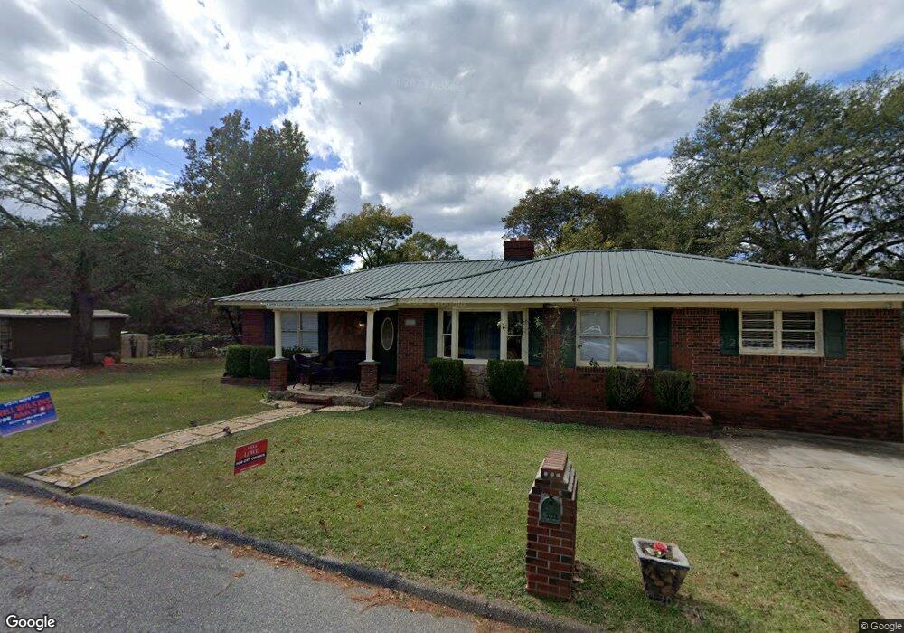
101 Rolax St Manchester, GA 31816
Estimated Value: $134,000 - $186,000
3
Beds
1
Bath
1,785
Sq Ft
$88/Sq Ft
Est. Value
About This Home
This home is located at 101 Rolax St, Manchester, GA 31816 and is currently estimated at $157,443, approximately $88 per square foot. 101 Rolax St is a home located in Meriwether County with nearby schools including Mountain View Elementary School, Manchester Middle School, and Manchester High School.
Ownership History
Date
Name
Owned For
Owner Type
Purchase Details
Closed on
Aug 26, 2004
Sold by
Jones Audra Lashay J
Bought by
Jones Audra and Jones Billy D
Current Estimated Value
Purchase Details
Closed on
Apr 8, 2004
Sold by
Jones Audra and Jones Billy D
Bought by
Jones Billy D and Jones Audra
Purchase Details
Closed on
Dec 14, 1994
Sold by
Johnson George
Bought by
Jones Audra Lashay J
Purchase Details
Closed on
Oct 3, 1994
Sold by
George Johnson
Bought by
Johnson George
Purchase Details
Closed on
Jan 1, 1994
Sold by
Johnson George
Bought by
George Johnson
Purchase Details
Closed on
Jan 1, 1956
Bought by
Johnson George
Create a Home Valuation Report for This Property
The Home Valuation Report is an in-depth analysis detailing your home's value as well as a comparison with similar homes in the area
Home Values in the Area
Average Home Value in this Area
Purchase History
| Date | Buyer | Sale Price | Title Company |
|---|---|---|---|
| Jones Audra | -- | -- | |
| Jones Billy D | -- | -- | |
| Jones Audra Lashay J | -- | -- | |
| Johnson George | -- | -- | |
| George Johnson | $24,300 | -- | |
| Johnson George | -- | -- |
Source: Public Records
Tax History Compared to Growth
Tax History
| Year | Tax Paid | Tax Assessment Tax Assessment Total Assessment is a certain percentage of the fair market value that is determined by local assessors to be the total taxable value of land and additions on the property. | Land | Improvement |
|---|---|---|---|---|
| 2024 | $1,186 | $43,960 | $1,360 | $42,600 |
| 2023 | $952 | $28,560 | $1,360 | $27,200 |
| 2022 | $952 | $28,560 | $1,360 | $27,200 |
| 2021 | $324 | $23,920 | $1,360 | $22,560 |
| 2020 | $327 | $23,920 | $1,360 | $22,560 |
| 2019 | $304 | $23,920 | $1,360 | $22,560 |
| 2018 | $331 | $23,920 | $1,360 | $22,560 |
| 2017 | $335 | $23,920 | $1,360 | $22,560 |
| 2016 | $335 | $23,920 | $1,360 | $22,560 |
| 2015 | $336 | $23,920 | $1,360 | $22,560 |
| 2014 | $336 | $23,920 | $1,360 | $22,560 |
| 2013 | -- | $23,920 | $1,360 | $22,560 |
Source: Public Records
Map
Nearby Homes
- 305 Holy Hill Place
- 200 Hunt Cir
- 802 Jd Parham Dr
- 919 L S Glencamp Way
- 603 Atlantic St
- 13.27 ACRES Roosevelt Hwy
- 522 4th St
- 322 Chalybeate St
- 514 Farris Blvd
- 434 Parkman Dr
- 0 Phil Howe Rd Unit 10494213
- 604 Farris Blvd
- 304 4th St
- 621 Mayes Way
- 617 Mayes Way
- 624 Sunset Dr
- 77 Cordwood St
- 12 Truitt St
- 408 Broad St
- 94 Cato St
- 103 Rolax St
- 1014 Tim Brown Dr
- 1012 Tim Brown Dr
- 1010 Tim Brown Dr
- 105 Holy Hill Place
- 103 Holy Hill Place
- 1002 Tim Brown Dr
- 201 Rolax St
- 1017 Tim Brown Dr
- 115 Holy Hill Place
- 1015 Tim Brown Dr
- 0 Rolax St
- 104 Holy Hill Place
- 203 Rolax St
- 611 Tim Brown Dr
- 114 Holy Hill Place
- 106 Holy Hill Place
- 1018 Tim Brown Dr
- 112 Holy Hill Place
- 203 Holy Hill Place