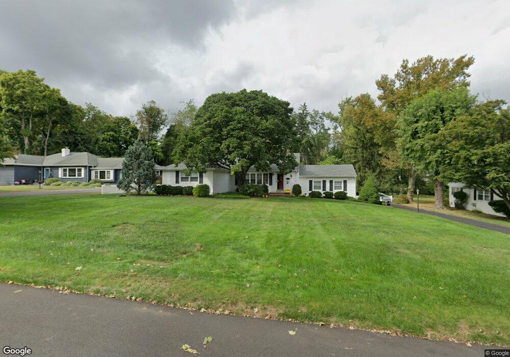
101 Rutledge Dr Red Bank, NJ 07701
New Monmouth NeighborhoodEstimated Value: $743,000 - $818,000
3
Beds
3
Baths
1,396
Sq Ft
$547/Sq Ft
Est. Value
About This Home
This home is located at 101 Rutledge Dr, Red Bank, NJ 07701 and is currently estimated at $763,398, approximately $546 per square foot. 101 Rutledge Dr is a home located in Monmouth County with nearby schools including Middletown Village Elementary School, Thompson Middle School, and Middletown High School North.
Ownership History
Date
Name
Owned For
Owner Type
Purchase Details
Closed on
Sep 2, 1997
Sold by
Lenhart Park
Bought by
Sullivan Anthony and Sullivan Ursula
Current Estimated Value
Home Financials for this Owner
Home Financials are based on the most recent Mortgage that was taken out on this home.
Original Mortgage
$65,000
Outstanding Balance
$10,064
Interest Rate
7.46%
Estimated Equity
$753,334
Purchase Details
Closed on
Sep 15, 1994
Sold by
Boyd Edwin
Bought by
Lenhart Park and Lenhart Karen
Home Financials for this Owner
Home Financials are based on the most recent Mortgage that was taken out on this home.
Original Mortgage
$180,000
Interest Rate
8.78%
Create a Home Valuation Report for This Property
The Home Valuation Report is an in-depth analysis detailing your home's value as well as a comparison with similar homes in the area
Home Values in the Area
Average Home Value in this Area
Purchase History
| Date | Buyer | Sale Price | Title Company |
|---|---|---|---|
| Sullivan Anthony | $220,000 | -- | |
| Lenhart Park | $200,000 | -- |
Source: Public Records
Mortgage History
| Date | Status | Borrower | Loan Amount |
|---|---|---|---|
| Open | Sullivan Anthony | $65,000 | |
| Previous Owner | Lenhart Park | $180,000 |
Source: Public Records
Tax History Compared to Growth
Tax History
| Year | Tax Paid | Tax Assessment Tax Assessment Total Assessment is a certain percentage of the fair market value that is determined by local assessors to be the total taxable value of land and additions on the property. | Land | Improvement |
|---|---|---|---|---|
| 2025 | $9,674 | $692,700 | $466,000 | $226,700 |
| 2024 | $8,817 | $588,100 | $375,200 | $212,900 |
| 2023 | $8,817 | $507,300 | $345,900 | $161,400 |
| 2022 | $8,268 | $480,700 | $327,000 | $153,700 |
| 2021 | $8,268 | $428,000 | $291,300 | $136,700 |
| 2020 | $9,084 | $424,900 | $291,300 | $133,600 |
| 2019 | $9,168 | $434,100 | $291,300 | $142,800 |
| 2018 | $9,281 | $428,300 | $265,000 | $163,300 |
| 2017 | $8,993 | $423,400 | $265,000 | $158,400 |
| 2016 | $8,667 | $406,700 | $255,000 | $151,700 |
| 2015 | $8,676 | $406,200 | $255,000 | $151,200 |
| 2014 | $7,513 | $343,200 | $205,000 | $138,200 |
Source: Public Records
Map
Nearby Homes
- 0 Hamiltonian Dr Unit 22514980
- 11 Mayflower Dr
- 20 Devon Rd
- 8 Allston St
- 304 April Way Unit 304
- 211 April Way Unit 211
- 35 Woodland Dr
- 93 Twin Brooks Ave
- 24 Princeton St
- 164 Heights Terrace
- 7 Meehan Ct
- 6 Waller Dr
- 10 Waller Dr
- 44 Monroe St
- 16 Waller Dr
- 22 Waller Dr
- Hartshorne Plan at Middletown Walk
- 58 Edmund Way
- 74 Fish Hawk Dr
- 152 Chapel Hill Rd
- 87 Rutledge Dr
- 119 Rutledge Dr
- 79 Rutledge Dr
- 125 Rutledge Dr
- 96 Rutledge Dr
- 104 Rutledge Dr
- 88 Rutledge Dr
- 143 Rutledge Dr
- 80 Rutledge Dr
- 71 Rutledge Dr
- 112 Rutledge Dr
- 157 Rutledge Dr
- 443 Brook Rd
- 3 Corn Ln
- 120 Rutledge Dr
- 72 Rutledge Dr
- 165 Rutledge Dr
- 136 Rutledge Dr
- 128 Rutledge Dr
- 63 Rutledge Dr