Estimated Value: $194,000 - $219,000
2
Beds
2
Baths
1,228
Sq Ft
$166/Sq Ft
Est. Value
About This Home
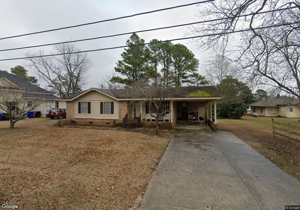
This home is located at 101 S Carrie St, Coats, NC 27521 and is currently estimated at $204,155, approximately $166 per square foot. 101 S Carrie St is a home with nearby schools including Coats Elementary School, Coats-Erwin Middle School, and Triton High School.
Ownership History
Date
Name
Owned For
Owner Type
Purchase Details
Closed on
Aug 1, 2025
Sold by
Barefoot Brendan Wayne
Bought by
Premier Property Group Llc
Current Estimated Value
Home Financials for this Owner
Home Financials are based on the most recent Mortgage that was taken out on this home.
Original Mortgage
$2,604,000
Outstanding Balance
$2,599,556
Interest Rate
6.81%
Mortgage Type
Credit Line Revolving
Estimated Equity
-$2,395,401
Purchase Details
Closed on
Jun 1, 2011
Sold by
Currin Nelson T and Currin Coma Lee
Bought by
Currin Nalsan Durane and Currin Daonna K
Create a Home Valuation Report for This Property
The Home Valuation Report is an in-depth analysis detailing your home's value as well as a comparison with similar homes in the area
Home Values in the Area
Average Home Value in this Area
Purchase History
| Date | Buyer | Sale Price | Title Company |
|---|---|---|---|
| Premier Property Group Llc | -- | None Listed On Document | |
| Premier Property Group Llc | -- | None Listed On Document | |
| Barefoot Brendan Wayne | $1,600,000 | None Available | |
| Currin Nalsan Durane | $119,000 | -- |
Source: Public Records
Mortgage History
| Date | Status | Borrower | Loan Amount |
|---|---|---|---|
| Open | Premier Property Group Llc | $2,604,000 | |
| Closed | Premier Property Group Llc | $2,604,000 | |
| Previous Owner | Barefoot Brendan Wayne | $1,600,000 |
Source: Public Records
Tax History Compared to Growth
Tax History
| Year | Tax Paid | Tax Assessment Tax Assessment Total Assessment is a certain percentage of the fair market value that is determined by local assessors to be the total taxable value of land and additions on the property. | Land | Improvement |
|---|---|---|---|---|
| 2025 | $1,575 | $125,090 | $0 | $0 |
| 2024 | $1,575 | $125,090 | $0 | $0 |
| 2023 | $1,575 | $125,090 | $0 | $0 |
| 2022 | $1,243 | $125,090 | $0 | $0 |
| 2021 | $1,243 | $79,890 | $0 | $0 |
| 2020 | $1,227 | $79,890 | $0 | $0 |
| 2019 | $1,212 | $79,890 | $0 | $0 |
| 2018 | $1,212 | $79,890 | $0 | $0 |
| 2017 | $1,212 | $79,890 | $0 | $0 |
| 2016 | $1,294 | $85,620 | $0 | $0 |
| 2015 | -- | $85,620 | $0 | $0 |
| 2014 | -- | $85,620 | $0 | $0 |
Source: Public Records
Map
Nearby Homes
- 221 E Jackson St
- 355 S Church St
- 211 E Washington St
- 221 E Washington St
- 229 E Washington St
- 440 S Church St
- 2113 N Carolina 55
- 0 Brick Mill Rd Unit 10081282
- 203 W Stewart St
- 30 E Lynn St
- 87 E Williams St
- 590 N Carolina 55
- 0 Nc 27 Hwy E Unit 10124283
- 145 E Jay St
- 76 Maple St
- 205 Regis Ln
- 205 Regis Ln Unit 11
- 486 S Denise Ave
- 00 N Carolina 27
- 121 Ash St
- 53 W Washington St
- 55 W Washington St
- 49 W Washington St
- 51 W Washington St
- 35 W Washington St
- 33 W Washington St
- 124 S Mckinley St
- 80 S Carrie St
- 82 S Mckinley St
- 114 S Carrie St
- 46 W Washington St
- 202 W Washington St
- 57 W Jackson St
- 39 W Jackson St Unit A
- 39 W Jackson St
- 52 S Carrie St
- 0 Washington St Unit 1999848
- 0 Washington St Unit 1999886
- 0 Washington St Unit 2060807
- 155 S Carrie St