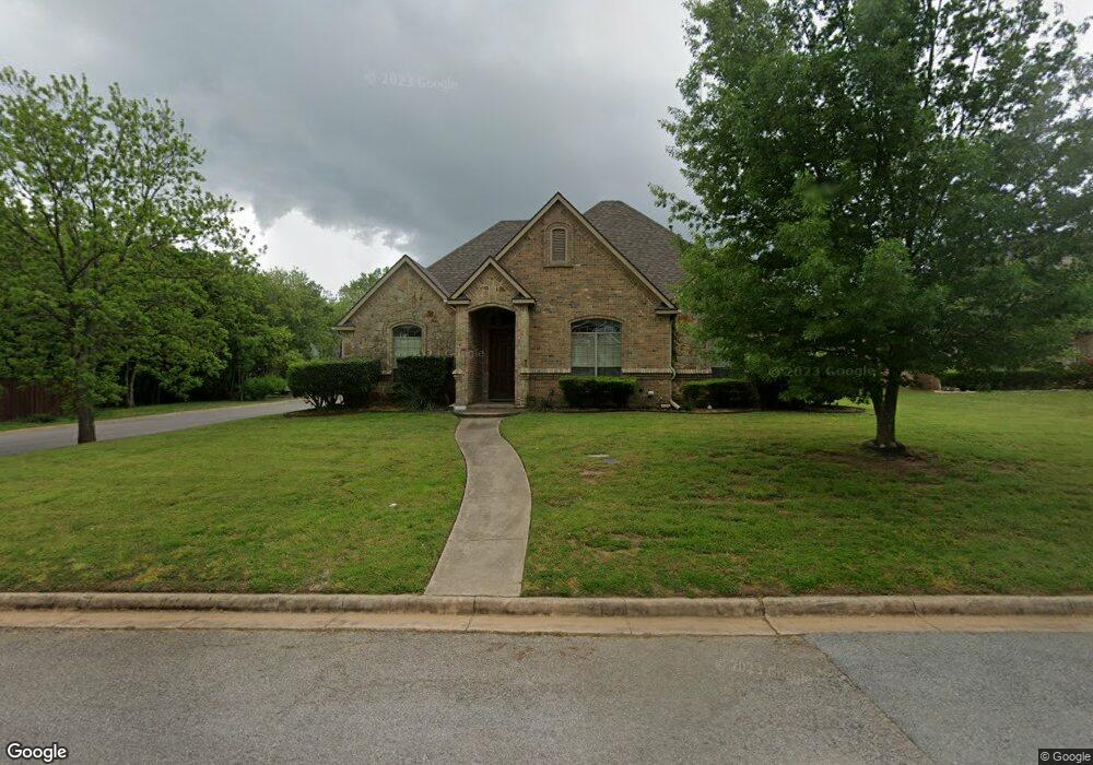
101 Sara Cir Pottsboro, TX 75076
Estimated Value: $372,044 - $411,000
--
Bed
--
Bath
2,056
Sq Ft
$190/Sq Ft
Est. Value
About This Home
This home is located at 101 Sara Cir, Pottsboro, TX 75076 and is currently estimated at $391,522, approximately $190 per square foot. 101 Sara Cir is a home located in Grayson County with nearby schools including Pottsboro Elementary School, Pottsboro Middle School, and Pottsboro High School.
Ownership History
Date
Name
Owned For
Owner Type
Purchase Details
Closed on
Jul 16, 2004
Sold by
Deaton Ronald and Deaton Florette
Bought by
Thompson James David and Thompson Marcia
Current Estimated Value
Home Financials for this Owner
Home Financials are based on the most recent Mortgage that was taken out on this home.
Original Mortgage
$169,600
Outstanding Balance
$85,283
Interest Rate
6.32%
Mortgage Type
Purchase Money Mortgage
Estimated Equity
$306,239
Create a Home Valuation Report for This Property
The Home Valuation Report is an in-depth analysis detailing your home's value as well as a comparison with similar homes in the area
Home Values in the Area
Average Home Value in this Area
Purchase History
| Date | Buyer | Sale Price | Title Company |
|---|---|---|---|
| Thompson James David | -- | -- |
Source: Public Records
Mortgage History
| Date | Status | Borrower | Loan Amount |
|---|---|---|---|
| Open | Thompson James David | $169,600 |
Source: Public Records
Tax History Compared to Growth
Tax History
| Year | Tax Paid | Tax Assessment Tax Assessment Total Assessment is a certain percentage of the fair market value that is determined by local assessors to be the total taxable value of land and additions on the property. | Land | Improvement |
|---|---|---|---|---|
| 2025 | $2,164 | $406,993 | -- | -- |
| 2024 | $7,140 | $369,994 | $0 | $0 |
| 2023 | $2,151 | $336,358 | $0 | $0 |
| 2022 | $6,479 | $305,780 | $0 | $0 |
| 2021 | $6,166 | $286,766 | $20,928 | $265,838 |
| 2020 | $5,792 | $252,711 | $20,928 | $231,783 |
| 2019 | $6,848 | $294,978 | $20,928 | $274,050 |
| 2018 | $6,283 | $259,412 | $20,928 | $238,484 |
| 2017 | $5,856 | $238,908 | $20,928 | $217,980 |
| 2016 | $5,417 | $221,004 | $20,928 | $200,076 |
| 2015 | $3,765 | $202,416 | $15,696 | $186,720 |
| 2014 | $3,795 | $187,111 | $15,696 | $171,415 |
Source: Public Records
Map
Nearby Homes
- Lot 14 Lauren Ln
- 105 Park Ln
- 412 Main St
- 505 S Magnolia St
- TBD Cardinal Ln
- 408 Front St
- 106 Cardinal Ln
- 113 Ginger Dr
- 206 S Magnolia St
- 308 Front St
- 137 Pearce Dr
- 105 E William St
- 110 E Fm 120
- 106 Kristy Ct
- 614 Franklin Ave
- 622 Franklin Ave
- 102 William St
- Lot 39 White Tail Way
- 401 Grayson St
- 405 Grayson St