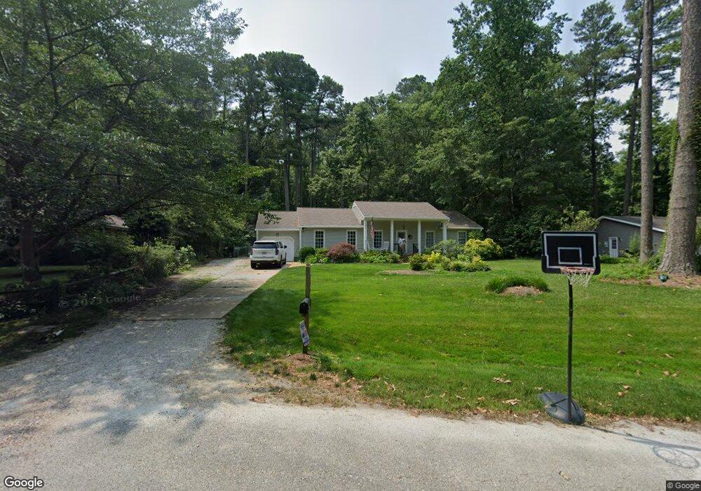
101 Somerset Cir Yorktown, VA 23692
Grafton NeighborhoodEstimated Value: $429,467 - $470,000
3
Beds
2
Baths
1,872
Sq Ft
$238/Sq Ft
Est. Value
About This Home
This home is located at 101 Somerset Cir, Yorktown, VA 23692 and is currently estimated at $444,867, approximately $237 per square foot. 101 Somerset Cir is a home located in York County with nearby schools including Dare Elementary School, Yorktown Middle School, and York High School.
Ownership History
Date
Name
Owned For
Owner Type
Purchase Details
Closed on
Apr 12, 2021
Sold by
Leatherbury Philip T and Leatherbury Geralyn C
Bought by
Cook Robert S and Cook Sarah
Current Estimated Value
Home Financials for this Owner
Home Financials are based on the most recent Mortgage that was taken out on this home.
Original Mortgage
$288,800
Outstanding Balance
$260,751
Interest Rate
3%
Mortgage Type
New Conventional
Estimated Equity
$184,116
Purchase Details
Closed on
Oct 12, 2017
Sold by
Leatherbury Philip T and Leatherbury Geralyn C
Bought by
Leatherbury Philip T and Leatherbury Geralyn C
Create a Home Valuation Report for This Property
The Home Valuation Report is an in-depth analysis detailing your home's value as well as a comparison with similar homes in the area
Home Values in the Area
Average Home Value in this Area
Purchase History
| Date | Buyer | Sale Price | Title Company |
|---|---|---|---|
| Cook Robert S | $361,000 | Attorney | |
| Leatherbury Philip T | -- | None Available |
Source: Public Records
Mortgage History
| Date | Status | Borrower | Loan Amount |
|---|---|---|---|
| Open | Cook Robert S | $288,800 |
Source: Public Records
Tax History Compared to Growth
Tax History
| Year | Tax Paid | Tax Assessment Tax Assessment Total Assessment is a certain percentage of the fair market value that is determined by local assessors to be the total taxable value of land and additions on the property. | Land | Improvement |
|---|---|---|---|---|
| 2025 | $2,774 | $374,900 | $132,000 | $242,900 |
| 2024 | $2,774 | $374,900 | $132,000 | $242,900 |
| 2023 | $2,620 | $340,300 | $132,000 | $208,300 |
| 2022 | $2,654 | $340,300 | $132,000 | $208,300 |
| 2021 | $1,185 | $298,200 | $114,400 | $183,800 |
| 2020 | $2,371 | $298,200 | $114,400 | $183,800 |
| 2019 | $3,303 | $289,700 | $114,400 | $175,300 |
| 2018 | $3,303 | $289,700 | $114,400 | $175,300 |
| 2017 | $2,107 | $280,400 | $110,000 | $170,400 |
| 2016 | -- | $280,400 | $110,000 | $170,400 |
| 2015 | -- | $278,700 | $110,000 | $168,700 |
| 2014 | -- | $278,700 | $110,000 | $168,700 |
Source: Public Records
Map
Nearby Homes
- 102 Holly Place
- 100 Davids Way
- 205 Lynns Way
- 204 Harlan Dr
- 125 Winsome Haven Dr
- 303 Rosewood Ln
- 100 Seaford Rd
- 123 Kristin Ct
- 108 Osborn Ln
- 106 Karley Place
- 121 Dorothy Dr
- 421 Whispering Pine Dr
- 1404 Seaford Rd
- 2402 Wolf Trap Rd
- 400 Fielding Lewis Dr
- 110 Hailsham Place
- 231 Dare Rd
- 117 Stagecoach Watch
- 315 Dare Rd
- 100 Thornrose Dr
- 117 Barcroft Dr
- 103 Somerset Cir
- 115 Barcroft Dr
- 105 Somerset Cir
- 100 Somerset Cir
- 102 Somerset Cir
- 610 Allens Mill Rd
- 610-C Allens Mill Rd
- 114 Barcroft Dr
- 113 Barcroft Dr
- 107 Somerset Cir
- 112 Barcroft Dr
- 200 Barcroft Dr
- 104 Somerset Cir
- 205 Barcroft Dr
- 110 Barcroft Dr
- 111 Barcroft Dr
- 109 Somerset Cir
- 202 Barcroft Dr
- 602 Allens Mill Rd