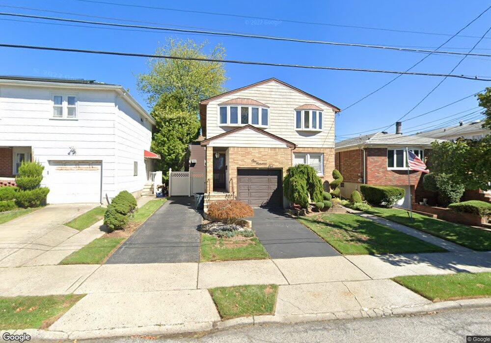
101 Spratt Ave Unit 1 Staten Island, NY 10306
Bay Terrace NeighborhoodEstimated Value: $926,718 - $1,164,000
2
Beds
1
Bath
1,000
Sq Ft
$1,069/Sq Ft
Est. Value
About This Home
This home is located at 101 Spratt Ave Unit 1, Staten Island, NY 10306 and is currently estimated at $1,069,180, approximately $1,069 per square foot. 101 Spratt Ave Unit 1 is a home located in Richmond County with nearby schools including P.S. 53 The Barbara Esselborn School, Myra S. Barnes Intermediate School 24, and New Dorp High School.
Ownership History
Date
Name
Owned For
Owner Type
Purchase Details
Closed on
Aug 28, 2017
Sold by
Sileo Victor J and Sileo Annabella
Bought by
Chen Kao Ming and Chen Li Duan
Current Estimated Value
Home Financials for this Owner
Home Financials are based on the most recent Mortgage that was taken out on this home.
Original Mortgage
$495,000
Outstanding Balance
$413,693
Interest Rate
3.93%
Mortgage Type
New Conventional
Estimated Equity
$655,487
Create a Home Valuation Report for This Property
The Home Valuation Report is an in-depth analysis detailing your home's value as well as a comparison with similar homes in the area
Home Values in the Area
Average Home Value in this Area
Purchase History
| Date | Buyer | Sale Price | Title Company |
|---|---|---|---|
| Chen Kao Ming | $710,000 | Fidelity National Title Insu |
Source: Public Records
Mortgage History
| Date | Status | Borrower | Loan Amount |
|---|---|---|---|
| Open | Chen Kao Ming | $495,000 |
Source: Public Records
Tax History Compared to Growth
Tax History
| Year | Tax Paid | Tax Assessment Tax Assessment Total Assessment is a certain percentage of the fair market value that is determined by local assessors to be the total taxable value of land and additions on the property. | Land | Improvement |
|---|---|---|---|---|
| 2025 | $9,857 | $62,880 | $9,809 | $53,071 |
| 2024 | $9,857 | $58,200 | $10,523 | $47,677 |
| 2023 | $9,625 | $47,394 | $9,371 | $38,023 |
| 2022 | $8,926 | $61,800 | $12,480 | $49,320 |
| 2021 | $9,187 | $51,180 | $12,480 | $38,700 |
| 2020 | $8,717 | $49,980 | $12,480 | $37,500 |
| 2019 | $8,555 | $43,440 | $12,480 | $30,960 |
| 2018 | $8,051 | $39,495 | $10,294 | $29,201 |
| 2017 | $7,296 | $37,260 | $12,480 | $24,780 |
| 2016 | $6,963 | $36,379 | $12,425 | $23,954 |
| 2015 | $6,235 | $34,320 | $10,380 | $23,940 |
| 2014 | $6,235 | $34,080 | $10,380 | $23,700 |
Source: Public Records
Map
Nearby Homes
- 133 Durant Ave
- 92 Twombly Ave
- 148 Hopkins Ave
- 55 O'Gorman Ave
- 220 O'Gorman Ave
- 26 Benton Ct
- 12 Benton Ct
- 2075 N Railroad Ave
- 3438 Amboy Rd Unit 3438
- 28 Bay Terrace Unit 2H
- 18 Bay Terrace Unit 1c
- 30 Greencroft Ave
- 238 Montreal Ave
- 276 Fairbanks Ave
- 3461 Amboy Rd Unit 1J
- 155 Woodcutters Ln
- 158 Malone Ave
- 390 Montreal Ave
- 52 Timber Ridge Dr Unit 52
- 29 Ashwood Ct
- 101 Spratt Ave
- 105 Spratt Ave
- 97 Spratt Ave
- 97 Spratt Ave Unit 1
- 111 Spratt Ave
- 92 Ogorman Ave
- 99 Hooper Ave
- 115 Spratt Ave
- 120 Ogorman Ave
- 120 O'Gorman Ave
- 88 Ogorman Ave
- 89 Spratt Ave
- 95 Hooper Ave
- 123 Hooper Ave
- 124 Ogorman Ave
- 85 Spratt Ave
- 91 Hooper Ave
- 93 Ogorman Ave
- 93 O'Gorman Ave
- 87 Hooper Ave