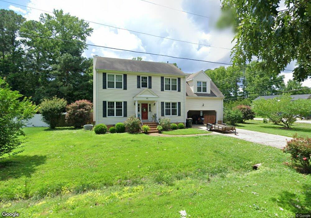
101 Tabb Ln Yorktown, VA 23693
Tabb NeighborhoodEstimated Value: $617,000 - $703,000
5
Beds
4
Baths
3,000
Sq Ft
$213/Sq Ft
Est. Value
About This Home
This home is located at 101 Tabb Ln, Yorktown, VA 23693 and is currently estimated at $639,723, approximately $213 per square foot. 101 Tabb Ln is a home located in York County with nearby schools including Mt. Vernon Elementary School, Tabb Middle School, and Tabb High School.
Ownership History
Date
Name
Owned For
Owner Type
Purchase Details
Closed on
Nov 3, 2023
Sold by
Lownds Cristina and Lownds Jesse S
Bought by
Rodrigues Neil Savio and Clements Kathryn Ann
Current Estimated Value
Home Financials for this Owner
Home Financials are based on the most recent Mortgage that was taken out on this home.
Original Mortgage
$440,800
Outstanding Balance
$432,827
Interest Rate
7.31%
Mortgage Type
New Conventional
Estimated Equity
$206,896
Purchase Details
Closed on
Aug 23, 2018
Sold by
Laney Mitchell L and Laney Roberta G
Bought by
Lownds Cristina and Lownds Jesse S
Home Financials for this Owner
Home Financials are based on the most recent Mortgage that was taken out on this home.
Original Mortgage
$433,116
Interest Rate
4.5%
Mortgage Type
VA
Create a Home Valuation Report for This Property
The Home Valuation Report is an in-depth analysis detailing your home's value as well as a comparison with similar homes in the area
Home Values in the Area
Average Home Value in this Area
Purchase History
| Date | Buyer | Sale Price | Title Company |
|---|---|---|---|
| Rodrigues Neil Savio | $551,000 | Stewart Title | |
| Lownds Cristina | $424,000 | Attorney |
Source: Public Records
Mortgage History
| Date | Status | Borrower | Loan Amount |
|---|---|---|---|
| Open | Rodrigues Neil Savio | $440,800 | |
| Previous Owner | Lownds Cristina | $433,116 |
Source: Public Records
Tax History Compared to Growth
Tax History
| Year | Tax Paid | Tax Assessment Tax Assessment Total Assessment is a certain percentage of the fair market value that is determined by local assessors to be the total taxable value of land and additions on the property. | Land | Improvement |
|---|---|---|---|---|
| 2025 | $3,873 | $523,400 | $133,000 | $390,400 |
| 2024 | $3,873 | $523,400 | $133,000 | $390,400 |
| 2023 | $3,440 | $446,800 | $120,000 | $326,800 |
| 2022 | $3,485 | $446,800 | $120,000 | $326,800 |
| 2021 | $3,225 | $405,600 | $115,800 | $289,800 |
| 2020 | $3,225 | $405,600 | $115,800 | $289,800 |
| 2019 | $4,048 | $355,100 | $115,800 | $239,300 |
| 2018 | $4,048 | $355,100 | $115,800 | $239,300 |
| 2017 | $2,666 | $354,700 | $110,000 | $244,700 |
| 2016 | -- | $354,700 | $110,000 | $244,700 |
| 2015 | -- | $354,700 | $110,000 | $244,700 |
| 2014 | -- | $354,700 | $110,000 | $244,700 |
Source: Public Records
Map
Nearby Homes
- 405 Yorktown Rd
- 116 Lawson Dr
- 102 Octavia Dr
- 119 Collington Run
- 203 William Storrs Rd
- 107 William Storrs Rd
- Lot 81 Smith Farm Estates
- 103 William Storrs Rd
- 101 Goffigans Trace
- 109 Carys Trace
- 113 Goffigans Trace
- 405 Octavia Dr
- 306 Meadowlake Rd
- 107 Freemans Trace
- 138 Yorkshire Dr
- 111 Mill Rd
- 214 Rich Rd
- 132 Breezy Point Dr
- 230 Rich Rd
- 112 Jesse St
- 103 Tabb Ln
- 408 Yorktown Rd
- 500 Yorktown Rd
- 406 Yorktown Rd
- 413 Yorktown Rd
- 409 Yorktown Rd
- 417 Yorktown Rd
- 105 Tabb Ln
- 501 Yorktown Rd
- 101 Greenland Dr
- 502 Yorktown Rd
- 105 Greenland Dr
- 401 Yorktown Rd
- 107 Tabb Ln
- 114 Lawson Dr
- 112 Lawson Dr
- 110 Lawson Dr
- 107 Greenland Dr
- 106 Tabb Ln
- 317 Yorktown Rd