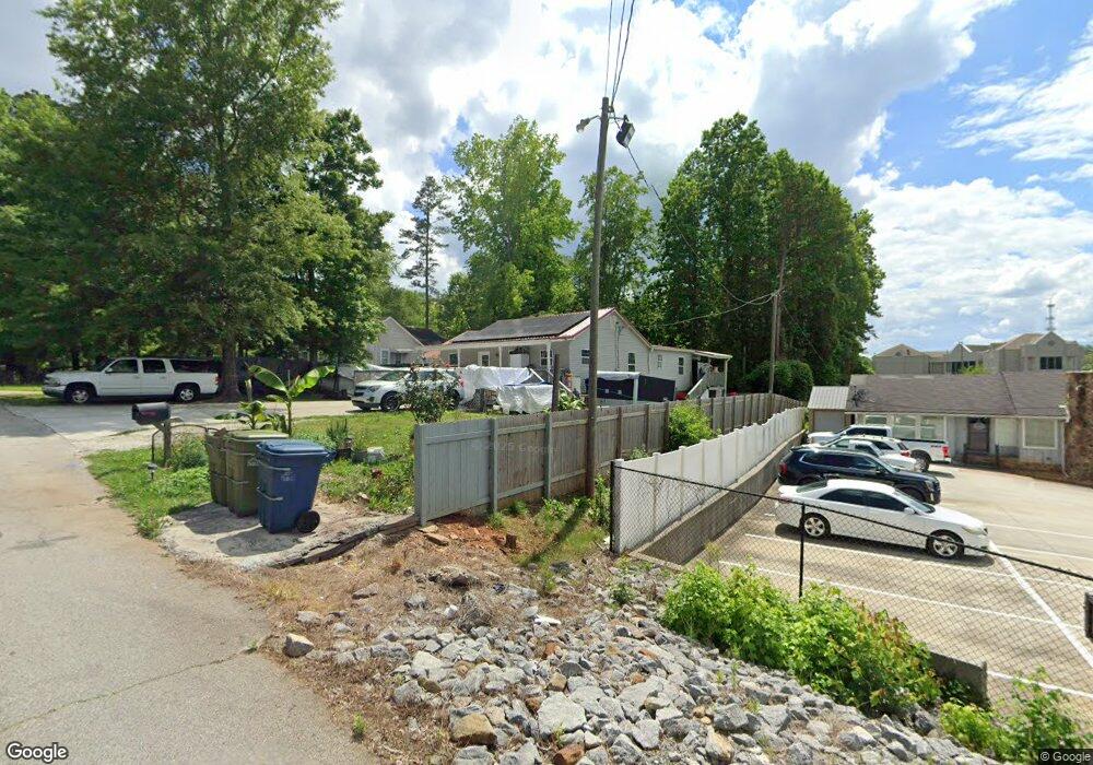
101 Thurman St Carrollton, GA 30117
Estimated Value: $233,000 - $266,000
2
Beds
3
Baths
1,640
Sq Ft
$148/Sq Ft
Est. Value
About This Home
This home is located at 101 Thurman St, Carrollton, GA 30117 and is currently estimated at $242,064, approximately $147 per square foot. 101 Thurman St is a home located in Carroll County with nearby schools including Carrollton Elementary School, Carrollton Upper Elementary School, and Carrollton Middle School.
Ownership History
Date
Name
Owned For
Owner Type
Purchase Details
Closed on
Jan 3, 2007
Sold by
Not Provided
Bought by
Banegas Martha
Current Estimated Value
Purchase Details
Closed on
Nov 29, 2004
Sold by
Norton Oliver T
Bought by
Diaz Wilber and Banegas Martha
Purchase Details
Closed on
Mar 6, 2002
Sold by
Miller Walter B
Bought by
Norton Oliver T
Purchase Details
Closed on
Feb 12, 1996
Bought by
Miller Walter B
Purchase Details
Closed on
Sep 1, 1978
Bought by
Shadinger
Create a Home Valuation Report for This Property
The Home Valuation Report is an in-depth analysis detailing your home's value as well as a comparison with similar homes in the area
Home Values in the Area
Average Home Value in this Area
Purchase History
| Date | Buyer | Sale Price | Title Company |
|---|---|---|---|
| Banegas Martha | -- | -- | |
| Diaz Wilber | $89,900 | -- | |
| Diaz Wilber | $89,892 | -- | |
| Norton Oliver T | $74,000 | -- | |
| Miller Walter B | $45,000 | -- | |
| Shadinger | -- | -- |
Source: Public Records
Tax History Compared to Growth
Tax History
| Year | Tax Paid | Tax Assessment Tax Assessment Total Assessment is a certain percentage of the fair market value that is determined by local assessors to be the total taxable value of land and additions on the property. | Land | Improvement |
|---|---|---|---|---|
| 2024 | $1,530 | $65,382 | $19,638 | $45,744 |
| 2023 | $1,530 | $61,409 | $19,639 | $41,770 |
| 2022 | $1,191 | $46,621 | $13,083 | $33,538 |
| 2021 | $1,008 | $38,679 | $9,681 | $28,998 |
| 2020 | $930 | $35,821 | $9,681 | $26,140 |
| 2019 | $887 | $34,089 | $9,681 | $24,408 |
| 2018 | $620 | $24,736 | $2,145 | $22,591 |
| 2017 | $624 | $24,736 | $2,145 | $22,591 |
| 2016 | $627 | $24,736 | $2,145 | $22,591 |
| 2015 | $1,050 | $37,990 | $8,000 | $29,990 |
| 2014 | $1,055 | $37,990 | $8,000 | $29,990 |
Source: Public Records
Map
Nearby Homes
- 0 Carroll Cir Unit LOTS 4-8 10571562
- 403 Burns Rd
- 0 Burns Rd Unit LOT 2 10571612
- 0 Burns Rd Unit LOT 3 10571635
- 0 Burns Rd Unit LOT 1 10571595
- 0 Burns Rd Unit 148013
- 114 Green Point Way
- 150 Cedar Park Way
- 0 Carroll Cir- Lots 4-8 Unit 148012
- 325 Almon Rd
- 204 Burns Rd
- 3 Burns Rd
- 2 Burns Rd
- 119 Oxford Square
- 123 Autumn Glen Dr
- 223 N Lakeshore Dr
- 201 Stewart St
- 231 N Lakeshore Dr
- 111 Lakeview Dr
- 123 Cedar Park Way
- 103 Thurman St
- 102 Thurman St
- 104 Thurman St
- 105 Thurman St
- 705 Bankhead Hwy
- 711 Bankhead Hwy
- 719 Bankhead Hwy
- 110 Thomas Newell Way
- 115 Thurman St
- 135 Carroll Cir
- 133 Carroll Cir
- 704 Bankhead Hwy
- 137 Carroll Cir
- 137 Carroll Cir
- 131 Carroll Cir
- 134 Carroll Cir
- 136 Carroll Cir
- 116 Leigh Ln
- 115 Leigh Ln
- 126 Carroll Cir