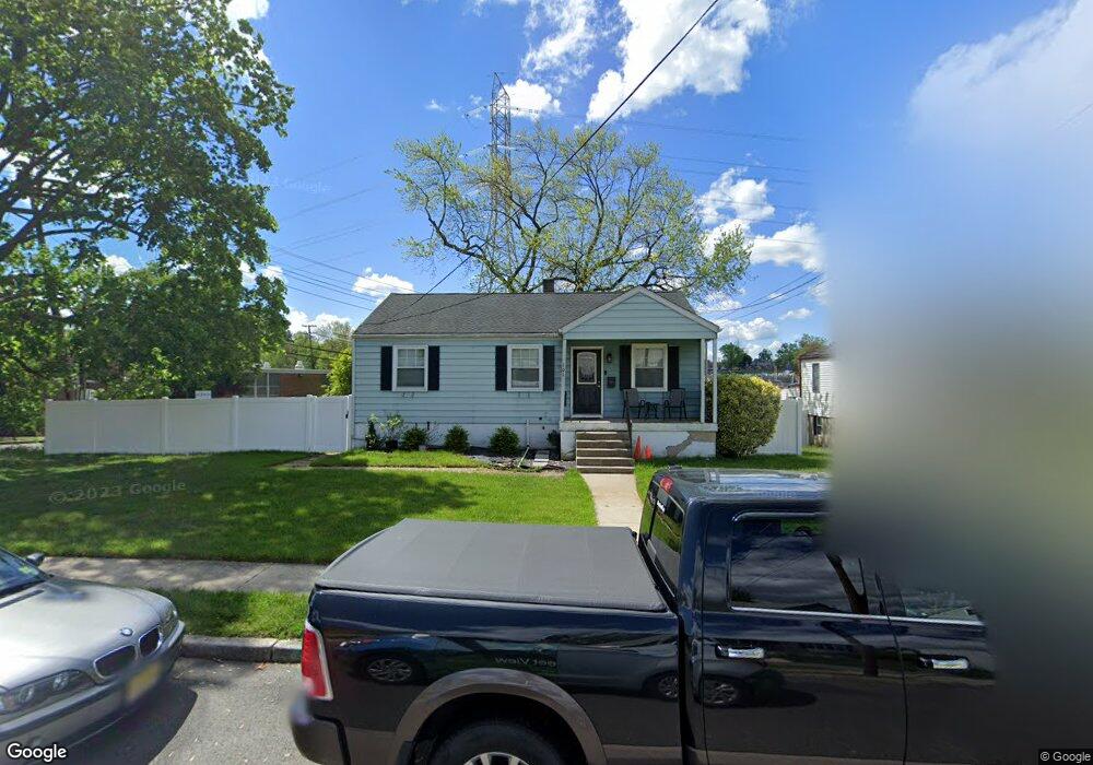
101 Underwood Ave West Deptford, NJ 08096
West Deptford Township NeighborhoodEstimated Value: $283,189 - $335,000
--
Bed
--
Bath
1,074
Sq Ft
$284/Sq Ft
Est. Value
About This Home
This home is located at 101 Underwood Ave, West Deptford, NJ 08096 and is currently estimated at $305,297, approximately $284 per square foot. 101 Underwood Ave is a home located in Gloucester County with nearby schools including Oakview Elementary School, Red Bank Elementary School, and Green-Fields Elementary School.
Ownership History
Date
Name
Owned For
Owner Type
Purchase Details
Closed on
Jun 18, 2004
Sold by
Ainsley Edward M and Ainsley Christina M
Bought by
Ruffin Shawn
Current Estimated Value
Home Financials for this Owner
Home Financials are based on the most recent Mortgage that was taken out on this home.
Original Mortgage
$152,820
Outstanding Balance
$76,203
Interest Rate
6.3%
Mortgage Type
Purchase Money Mortgage
Estimated Equity
$229,094
Create a Home Valuation Report for This Property
The Home Valuation Report is an in-depth analysis detailing your home's value as well as a comparison with similar homes in the area
Home Values in the Area
Average Home Value in this Area
Purchase History
| Date | Buyer | Sale Price | Title Company |
|---|---|---|---|
| Ruffin Shawn | $169,800 | Regional Title |
Source: Public Records
Mortgage History
| Date | Status | Borrower | Loan Amount |
|---|---|---|---|
| Open | Ruffin Shawn | $152,820 |
Source: Public Records
Tax History Compared to Growth
Tax History
| Year | Tax Paid | Tax Assessment Tax Assessment Total Assessment is a certain percentage of the fair market value that is determined by local assessors to be the total taxable value of land and additions on the property. | Land | Improvement |
|---|---|---|---|---|
| 2025 | $5,287 | $151,400 | $37,800 | $113,600 |
| 2024 | $5,219 | $151,400 | $37,800 | $113,600 |
| 2023 | $5,219 | $151,400 | $37,800 | $113,600 |
| 2022 | $5,195 | $151,400 | $37,800 | $113,600 |
| 2021 | $4,960 | $151,400 | $37,800 | $113,600 |
| 2020 | $5,164 | $151,400 | $37,800 | $113,600 |
| 2019 | $5,020 | $151,400 | $37,800 | $113,600 |
| 2018 | $4,884 | $151,400 | $37,800 | $113,600 |
| 2017 | $4,771 | $151,400 | $37,800 | $113,600 |
| 2016 | $4,637 | $151,400 | $37,800 | $113,600 |
| 2015 | $4,552 | $156,000 | $42,400 | $113,600 |
| 2014 | $4,326 | $156,000 | $42,400 | $113,600 |
Source: Public Records
Map
Nearby Homes
- 302 W Red Bank Ave
- 46 Lynn Dr
- 654 Frances Ave
- 30 N Broad St
- 626 Green St
- 34 Chestnut St
- 195 Delaware St
- 34 S Jackson St
- 7 Victorian Way
- 3 Victorian Way
- 2 Victorian Way
- 204 Hunter St
- 193 Dubois Ave
- 71 Cooper St
- 43 Curtis Ave
- 154 W Barber Ave
- 125 S Davis St
- 131 Watkins Ave
- 29 Aberdeen Place
- 17 Watkins Ave
- 111 Underwood Ave
- 115 Underwood Ave
- 6 Tatum St
- 414 Tatum St
- 119 Underwood Ave
- 112 Underwood Ave
- 116 Underwood Ave
- 122 Underwood Ave
- 2 Tatum St
- 121 Underwood Ave
- 128 Underwood Ave
- 101 Red Bank Ct
- 103 W Red Bank Ave
- 132 Underwood Ave
- 105 W Red Bank Ave
- 131 Underwood Ave
- 107 W Red Bank Ave
- 136 Underwood Ave
- 109 W Red Bank Ave
- 135 Underwood Ave