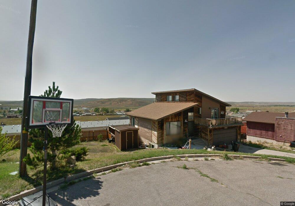
101 Union Cir Evanston, WY 82930
Estimated Value: $331,000 - $357,000
4
Beds
3
Baths
2,605
Sq Ft
$130/Sq Ft
Est. Value
About This Home
This home is located at 101 Union Cir, Evanston, WY 82930 and is currently estimated at $338,129, approximately $129 per square foot. 101 Union Cir is a home located in Uinta County with nearby schools including Evanston High School and Evanston Child Development Center.
Ownership History
Date
Name
Owned For
Owner Type
Purchase Details
Closed on
Dec 20, 2016
Sold by
Holgate Jeffrey Ryan
Bought by
Sutherland Dax M
Current Estimated Value
Home Financials for this Owner
Home Financials are based on the most recent Mortgage that was taken out on this home.
Original Mortgage
$161,616
Outstanding Balance
$130,703
Interest Rate
3.57%
Mortgage Type
New Conventional
Estimated Equity
$207,426
Purchase Details
Closed on
Dec 9, 2014
Sold by
Holgate Sheralyn
Bought by
Holgate Jeffrey Ryan
Create a Home Valuation Report for This Property
The Home Valuation Report is an in-depth analysis detailing your home's value as well as a comparison with similar homes in the area
Purchase History
| Date | Buyer | Sale Price | Title Company |
|---|---|---|---|
| Sutherland Dax M | -- | First American Title Ins Co | |
| Holgate Jeffrey Ryan | -- | None Available |
Source: Public Records
Mortgage History
| Date | Status | Borrower | Loan Amount |
|---|---|---|---|
| Open | Sutherland Dax M | $161,616 |
Source: Public Records
Tax History
| Year | Tax Paid | Tax Assessment Tax Assessment Total Assessment is a certain percentage of the fair market value that is determined by local assessors to be the total taxable value of land and additions on the property. | Land | Improvement |
|---|---|---|---|---|
| 2025 | $1,649 | $18,927 | $2,148 | $16,779 |
| 2024 | $1,649 | $24,259 | $2,754 | $21,505 |
| 2023 | $1,582 | $23,380 | $2,621 | $20,759 |
| 2022 | $1,518 | $22,304 | $1,996 | $20,308 |
| 2021 | $1,059 | $15,542 | $1,409 | $14,133 |
| 2020 | $1,009 | $14,806 | $1,409 | $13,397 |
| 2019 | $894 | $13,139 | $1,409 | $11,730 |
| 2018 | $1,098 | $14,040 | $1,465 | $12,575 |
| 2017 | $949 | $13,971 | $1,722 | $12,249 |
| 2016 | $940 | $13,826 | $1,722 | $12,104 |
| 2015 | -- | $14,791 | $1,722 | $13,069 |
| 2014 | -- | $13,348 | $1,501 | $11,847 |
| 2010 | -- | $16,037 | $0 | $0 |
Source: Public Records
Map
Nearby Homes
- 103 Revolution Ave
- 99 Union Cir
- 97 Union Cir
- 105 Revolution Ave
- 103 Rebel Dr
- 114 Revolution Ave
- 107 Revolution Ave
- 105 Rebel Dr
- 95 Union Cir
- 112 Revolution Ave
- 148 Benjamin Franklin St
- 107 Rebel Dr
- 102 Rebel Dr
- 136 Benjamin Franklin St
- 0 Rebel Dr
- 124 Benjamin Franklin St
- 109 Rebel Dr
- 106 Rebel Dr
- 101 John Hancock St
- 131 Porter Rd