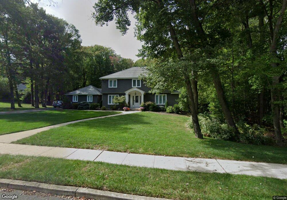
101 University Dr Lincroft, NJ 07738
Estimated Value: $1,071,000 - $1,195,000
4
Beds
2
Baths
2,595
Sq Ft
$436/Sq Ft
Est. Value
About This Home
This home is located at 101 University Dr, Lincroft, NJ 07738 and is currently estimated at $1,130,673, approximately $435 per square foot. 101 University Dr is a home located in Monmouth County with nearby schools including Lincroft Elementary School, Thompson Middle School, and Middletown - South High School.
Ownership History
Date
Name
Owned For
Owner Type
Purchase Details
Closed on
May 5, 2008
Sold by
Keane Eugene R
Bought by
Rabaglia John R and Rabaglia Daenna M
Current Estimated Value
Home Financials for this Owner
Home Financials are based on the most recent Mortgage that was taken out on this home.
Original Mortgage
$590,730
Outstanding Balance
$374,693
Interest Rate
5.91%
Mortgage Type
FHA
Estimated Equity
$755,980
Create a Home Valuation Report for This Property
The Home Valuation Report is an in-depth analysis detailing your home's value as well as a comparison with similar homes in the area
Home Values in the Area
Average Home Value in this Area
Purchase History
| Date | Buyer | Sale Price | Title Company |
|---|---|---|---|
| Rabaglia John R | $600,000 | None Available |
Source: Public Records
Mortgage History
| Date | Status | Borrower | Loan Amount |
|---|---|---|---|
| Open | Rabaglia John R | $590,730 |
Source: Public Records
Tax History Compared to Growth
Tax History
| Year | Tax Paid | Tax Assessment Tax Assessment Total Assessment is a certain percentage of the fair market value that is determined by local assessors to be the total taxable value of land and additions on the property. | Land | Improvement |
|---|---|---|---|---|
| 2025 | $14,458 | $982,400 | $546,200 | $436,200 |
| 2024 | $14,591 | $878,900 | $444,900 | $434,000 |
| 2023 | $14,591 | $839,500 | $415,600 | $423,900 |
| 2022 | $12,047 | $655,200 | $250,100 | $405,100 |
| 2021 | $12,047 | $579,200 | $218,900 | $360,300 |
| 2020 | $12,411 | $580,500 | $218,900 | $361,600 |
| 2019 | $12,216 | $578,400 | $218,900 | $359,500 |
| 2018 | $13,039 | $601,700 | $255,300 | $346,400 |
| 2017 | $12,939 | $591,100 | $255,300 | $335,800 |
| 2016 | $11,880 | $557,500 | $255,300 | $302,200 |
| 2015 | $12,315 | $558,000 | $255,300 | $302,700 |
| 2014 | $12,037 | $531,900 | $255,300 | $276,600 |
Source: Public Records
Map
Nearby Homes
- 1497 W Front St
- 7 Mccampbell Rd
- 1476 W Front St
- 246 Sunnyside Rd
- 107 Lawley Dr
- 86 Stillwell Rd
- 63 Eckert Dr
- 7 Bordeaux Ln
- 45 Turnberry Dr
- 660 County Route 520
- 185 Ballantine Rd
- 911 Middletown Lincroft Rd
- 17 Terry Ln
- 234 Borden Rd
- 83 Green Meadow Blvd
- 110 Whispering Pines Dr
- 7 Cormorant Dr
- 59 Boxwood Terrace
- 7 Boxwood Terrace Unit 250
- 80 Boxwood Terrace
- 103 University Dr
- 102 University Dr
- 102 Yale Dr
- 105 University Dr
- 104 Yale Dr
- 1608 W Front St
- 106 University Dr
- 200 Yale Dr
- 1618 W Front St
- 108 University Dr
- 107 University Dr
- 1588 W Front St
- 203 Yale Dr
- 202 Yale Dr
- 4 Penny Ln
- 1584 W Front St
- 110 University Dr
- 2 Penny Ln
- 109 University Dr
- 205 Yale Dr