NOT LISTED FOR SALE

101 Valnes Ln Bellvue, CO 80512

Estimated Value: $71,000 - $158,000

6 Acres
$21,664 Price per Acre
250,906 Sq Ft Lot

Last Sold July 18, 2022

Last sale price $145,000

Est. 14% decrease in value since last sale

Current estimated payment $907/month

26 Days on Market

About This Lot

As of July 2022

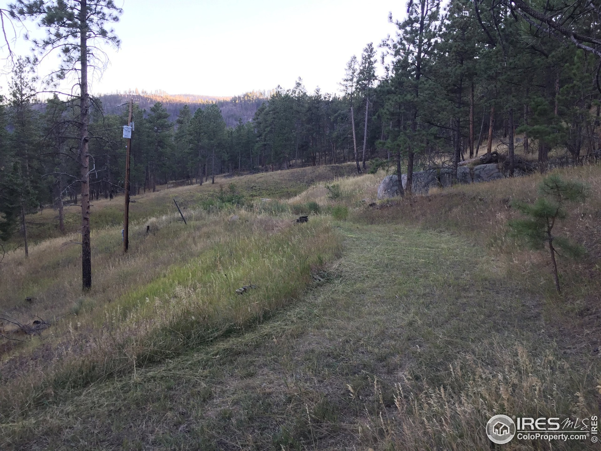
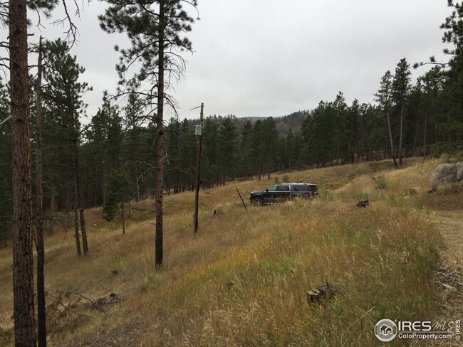
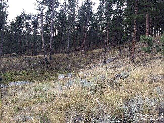
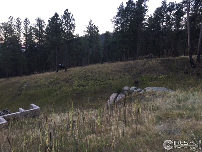
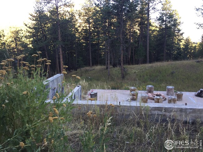
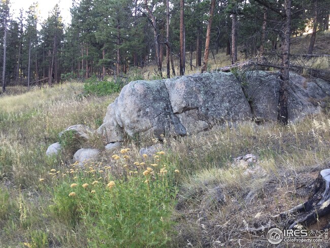
Wonderful Bellvue/Rist Canyon location in the foothills west of Ft. Collins, Approximately 5.76 +/- acres of land. House was lost in the High Park Fire and has been cleaned up along with many trees. As you can see from the photos, the land looks unaffected today. Existing Well, Septic System w/ Leach field, Electric & Propane Tank all were working properly prior to fire, buyer to verify condition of utilities and existing foundation.

Last Listed By

Jason Humpal

CENTURY 21 Elevated Listed on: 05/11/2022

CENTURY 21 Elevated

Property Details

Property Type

  • Land

Est. Annual Taxes

  • $1,711

Year Built

  • 1975

Lot Details

  • 5.76 Acre Lot
  • Rock Outcropping
  • Level Lot
  • Wooded Lot

HOA Fees

  • $27 Monthly HOA Fees

Schools

  • Cache La Poudre Elementary And Middle School
  • Poudre High School

Utilities

  • Propane
  • Septic System

Community Details

  • Redstone Estates Subdivision

Listing and Financial Details

  • Assessor Parcel Number R0250007

Property Details

Property Type

Land

Est. Annual Taxes

$1,711

Year Built

1975

Lot Details

0

HOA Fees

$27 per month

Listing Details

  • Property Sub Type: Unimproved Land
  • Prop. Type: Land
  • Horses: No
  • Lot Size Acres: 5.76
  • Subdivision Name: Redstone Estates
  • Directions: West on Rist Canyon Rd for 6.5 miles. Left onto Davis Ranch Rd & travel .09 miles. Stay right onto Davis Ranch Rd/Fire Rt 1 for 1/6 miles. Left onto Redstone DRIVE for 1.5 miles, turn left onto Valnes Lane, turn into driveway by the Century 21 sign.
  • Special Features: None
  • Year Built (Public Record): 1975

Interior Features

  • Possible Use: Single Family

Exterior Features

  • Lot Features: Wooded, Level, Rolling Slope, Sloped, Rock Outcropping
  • Waterfront: No

Utilities

  • Electric: Electric, PVREA
  • Utilities: Electricity Available, Propane, Propane Installed
  • Sewer: Septic
  • Water Source: Well

Condo/Co-op/Association

  • Senior Community: No
  • Association Fee: 325
  • Association Fee Frequency: Annually
  • Association: Yes

Association/Amenities

  • IRESDS_HasAssociationReserve: Yes
  • IRESDS_HasAssociationFee: Yes

Schools

  • Elementary School: Cache La Poudre
  • HighSchool: Poudre
  • Junior High Dist: Poudre
  • Middle Or Junior School: Cache La Poudre

Lot Info

  • Zoning: O
  • Lot Size Sq Ft: 250906
  • Parcel #: R0250007
  • ResoLotSizeUnits: SquareFeet

Tax Info

  • Tax Year: 2021
  • Tax Annual Amount: 1711

Multi Family

Ownership History

Date Name Owned For Owner Type

Purchase Details

Closed on
Jun 13, 2016
Sold by
Sullivan Patricia J
Bought by
Patricia J Sullivan Trust
Total Days on Market
26
Current Estimated Value
$124,782

Purchase Details

Closed on
Jun 11, 2001
Sold by
Klausmeyer Nancee I and Klausmeyer Jacalyn L
Bought by
Sullivan Patricia J

Purchase Details

Closed on
Feb 1, 1996
Sold by
Klausmeyer Nancee I
Bought by
Klausmeyer Jacalyn L

Range of Values:

Collateral Analytics

Collateral Analytics Collateral Analytics AVMs (Automated Valuation Model) employ a number of statistical approaches combined with neighborhood-specific comparable selection guarantees the most up-to-date and precise valuations.

Not Available

Collateral Analytics does not have data for the current month. Please view the chart for historical values.

ICE

ICE Mortgage Technology ICE Mortgage Technology’s AVM (Automated Valuation Model) is a state-of-the-art online residential property valuation tool that provides a quick and accurate estimate of the value of almost any home in the U.S.

Not Available

ICE Mortgage Technology does not have data for the current month. Please view the chart for historical values.

First American

First American First American Data & Analytics’ next-generation AVM combines unrivaled data assets with a blended ensemble of valuation models to produce highly accurate, reliable valuations you can trust.

Not Available

First American does not have data for the current month. Please view the chart for historical values.

Quantarium

Quantarium Quantarium’s valuation service, repeatedly proven the industry’s most accurate and comprehensive, is supercharged with a self-learning and auto-tuning AI engine that continually becomes smarter and more accurate as it processes daily inputs from the industry’s leading RE data lake.

Not Available

Quantarium does not have data for the current month. Please view the chart for historical values.

Average Value
Not Available
List Price
Sold Price
Create a Home Valuation Report for This Property
The Home Valuation Report is an in-depth analysis detailing your home's value as well as a comparison with similar homes in the area

Similar Property in the area

  • 0 County Road 69, De Soto, CO 80512

    $100,000

    • Land
    • 6 Acres
    • $16,892 per Acre
    • 0 County Road 69
    • De Soto, CO

    5.92 Acres of Breathtaking Views in Bellvue.Discover the perfect Colorado mountain retreat on this stunning 5.92-acre property near Glen Echo in Bellvue! Perched at the base of Pingree Hill, this unique parcel offers spectacular panoramic views of the valley and surrounding peaks, making it an ideal spot for a dream mountain getaway or future home site.The land features beautiful rock

    The Galbate Team Group Harmony

    Section Image

Home Values in the Area

Source: Public Records

Average Home Value in this Area


Source: Public Records

Purchase History

Date Buyer Sale Price Title Company
Patricia J Sullivan Trust -- None Available
Sullivan Patricia J $218,900 --
Klausmeyer Jacalyn L -- --
Source: Public Records

Mortgage History

Date Status Borrower Loan Amount
Open Hearn Daniel $100,000
Source: Public Records

Property History

Date Event Price Change Sq Ft Price
07/18/2022 07/18/22 Sold $145,000 -3.3% --
05/11/2022 05/11/22 For Sale $149,900 -- --
Source: IRES MLS

Tax History Compared to Growth

Source: Public Records

Tax History

Year Tax Paid Tax Assessment Tax Assessment Total Assessment is a certain percentage of the fair market value that is determined by local assessors to be the total taxable value of land and additions on the property. Land Improvement
2025 $2,253 $26,505 $26,505 --
2024 $2,130 $26,505 $26,505 --
2022 $1,711 $20,909 $20,909 --
2021 $1,711 $20,909 $20,909 $0
2020 $1,462 $17,690 $17,690 $0
2019 $1,469 $17,690 $17,690 $0
2018 $1,419 $17,690 $17,690 $0
2017 $1,413 $17,690 $17,690 $0
2016 $256 $3,184 $3,184 $0
2015 $254 $3,180 $3,180 $0
2014 $166 $2,070 $2,070 $0
Source: Public Records

Agents Affiliated with this Home

  • Section Image
  • Section Image
See All Agents

Map

Source: IRES MLS

MLS Number: 965247

IRES MLS

APN: 07053-05-040