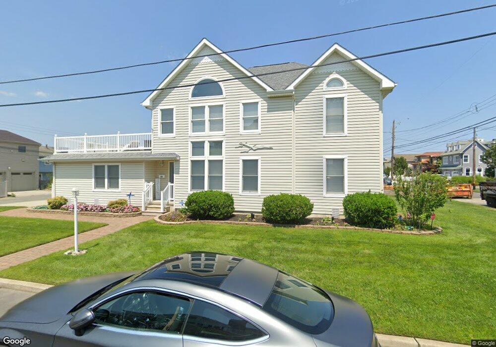
101 Walnut Rd Ocean City, NJ 08226
Estimated Value: $1,412,000 - $3,085,000
--
Bed
--
Bath
2,288
Sq Ft
$888/Sq Ft
Est. Value
About This Home
This home is located at 101 Walnut Rd, Ocean City, NJ 08226 and is currently estimated at $2,031,870, approximately $888 per square foot. 101 Walnut Rd is a home located in Cape May County with nearby schools including Ocean City Primary School, Ocean City Intermediate School, and Ocean City High School.
Ownership History
Date
Name
Owned For
Owner Type
Purchase Details
Closed on
Mar 15, 2001
Current Estimated Value
Purchase Details
Closed on
Apr 19, 2000
Sold by
Mlfs Llc
Bought by
Monastra George P and Monastra Dorothy H
Purchase Details
Closed on
Dec 5, 1997
Sold by
Design One Inc Llc
Bought by
Turney Jack
Purchase Details
Closed on
Apr 2, 1997
Sold by
Barshinger Donald W
Bought by
Design One Inc
Purchase Details
Closed on
Aug 31, 1995
Sold by
Williams Thomas
Bought by
Mahar James and Mahar Karen
Home Financials for this Owner
Home Financials are based on the most recent Mortgage that was taken out on this home.
Original Mortgage
$113,000
Interest Rate
7.61%
Purchase Details
Closed on
Apr 3, 1992
Sold by
Smith Sara E
Bought by
Barshinger Donald and Barshinger Gordon,Linda
Create a Home Valuation Report for This Property
The Home Valuation Report is an in-depth analysis detailing your home's value as well as a comparison with similar homes in the area
Home Values in the Area
Average Home Value in this Area
Purchase History
| Date | Buyer | Sale Price | Title Company |
|---|---|---|---|
| -- | $1,300 | -- | |
| Monastra George P | $485,000 | -- | |
| Monastra George P | $485,000 | -- | |
| Turney Jack | $183,440 | -- | |
| Design One Inc | $144,700 | -- | |
| Mahar James | $99,000 | -- | |
| Barshinger Donald | $152,000 | -- |
Source: Public Records
Mortgage History
| Date | Status | Borrower | Loan Amount |
|---|---|---|---|
| Previous Owner | Mahar James | $113,000 |
Source: Public Records
Tax History Compared to Growth
Tax History
| Year | Tax Paid | Tax Assessment Tax Assessment Total Assessment is a certain percentage of the fair market value that is determined by local assessors to be the total taxable value of land and additions on the property. | Land | Improvement |
|---|---|---|---|---|
| 2025 | $8,077 | $719,900 | $427,400 | $292,500 |
| 2024 | $8,077 | $719,900 | $427,400 | $292,500 |
| 2023 | $7,710 | $719,900 | $427,400 | $292,500 |
| 2022 | $7,408 | $719,900 | $427,400 | $292,500 |
| 2021 | $7,235 | $719,900 | $427,400 | $292,500 |
| 2020 | $7,041 | $719,900 | $427,400 | $292,500 |
| 2019 | $6,961 | $719,900 | $427,400 | $292,500 |
| 2018 | $6,897 | $719,900 | $427,400 | $292,500 |
| 2017 | $6,789 | $719,900 | $427,400 | $292,500 |
| 2016 | $6,529 | $719,900 | $427,400 | $292,500 |
| 2015 | $6,443 | $719,900 | $427,400 | $292,500 |
| 2014 | $6,350 | $719,900 | $427,400 | $292,500 |
Source: Public Records
Map
Nearby Homes
- 1901 Glenwood Dr
- 1904 Glenwood Dr
- 71 Spruce Rd
- 2019 Glenwood Dr
- 38 Arkansas Ave
- 4 Grenada Ln
- 233 W 17th St
- 31 Spruce Rd
- 195 W 17th St Unit 1
- 1909 Rosemar Ln
- 170 W 17th St Unit 2
- 20 Gilbert Ln
- 1612 Pleasure Ave Unit 1
- 6 Walnut Rd
- 2104 Bay Ave
- 1755 Bay Ave
- 100 Reef Dr
- 100 Reef Dr Unit 94
- 29 Sunset Place
- 2044 Haven Ave
- 1912 Ferndale Dr
- 1910 Ferndale Dr
- 100 Walnut Rd
- 103 Walnut Rd
- 1907 Glenwood Dr
- 1908 Ferndale Dr
- 1911 Glenwood Dr
- 1918 Ferndale Dr
- 1913 Ferndale Dr
- 1915 Ferndale Dr
- 83 Walnut Rd
- 1911 Ferndale Dr
- 1906 Ferndale Dr
- 1913 Glenwood Dr
- 1903 Glenwood Dr
- 1920 Ferndale Dr
- 81 Walnut Rd
- 1909 Ferndale Dr
- 1915 Glenwood Dr
- 1904 Ferndale Dr