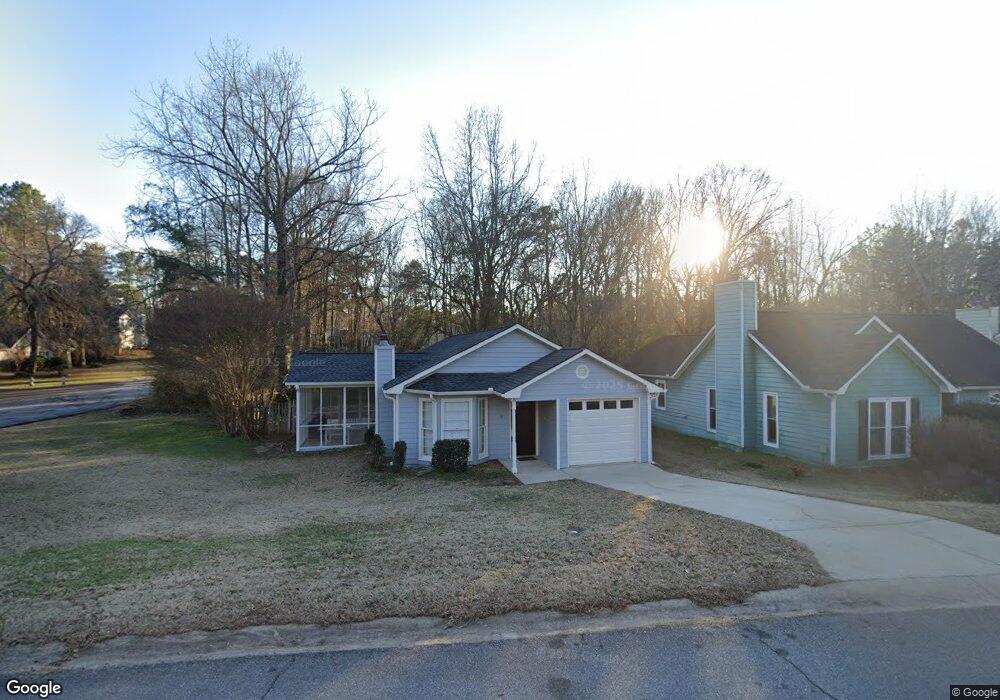
101 Warren Way Athens, GA 30605
Estimated Value: $263,858 - $279,000
2
Beds
2
Baths
1,054
Sq Ft
$261/Sq Ft
Est. Value
About This Home
This home is located at 101 Warren Way, Athens, GA 30605 and is currently estimated at $274,715, approximately $260 per square foot. 101 Warren Way is a home located in Clarke County with nearby schools including Barnett Shoals Elementary School, Hilsman Middle School, and Cedar Shoals High School.
Ownership History
Date
Name
Owned For
Owner Type
Purchase Details
Closed on
May 30, 2001
Sold by
Hoitink Melissa C William C Ho
Bought by
Titshaw John H and Titshaw Janie H
Current Estimated Value
Purchase Details
Closed on
Jul 30, 1997
Sold by
Miller Gary W
Bought by
Hoitink Melissa C William C Hoitink
Purchase Details
Closed on
May 2, 1997
Sold by
Miller Gary W Patti J Miller Ricahrd
Bought by
Miller Gary W
Purchase Details
Closed on
Sep 30, 1993
Sold by
Armour Homes Inc
Bought by
Miller Gary W Patti J Miller Ricahr
Create a Home Valuation Report for This Property
The Home Valuation Report is an in-depth analysis detailing your home's value as well as a comparison with similar homes in the area
Home Values in the Area
Average Home Value in this Area
Purchase History
| Date | Buyer | Sale Price | Title Company |
|---|---|---|---|
| Titshaw John H | $102,000 | -- | |
| Hoitink Melissa C William C Hoitink | $77,400 | -- | |
| Miller Gary W | -- | -- | |
| Miller Gary W Patti J Miller Ricahr | $61,800 | -- |
Source: Public Records
Tax History Compared to Growth
Tax History
| Year | Tax Paid | Tax Assessment Tax Assessment Total Assessment is a certain percentage of the fair market value that is determined by local assessors to be the total taxable value of land and additions on the property. | Land | Improvement |
|---|---|---|---|---|
| 2025 | $3,000 | $96,621 | $12,000 | $84,621 |
| 2024 | $3,000 | $93,523 | $12,000 | $81,523 |
| 2023 | $2,923 | $88,582 | $12,000 | $76,582 |
| 2022 | $2,366 | $74,169 | $10,400 | $63,769 |
| 2021 | $1,974 | $58,588 | $8,800 | $49,788 |
| 2020 | $1,852 | $54,964 | $8,800 | $46,164 |
| 2019 | $1,658 | $48,841 | $8,800 | $40,041 |
| 2018 | $1,608 | $47,377 | $8,800 | $38,577 |
| 2017 | $1,484 | $43,706 | $8,800 | $34,906 |
| 2016 | $1,310 | $38,597 | $8,800 | $29,797 |
| 2015 | $1,284 | $37,756 | $8,800 | $28,956 |
| 2014 | $1,267 | $37,223 | $8,800 | $28,423 |
Source: Public Records
Map
Nearby Homes
- 109 Warren Way
- 117 Warren Way
- 0 Sorenson Ridge
- 111 Richmond Ct
- 125 Warren Way
- 300 Sorenson Ridge
- 100 Lauren Ln
- 115 Richmond Ct
- 112 Richmond Ct
- 100 Warren Way
- 133 Warren Way
- 108 Warren Way
- 104 Lauren Ln
- 114 Richmond Ct
- 116 Warren Way
- 117 Richmond Ct
- 141 Warren Way
- 124 Warren Way
- 108 Lauren Ln
- 132 Warren Way