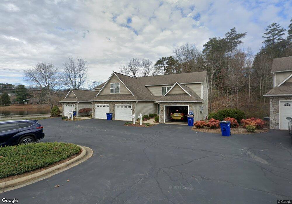
101 Waters Edge Dr Unit 101 Weaverville, NC 28787
Estimated Value: $347,000 - $399,000
2
Beds
2
Baths
1,297
Sq Ft
$287/Sq Ft
Est. Value
About This Home
This home is located at 101 Waters Edge Dr Unit 101, Weaverville, NC 28787 and is currently estimated at $372,217, approximately $286 per square foot. 101 Waters Edge Dr Unit 101 is a home located in Buncombe County with nearby schools including Weaverville Elementary, Weaverville Primary, and North Buncombe Middle.
Ownership History
Date
Name
Owned For
Owner Type
Purchase Details
Closed on
Jul 15, 2011
Sold by
Cole Geraldine Bradley and Cole Roy
Bought by
Downer Richard R and Downer Linda L
Current Estimated Value
Purchase Details
Closed on
Aug 8, 2001
Sold by
Mayfair Partners Llc
Bought by
Cobb Bettie
Home Financials for this Owner
Home Financials are based on the most recent Mortgage that was taken out on this home.
Original Mortgage
$92,000
Interest Rate
7.1%
Create a Home Valuation Report for This Property
The Home Valuation Report is an in-depth analysis detailing your home's value as well as a comparison with similar homes in the area
Home Values in the Area
Average Home Value in this Area
Purchase History
| Date | Buyer | Sale Price | Title Company |
|---|---|---|---|
| Downer Richard R | $162,000 | None Available | |
| Cobb Bettie | $129,000 | -- |
Source: Public Records
Mortgage History
| Date | Status | Borrower | Loan Amount |
|---|---|---|---|
| Previous Owner | Cobb Bettie | $92,000 |
Source: Public Records
Tax History Compared to Growth
Tax History
| Year | Tax Paid | Tax Assessment Tax Assessment Total Assessment is a certain percentage of the fair market value that is determined by local assessors to be the total taxable value of land and additions on the property. | Land | Improvement |
|---|---|---|---|---|
| 2025 | -- | $224,200 | -- | $224,200 |
| 2024 | -- | $224,200 | -- | $224,200 |
| 2023 | $1,901 | $224,200 | $0 | $224,200 |
| 2022 | $1,879 | $224,200 | $0 | $0 |
| 2021 | $1,879 | $224,200 | $0 | $0 |
| 2020 | $1,681 | $184,900 | $0 | $0 |
| 2019 | $978 | $184,900 | $0 | $0 |
| 2018 | $978 | $184,900 | $0 | $0 |
| 2017 | $997 | $159,300 | $0 | $0 |
| 2016 | $962 | $0 | $0 | $0 |
| 2015 | $962 | $159,300 | $0 | $0 |
| 2014 | $962 | $159,300 | $0 | $0 |
Source: Public Records
Map
Nearby Homes
- 53 Loftin St
- 56 Brown St
- 17 Sandstone Dr
- 9 Barnett Shoals Dr
- 5 W Cove St
- 20 Barnett Shoals Dr
- 99999 Robin Roost Rd
- 1 Old Mill Ln
- 84 West St
- 406 Kyfields None
- 204 Kyfields None
- 305 Kyfields
- 338 Kyfields None
- 88 S Main St
- 9 Oakwood Dr
- 143 Reems Creek Rd
- 143 Reems Creek Rd
- 94 Church St
- 57 Moore St
- 65 Knoll Ridge Dr
- 103 Waters Edge Dr Unit 103
- 104 Waters Edge Dr Unit 104
- 204 Waters Edge Dr Unit 204
- 201 Waters Edge Dr Unit 201
- 202 Waters Edge Dr Unit 202
- 206 Waters Edge Dr Unit 206
- 205 Waters Edge Dr
- 203 Waters Edge Dr
- 2 Bankstown Rd
- 2 Banks Town Rd
- 8 Bankstown Rd
- 307 Waters Edge Dr Unit 307
- 120 Merrimon Ave
- 301 Waters Edge Dr Unit 301
- 305 Waters Edge Dr Unit 305
- 303 Waters Edge Dr
- 302 Waters Edge Dr Unit 302
- 308 Waters Edge Dr
- 306 Waters Edge Dr Unit 306
- 304 Waters Edge Dr Unit 304