Estimated Value: $441,000 - $537,000
5
Beds
3
Baths
4,240
Sq Ft
$110/Sq Ft
Est. Value
About This Home
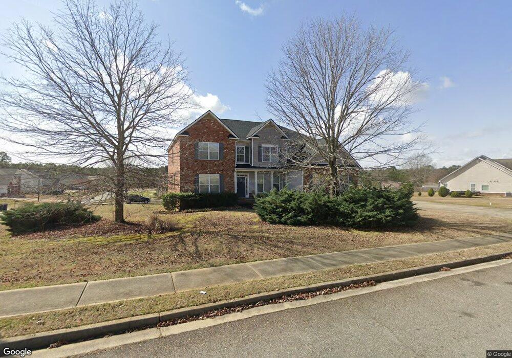
This home is located at 101 Westbourne Way, Perry, GA 31069 and is currently estimated at $467,090, approximately $110 per square foot. 101 Westbourne Way is a home located in Houston County with nearby schools including Langston Road Elementary School, Perry Middle School, and Perry High School.
Ownership History
Date
Name
Owned For
Owner Type
Purchase Details
Closed on
Sep 29, 2025
Sold by
Nguyen Paul
Bought by
Nguyen Trai Son and Tran Van Thi
Current Estimated Value
Home Financials for this Owner
Home Financials are based on the most recent Mortgage that was taken out on this home.
Original Mortgage
$315,000
Outstanding Balance
$314,720
Interest Rate
6.58%
Mortgage Type
New Conventional
Estimated Equity
$152,370
Purchase Details
Closed on
Sep 8, 2009
Sold by
Included On Deed In Error
Bought by
Nguyen Paul
Purchase Details
Closed on
Mar 23, 2009
Sold by
D R Horton Inc
Bought by
Nguyen Paul
Home Financials for this Owner
Home Financials are based on the most recent Mortgage that was taken out on this home.
Original Mortgage
$274,829
Interest Rate
5.13%
Mortgage Type
FHA
Purchase Details
Closed on
Jan 30, 2007
Sold by
The Stoker Group Inc
Bought by
D R Horton Inc
Create a Home Valuation Report for This Property
The Home Valuation Report is an in-depth analysis detailing your home's value as well as a comparison with similar homes in the area
Home Values in the Area
Average Home Value in this Area
Purchase History
| Date | Buyer | Sale Price | Title Company |
|---|---|---|---|
| Nguyen Trai Son | $450,000 | None Listed On Document | |
| Nguyen Paul | -- | -- | |
| Nguyen Paul | $279,900 | None Available | |
| D R Horton Inc | $31,900 | -- |
Source: Public Records
Mortgage History
| Date | Status | Borrower | Loan Amount |
|---|---|---|---|
| Open | Nguyen Trai Son | $315,000 | |
| Previous Owner | Nguyen Paul | $274,829 |
Source: Public Records
Tax History Compared to Growth
Tax History
| Year | Tax Paid | Tax Assessment Tax Assessment Total Assessment is a certain percentage of the fair market value that is determined by local assessors to be the total taxable value of land and additions on the property. | Land | Improvement |
|---|---|---|---|---|
| 2024 | $1,627 | $161,280 | $12,400 | $148,880 |
| 2023 | $788 | $131,280 | $12,400 | $118,880 |
| 2022 | $486 | $122,880 | $12,400 | $110,480 |
| 2021 | $235 | $111,080 | $12,400 | $98,680 |
| 2020 | $404 | $107,760 | $12,400 | $95,360 |
| 2019 | $514 | $107,760 | $12,400 | $95,360 |
| 2018 | $620 | $107,760 | $12,400 | $95,360 |
| 2017 | $708 | $107,760 | $12,400 | $95,360 |
| 2016 | $792 | $107,760 | $12,400 | $95,360 |
| 2015 | $870 | $107,760 | $12,400 | $95,360 |
| 2014 | -- | $107,760 | $12,400 | $95,360 |
| 2013 | -- | $112,040 | $12,400 | $99,640 |
Source: Public Records
Map
Nearby Homes
- 302 Brampton Way
- 118 Bramblewood Way
- 128 Bramblewood Ln
- 124 Bramblewood Ln
- 210 Overton Dr
- 309 E River Cane Run
- 103 Breakwater Way
- 107 Breakwater Way
- 3004 Cellar Ln
- 114 Sutton Dr
- 111 Breakwater Way
- 3054 Cellar Ln
- 3048 Cellar Ln
- 206 Sutton Dr
- 204 Sutton Dr
- 0 Langston Rd Unit 16828609
- 3051 Cellar Ln
- 3055 Cellar Ln
- 0 Hwy 41 & Langston Rd Unit M170042
- 220 Overton Dr
- 103 Westbourne Way
- 303 Notting Hill Dr
- 303 Notting Hill Drive(138)
- 203 Notting Hill Dr
- 102 Westbourne Way
- 105 Westbourne Way
- 300 Notting Hill Dr
- 302 Notting Hill Dr
- 206 Notting Hill Dr
- 104 Westbourne Way
- 104 Westbourne Way Unit 148
- 305 Notting Hill Dr Unit 137
- 304 Notting Hill Dr
- 204 Notting Hill Dr
- 107 Westbourne Way
- 106 Westbourne Way
- Lot 62 Bankstone Landing
- 200 Haddenham Ct
- 202 Notting Hill Dr Unit 124
- 202 Notting Hill Dr