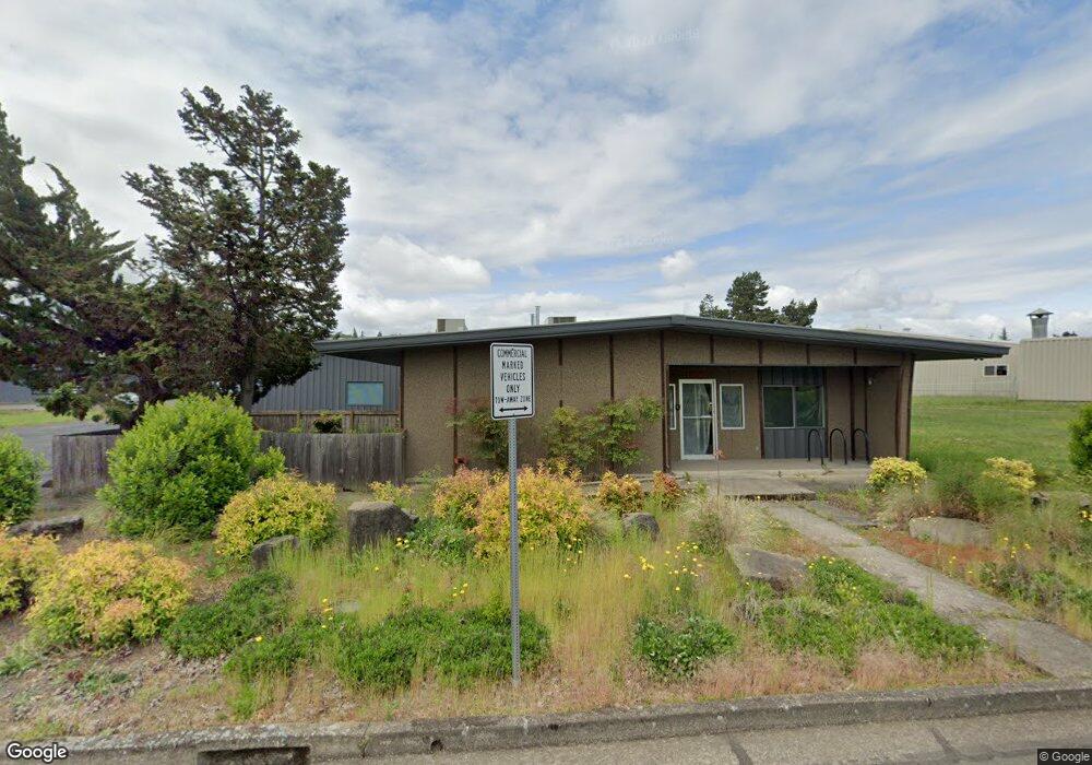
1010 Arrowsmith St Eugene, OR 97402
West Eugene NeighborhoodEstimated Value: $933,505
Studio
--
Bath
6,264
Sq Ft
$149/Sq Ft
Est. Value
About This Home
This home is located at 1010 Arrowsmith St, Eugene, OR 97402 and is currently estimated at $933,505, approximately $149 per square foot. 1010 Arrowsmith St is a home located in Lane County with nearby schools including Danebo Elementary School, Shasta Middle School, and Willamette High School.
Ownership History
Date
Name
Owned For
Owner Type
Purchase Details
Closed on
May 13, 2025
Sold by
Accurate Remodeling and Blackley Inc
Bought by
Blackley Nathan D
Current Estimated Value
Purchase Details
Closed on
Apr 10, 2013
Sold by
Emel Diana L
Bought by
Emel Diana L and Emel Revocable Trust
Purchase Details
Closed on
Feb 14, 2000
Sold by
Emel Michael Major and Emel William Paul
Bought by
Emel Diana L
Home Financials for this Owner
Home Financials are based on the most recent Mortgage that was taken out on this home.
Original Mortgage
$260,000
Interest Rate
8.16%
Mortgage Type
Credit Line Revolving
Purchase Details
Closed on
Jun 1, 1995
Sold by
Emel Michael Major and Emel William Paul
Bought by
Emel Thomas Edward
Create a Home Valuation Report for This Property
The Home Valuation Report is an in-depth analysis detailing your home's value as well as a comparison with similar homes in the area
Home Values in the Area
Average Home Value in this Area
Purchase History
| Date | Buyer | Sale Price | Title Company |
|---|---|---|---|
| Blackley Nathan D | -- | Fidelity National Title | |
| Blackley Inc | $950,000 | Fidelity National Title | |
| Emel Diana L | -- | None Available | |
| Emel Diana L | -- | Cascade Title Co | |
| Emel Thomas Edward | $170,000 | Key Title Company |
Source: Public Records
Mortgage History
| Date | Status | Borrower | Loan Amount |
|---|---|---|---|
| Previous Owner | Emel Diana L | $260,000 |
Source: Public Records
Tax History
| Year | Tax Paid | Tax Assessment Tax Assessment Total Assessment is a certain percentage of the fair market value that is determined by local assessors to be the total taxable value of land and additions on the property. | Land | Improvement |
|---|---|---|---|---|
| 2025 | $6,433 | $369,807 | -- | -- |
| 2024 | $6,270 | $359,036 | -- | -- |
| 2023 | $6,270 | $348,579 | -- | -- |
| 2022 | $5,837 | $338,427 | $0 | $0 |
| 2021 | $5,714 | $328,570 | $0 | $0 |
| 2020 | $5,547 | $319,000 | $0 | $0 |
| 2019 | $5,274 | $309,709 | $0 | $0 |
| 2018 | $5,127 | $291,931 | $0 | $0 |
| 2017 | $4,900 | $291,931 | $0 | $0 |
| 2016 | $4,775 | $283,428 | $0 | $0 |
| 2015 | $4,681 | $275,173 | $0 | $0 |
| 2014 | $4,610 | $267,158 | $0 | $0 |
Source: Public Records
Map
Nearby Homes
- 0 Ed Cone Blvd
- 5335 W 11th Ave
- 536 Raber Rd
- 650 Saint Charles St
- 654 Saint Charles St
- 4985 Cone Ave
- 647 Oakwood Dr
- 639 Oakwood Dr
- 658 Saint Charles St
- 4900 Royal Ave Unit 105
- 4900 Royal Ave Unit SP13
- 648 Oakwood Dr
- 664 Saint Charles St
- 671 Saint Charles St
- 670 Saint Charles St
- 683 Saint Charles St
- 684 Saint Charles St
- 5254 Forest Ln
- 5260 Forest Ln
- 5272 Forest Ln
- 1050 Owen Loop S
- 1450 Westec Dr
- 1457 Westec Dr
- 600 S Danebo Ave
- 29913 Willow Creek Rd
- 000 Westec Dr Unit 12
- 1011 S Danebo Ave
- 1505 Westec Dr
- 5338 W 11th Ave
- 29903 Willow Creek Rd
- 1509 Westec Dr
- 0 W 11th Ave
- 1515 Westec Dr
- 29885 Willow Creek Rd
- 4677 Isabelle St Unit B
- 4677 Isabelle St Unit A
- 1500 Renne St
- 450 N Terry #147
- 87941 La Porte Dr
- 0 Pitchford Ave
Your Personal Tour Guide
Ask me questions while you tour the home.