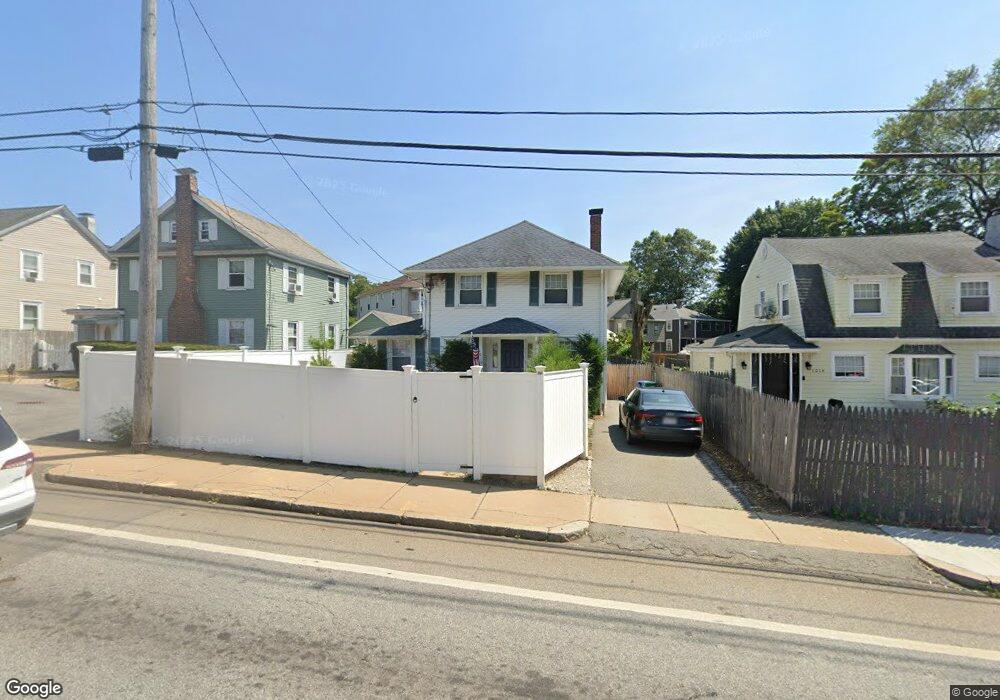
1010 Boylston St Newton Highlands, MA 02461
Newton Highlands NeighborhoodEstimated Value: $972,000 - $1,230,000
3
Beds
2
Baths
1,392
Sq Ft
$749/Sq Ft
Est. Value
About This Home
This home is located at 1010 Boylston St, Newton Highlands, MA 02461 and is currently estimated at $1,042,509, approximately $748 per square foot. 1010 Boylston St is a home located in Middlesex County with nearby schools including Zervas Elementary School, Oak Hill Middle School, and Newton South High School.
Ownership History
Date
Name
Owned For
Owner Type
Purchase Details
Closed on
Mar 19, 1999
Sold by
Lesanto Dev Corp
Bought by
Michell Annette L
Current Estimated Value
Purchase Details
Closed on
Sep 29, 1998
Sold by
Shokrollahi Abdolkarim
Bought by
Lesanto Dev Corp
Purchase Details
Closed on
Jun 12, 1998
Sold by
Mason John A and Mason Mable L
Bought by
Shokrollahi Abdolkarim
Create a Home Valuation Report for This Property
The Home Valuation Report is an in-depth analysis detailing your home's value as well as a comparison with similar homes in the area
Home Values in the Area
Average Home Value in this Area
Purchase History
| Date | Buyer | Sale Price | Title Company |
|---|---|---|---|
| Michell Annette L | $269,000 | -- | |
| Lesanto Dev Corp | $137,000 | -- | |
| Shokrollahi Abdolkarim | $95,000 | -- |
Source: Public Records
Mortgage History
| Date | Status | Borrower | Loan Amount |
|---|---|---|---|
| Open | Shokrollahi Abdolkarim | $324,000 | |
| Closed | Shokrollahi Abdolkarim | $220,000 | |
| Closed | Shokrollahi Abdolkarim | $190,000 |
Source: Public Records
Tax History Compared to Growth
Tax History
| Year | Tax Paid | Tax Assessment Tax Assessment Total Assessment is a certain percentage of the fair market value that is determined by local assessors to be the total taxable value of land and additions on the property. | Land | Improvement |
|---|---|---|---|---|
| 2025 | $6,900 | $704,100 | $569,800 | $134,300 |
| 2024 | $6,672 | $683,600 | $553,200 | $130,400 |
| 2023 | $6,240 | $613,000 | $413,600 | $199,400 |
| 2022 | $5,971 | $567,600 | $383,000 | $184,600 |
| 2021 | $5,762 | $535,500 | $361,300 | $174,200 |
| 2020 | $5,591 | $535,500 | $361,300 | $174,200 |
| 2019 | $5,433 | $519,900 | $350,800 | $169,100 |
| 2018 | $5,089 | $470,300 | $317,400 | $152,900 |
| 2017 | $4,934 | $443,700 | $299,400 | $144,300 |
| 2016 | $4,719 | $414,700 | $279,800 | $134,900 |
| 2015 | $4,500 | $387,600 | $261,500 | $126,100 |
Source: Public Records
Map
Nearby Homes
- 3 Glenmore Terrace Unit 2
- 200 Lincoln St
- 17 Circuit Ave Unit 2
- 59 Roundwood Rd
- 116 Upland Ave
- 35 Bradford Rd
- 29 Cottage St
- 1151 Walnut St Unit 205
- 1151 Walnut St Unit 405
- 1151 Walnut St Unit 207
- 1629 Centre St
- 1623-1625 Centre St
- 103 Thurston Rd
- 102 Thurston Rd Unit 100
- 35 Kingston Rd
- 120 Stanley Rd
- 2 Raeburn Terrace
- 1597 Centre St
- 1597 Centre St Unit 1
- 66 Rockland Place
- 1014 Boylston St
- 1006 Boylston St
- 1006 Boylston St Unit 1
- 19-21 Elliot St Unit 19
- 19-21 Elliot St Unit 21
- 19 Elliot St Unit 21
- 19 Elliot St
- 15-17 Elliot St
- 1018 Boylston St
- 15 Elliot St Unit 17
- 23-25 Elliot St
- 25 Elliot St Unit 1
- 23 Elliot St Unit 25
- 23 Elliot St Unit 1
- 23 Elliot St
- 21 Elliot St Unit 21
- 21 Elliot St
- 21 Elliot St Unit 1
- 27-29 Elliot St
- 5 Elliot St