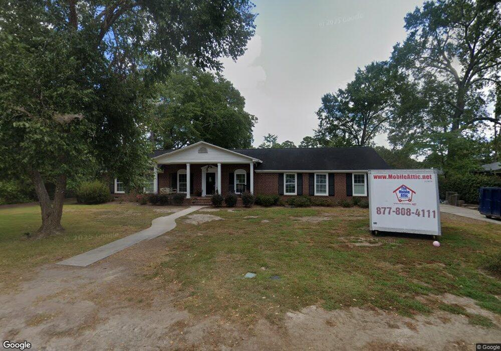
1010 Byron Rd Columbia, SC 29209
The Hamptons NeighborhoodEstimated Value: $323,000 - $385,000
4
Beds
2
Baths
1,892
Sq Ft
$189/Sq Ft
Est. Value
About This Home
This home is located at 1010 Byron Rd, Columbia, SC 29209 and is currently estimated at $357,578, approximately $188 per square foot. 1010 Byron Rd is a home located in Richland County with nearby schools including Meadowfield Elementary School, Hand Middle School, and Dreher High School.
Ownership History
Date
Name
Owned For
Owner Type
Purchase Details
Closed on
Jan 18, 2019
Sold by
Senn Linda
Bought by
Sowell Aubrey K
Current Estimated Value
Home Financials for this Owner
Home Financials are based on the most recent Mortgage that was taken out on this home.
Original Mortgage
$220,400
Outstanding Balance
$194,168
Interest Rate
4.7%
Mortgage Type
New Conventional
Estimated Equity
$163,410
Purchase Details
Closed on
Oct 23, 2017
Sold by
Senn Carroll
Bought by
Senn Linda
Create a Home Valuation Report for This Property
The Home Valuation Report is an in-depth analysis detailing your home's value as well as a comparison with similar homes in the area
Home Values in the Area
Average Home Value in this Area
Purchase History
| Date | Buyer | Sale Price | Title Company |
|---|---|---|---|
| Sowell Aubrey K | $220,000 | None Available | |
| Senn Linda | -- | None Available |
Source: Public Records
Mortgage History
| Date | Status | Borrower | Loan Amount |
|---|---|---|---|
| Open | Sowell Aubrey K | $220,400 |
Source: Public Records
Tax History Compared to Growth
Tax History
| Year | Tax Paid | Tax Assessment Tax Assessment Total Assessment is a certain percentage of the fair market value that is determined by local assessors to be the total taxable value of land and additions on the property. | Land | Improvement |
|---|---|---|---|---|
| 2024 | $1,745 | $253,000 | $0 | $0 |
| 2023 | $1,745 | $8,800 | $0 | $0 |
| 2022 | $1,595 | $220,000 | $34,500 | $185,500 |
| 2021 | $1,648 | $8,800 | $0 | $0 |
| 2020 | $1,738 | $8,800 | $0 | $0 |
| 2019 | $1,078 | $7,420 | $0 | $0 |
| 2018 | $905 | $6,450 | $0 | $0 |
| 2017 | $882 | $6,450 | $0 | $0 |
| 2016 | $850 | $6,450 | $0 | $0 |
| 2015 | $850 | $6,450 | $0 | $0 |
| 2014 | $1,231 | $161,300 | $0 | $0 |
| 2013 | -- | $6,450 | $0 | $0 |
Source: Public Records
Map
Nearby Homes
- 821 Walters Ln
- 6400 Saye Cut
- 6627 Christie Rd
- 6603 Christie Rd
- 1040 Coatesdale Rd
- 109 Rosebank Dr
- 1284 Rockwood Rd
- 811 Rockwood Rd
- 513 Knollwood Dr
- 755 Burnside Dr
- 622 Chimney Hill Rd
- 444 Cami Forest Ln
- 509 Burnside Dr
- 604 Hampton Trace Ln
- 497 Galway Ln
- 206 Hampton Forest Dr
- 404 Hampton Forest Dr
- 411 Hampton Forest Dr
- 405 Black Friars Rd
- 1920 Harlem St
- 1020 Byron Rd
- 1017 Wordsworth Dr
- 1021 Wordsworth Dr
- 1015 Wordsworth Dr
- 1009 Byron Rd
- 1019 Byron Rd
- 1005 Byron Rd
- 1029 Wordsworth Dr
- 1027 Byron Rd
- 1001 Byron Rd
- 1006 Wordsworth Dr
- 1034 Byron Rd
- 1018 Wordsworth Dr
- 1033 Byron Rd
- 960 Wordsworth Dr
- 945 Byron Rd
- 1035 Wordsworth Dr
- 942 Byron Rd
- 1021 Milton Ln
- 950 Wordsworth Dr