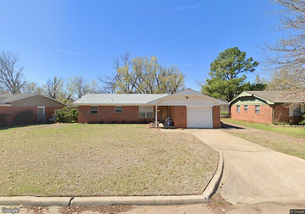
1010 Carlisle Cir Norman, OK 73069
Westwood Park NeighborhoodEstimated Value: $161,000 - $179,000
3
Beds
2
Baths
1,068
Sq Ft
$159/Sq Ft
Est. Value
About This Home
This home is located at 1010 Carlisle Cir, Norman, OK 73069 and is currently estimated at $170,108, approximately $159 per square foot. 1010 Carlisle Cir is a home located in Cleveland County with nearby schools including Adams Elementary School, Whittier Middle School, and Norman North High School.
Ownership History
Date
Name
Owned For
Owner Type
Purchase Details
Closed on
Jan 19, 2024
Sold by
Siekierski John Phillip
Bought by
Siekierski John Phillip and Siekierski John Samuel
Current Estimated Value
Purchase Details
Closed on
Jul 31, 2009
Sold by
Jewell Virginia Alice and Siekierski Virginia Alice
Bought by
Siekierski John Phillip
Home Financials for this Owner
Home Financials are based on the most recent Mortgage that was taken out on this home.
Original Mortgage
$77,838
Interest Rate
5.31%
Mortgage Type
FHA
Create a Home Valuation Report for This Property
The Home Valuation Report is an in-depth analysis detailing your home's value as well as a comparison with similar homes in the area
Home Values in the Area
Average Home Value in this Area
Purchase History
| Date | Buyer | Sale Price | Title Company |
|---|---|---|---|
| Siekierski John Phillip | -- | None Listed On Document | |
| Siekierski John Phillip | -- | Agt |
Source: Public Records
Mortgage History
| Date | Status | Borrower | Loan Amount |
|---|---|---|---|
| Previous Owner | Siekierski John Phillip | $77,838 |
Source: Public Records
Tax History Compared to Growth
Tax History
| Year | Tax Paid | Tax Assessment Tax Assessment Total Assessment is a certain percentage of the fair market value that is determined by local assessors to be the total taxable value of land and additions on the property. | Land | Improvement |
|---|---|---|---|---|
| 2024 | $1,199 | $11,013 | $2,778 | $8,235 |
| 2023 | $1,163 | $10,692 | $2,970 | $7,722 |
| 2022 | $1,080 | $10,381 | $2,429 | $7,952 |
| 2021 | $1,102 | $10,079 | $1,800 | $8,279 |
| 2020 | $1,078 | $10,079 | $1,800 | $8,279 |
| 2019 | $1,097 | $10,079 | $1,800 | $8,279 |
| 2018 | $1,064 | $10,079 | $1,800 | $8,279 |
| 2017 | $1,075 | $10,079 | $0 | $0 |
| 2016 | $1,093 | $10,079 | $1,800 | $8,279 |
| 2015 | $1,044 | $9,937 | $1,329 | $8,608 |
| 2014 | $1,020 | $9,647 | $1,290 | $8,357 |
Source: Public Records
Map
Nearby Homes
- 1103 Woods Ave
- 916 Canterbury Ave
- 1337 Regent St
- 748 Highland Pkwy
- 1713 Canterbury St
- 1603 Denison Dr
- 1502 Denison Dr
- 718 Highland Pkwy
- 1702 Denison Dr
- 717 Denison Dr
- 1313 Dorchester Dr
- 1213 Iowa St
- 1502 Iowa St
- 713 Dakota St
- 627 W Acres St
- 751 Iowa St
- 409 W Johnson St
- 920 Nebraska St
- 336 N Sherry Ave
- 923 Kansas St
- 1016 Carlisle Cir
- 1004 Carlisle Cir
- 1022 Carlisle Cir
- 1017 Woods Ave
- 1021 Woods Ave
- 1009 Woods Ave
- 1005 Woods Ave
- 1029 Woods Ave
- 1042 Carlisle Cir
- 1019 Carlisle Cir
- 1015 Carlisle Cir
- 1011 Carlisle Cir
- 1032 Carlisle Cir
- 1023 Carlisle Cir
- 1007 Carlisle Cir
- 1048 Carlisle Cir
- 1003 Carlisle Cir
- 1027 Carlisle Cir
- 1056 Carlisle Cir
- 927 Woods Ave