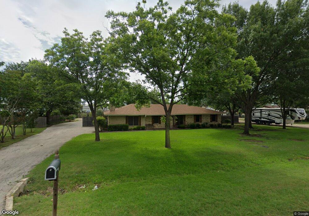
1010 Cowling Rd Sanger, TX 76266
Estimated Value: $280,000 - $356,000
3
Beds
2
Baths
1,684
Sq Ft
$181/Sq Ft
Est. Value
About This Home
This home is located at 1010 Cowling Rd, Sanger, TX 76266 and is currently estimated at $304,583, approximately $180 per square foot. 1010 Cowling Rd is a home located in Denton County with nearby schools including Chisholm Trail Elementary School, Clear Creek Intermediate School, and Sanger Sixth Grade Campus.
Ownership History
Date
Name
Owned For
Owner Type
Purchase Details
Closed on
Jan 5, 2001
Sold by
Cain Ralph E and Cain Yvonne Yeatts
Bought by
Cain Ralph E and Cain Yvonne Yeatts
Current Estimated Value
Purchase Details
Closed on
Aug 11, 1993
Sold by
Bourland Burl Hunter and Bourland Carmen P
Bought by
Cain Randall E
Home Financials for this Owner
Home Financials are based on the most recent Mortgage that was taken out on this home.
Original Mortgage
$43,780
Outstanding Balance
$2,263
Interest Rate
7.22%
Estimated Equity
$302,320
Create a Home Valuation Report for This Property
The Home Valuation Report is an in-depth analysis detailing your home's value as well as a comparison with similar homes in the area
Home Values in the Area
Average Home Value in this Area
Purchase History
| Date | Buyer | Sale Price | Title Company |
|---|---|---|---|
| Cain Ralph E | -- | -- | |
| Cain Randall E | -- | -- | |
| Cain Randall E | -- | -- |
Source: Public Records
Mortgage History
| Date | Status | Borrower | Loan Amount |
|---|---|---|---|
| Open | Cain Randall E | $43,780 | |
| Closed | Cain Randall E | $43,780 |
Source: Public Records
Tax History
| Year | Tax Paid | Tax Assessment Tax Assessment Total Assessment is a certain percentage of the fair market value that is determined by local assessors to be the total taxable value of land and additions on the property. | Land | Improvement |
|---|---|---|---|---|
| 2025 | $824 | $126,435 | $107,316 | $138,764 |
| 2024 | $2,367 | $117,113 | $0 | $0 |
| 2023 | $523 | $96,109 | $80,487 | $138,631 |
| 2022 | $1,953 | $88,057 | $22,100 | $86,845 |
| 2021 | $1,681 | $97,448 | $22,100 | $75,348 |
| 2020 | $1,643 | $74,256 | $22,100 | $68,830 |
| 2019 | $1,528 | $67,103 | $22,100 | $79,226 |
| 2018 | $1,406 | $61,428 | $22,100 | $64,412 |
| 2017 | $1,286 | $55,920 | $9,750 | $46,170 |
| 2016 | $1,245 | $54,128 | $9,750 | $44,378 |
| 2015 | $477 | $54,680 | $9,750 | $44,930 |
| 2014 | $477 | $53,416 | $9,750 | $43,666 |
| 2013 | -- | $53,827 | $9,750 | $44,077 |
Source: Public Records
Map
Nearby Homes
- 1012 Cowling Rd
- 226 Hillcrest St
- 327 Deer Run Dr
- 307 Quail Crossing Dr
- 141 Ringneck Dr
- 136 Eider Dr
- 140 Ringneck Dr
- 2000 S Stemmons St
- 124 Morning Glory
- 2004 S Stemmons St
- 113 Kincaid Dr
- 113 Diane Dr
- 117 Kathryn Dr
- 108 Eider Dr
- Tbd I35
- 188 Aster Dr
- 185 Aster Dr
- 0000 Rector Rd
- TBD Church St
- Tbd Church St
- 110 Southside Dr
- 108 Southside Dr
- 1008 Cowling Rd
- 112 Southside Dr
- 106 Southside Dr
- 114 Southside Dr
- 104 Southside Dr
- 116 Southside Dr
- 102 Southland Dr
- 118 Southside Dr
- 109 Southside Dr
- 107 Southside Dr
- 111 Southside Dr
- 105 Southside Dr
- 1000 Cowling Rd
- 113 Southside Dr
- 103 Southside Dr
- 120 Southside Dr
- 115 Southside Dr
- 106 Southland Dr
Your Personal Tour Guide
Ask me questions while you tour the home.