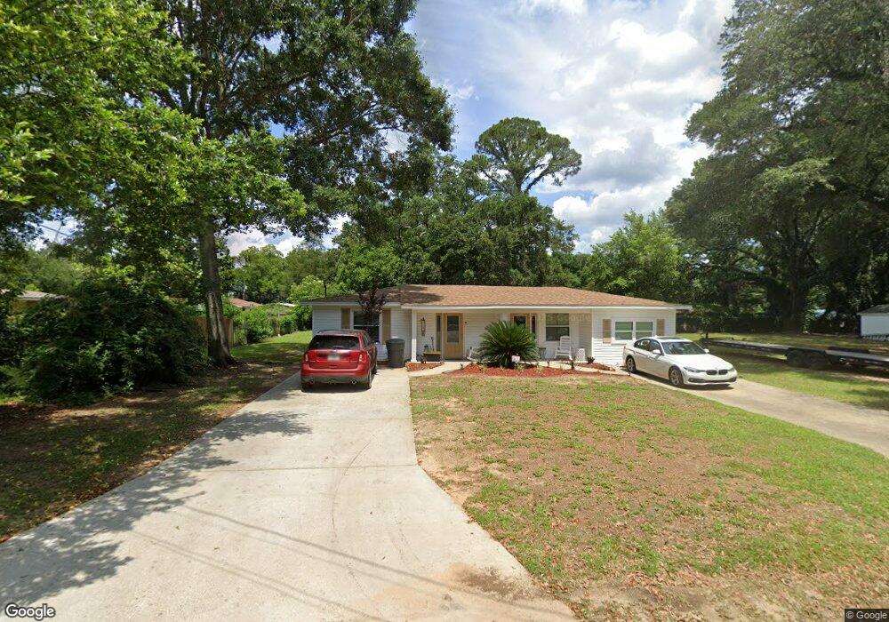
1010 Deason St Pensacola, FL 32505
Estimated Value: $102,329 - $163,000
--
Bed
1
Bath
1,304
Sq Ft
$100/Sq Ft
Est. Value
About This Home
This home is located at 1010 Deason St, Pensacola, FL 32505 and is currently estimated at $130,582, approximately $100 per square foot. 1010 Deason St is a home located in Escambia County with nearby schools including Brentwood Elementary School, J.H. Workman Middle School, and Pensacola High School.
Ownership History
Date
Name
Owned For
Owner Type
Purchase Details
Closed on
Jun 7, 2021
Sold by
Giannotti Linda and Giannotti David
Bought by
Coon Street Inc
Current Estimated Value
Purchase Details
Closed on
Sep 1, 2016
Bought by
Giannotti Linda D
Home Financials for this Owner
Home Financials are based on the most recent Mortgage that was taken out on this home.
Original Mortgage
$49,400
Interest Rate
3.43%
Mortgage Type
New Conventional
Create a Home Valuation Report for This Property
The Home Valuation Report is an in-depth analysis detailing your home's value as well as a comparison with similar homes in the area
Home Values in the Area
Average Home Value in this Area
Purchase History
| Date | Buyer | Sale Price | Title Company |
|---|---|---|---|
| Coon Street Inc | $62,100 | None Available | |
| Giannotti Linda D | $100 | -- |
Source: Public Records
Mortgage History
| Date | Status | Borrower | Loan Amount |
|---|---|---|---|
| Previous Owner | Giannotti Linda D | $49,400 |
Source: Public Records
Tax History Compared to Growth
Tax History
| Year | Tax Paid | Tax Assessment Tax Assessment Total Assessment is a certain percentage of the fair market value that is determined by local assessors to be the total taxable value of land and additions on the property. | Land | Improvement |
|---|---|---|---|---|
| 2024 | $1,218 | $86,662 | $10,000 | $76,662 |
| 2023 | $1,218 | $82,243 | $0 | $0 |
| 2022 | $1,127 | $74,767 | $10,000 | $64,767 |
| 2021 | $963 | $61,015 | $0 | $0 |
| 2020 | $870 | $54,697 | $0 | $0 |
| 2019 | $865 | $53,877 | $0 | $0 |
| 2018 | $856 | $52,141 | $0 | $0 |
| 2017 | $0 | $52,948 | $0 | $0 |
| 2016 | $517 | $51,859 | $0 | $0 |
| 2015 | $492 | $51,499 | $0 | $0 |
| 2014 | $469 | $51,091 | $0 | $0 |
Source: Public Records
Map
Nearby Homes
- 1011 Barnett St
- 303 Yoakum Ct
- 808 Cary Memorial Dr
- 316 Rosalyn Way
- 5896 Moss Ln
- 602 Palm Ct
- 103 Airport Blvd
- 125 Memory Ln
- 121 Airport Blvd
- 117 Hansen Blvd
- 701 Montclair Rd
- 117 Lenox Pkwy
- 810 Lucerne Ave
- 109 Bayliss Ct
- 718 Montclair Rd
- 809 Fremont Ave
- 800 Montclair Rd
- 812 Montclair Rd
- 325 Massachusetts Ave
- 4203 N P St
- 0 Deason St
- 1016 Deason St
- 1006 Deason St
- 1011 Cary Memorial Dr
- 1019 Cary Memorial Dr
- 1013 Deason St
- 1009 Cary Memorial Dr
- 1007 Deason St
- 1020 Deason St
- 1017 Deason St
- 1001 Deason St
- 214 W Michigan Ave
- 208 W Michigan Ave
- 1003 Cary Memorial Dr
- 1014 Armenia Dr
- 1012 Armenia Dr
- 200 W Michigan Ave
- 1008 Armenia Dr
- 1020 Armenia Dr
- 1026 Cary Memorial Dr