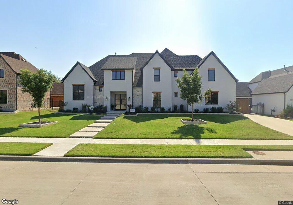
1010 Double B Trail Prosper, TX 75078
Estimated Value: $1,373,000 - $1,610,128
5
Beds
6
Baths
5,049
Sq Ft
$295/Sq Ft
Est. Value
About This Home
This home is located at 1010 Double B Trail, Prosper, TX 75078 and is currently estimated at $1,489,782, approximately $295 per square foot. 1010 Double B Trail is a home with nearby schools including Reynolds Middle School, Prosper High School, and Whispering Farms Montessori Academy.
Ownership History
Date
Name
Owned For
Owner Type
Purchase Details
Closed on
Jul 10, 2025
Sold by
Marshall James and Marshall Wendeline
Bought by
Jw Marshall Family Trust and Marshall
Current Estimated Value
Purchase Details
Closed on
Nov 4, 2021
Sold by
Jpa Development Corporation
Bought by
Marshall James and Marshall Wendeline
Home Financials for this Owner
Home Financials are based on the most recent Mortgage that was taken out on this home.
Original Mortgage
$260,000
Interest Rate
2.88%
Mortgage Type
Purchase Money Mortgage
Purchase Details
Closed on
Feb 9, 2021
Sold by
Griffin Land Company
Bought by
Jpa Development Corporation
Home Financials for this Owner
Home Financials are based on the most recent Mortgage that was taken out on this home.
Original Mortgage
$695,106
Interest Rate
2.6%
Mortgage Type
Construction
Create a Home Valuation Report for This Property
The Home Valuation Report is an in-depth analysis detailing your home's value as well as a comparison with similar homes in the area
Home Values in the Area
Average Home Value in this Area
Purchase History
| Date | Buyer | Sale Price | Title Company |
|---|---|---|---|
| Jw Marshall Family Trust | -- | None Listed On Document | |
| Marshall James | -- | Capital Title | |
| Jpa Development Corporation | -- | Capital Title |
Source: Public Records
Mortgage History
| Date | Status | Borrower | Loan Amount |
|---|---|---|---|
| Previous Owner | Marshall James | $260,000 | |
| Previous Owner | Jpa Development Corporation | $695,106 |
Source: Public Records
Tax History
| Year | Tax Paid | Tax Assessment Tax Assessment Total Assessment is a certain percentage of the fair market value that is determined by local assessors to be the total taxable value of land and additions on the property. | Land | Improvement |
|---|---|---|---|---|
| 2025 | $26,705 | $1,547,643 | $432,000 | $1,115,643 |
| 2024 | $26,144 | $1,462,634 | $432,000 | $1,100,786 |
| 2023 | $26,144 | $1,329,667 | $270,000 | $1,059,667 |
| 2022 | $28,425 | $1,300,000 | $270,000 | $1,030,000 |
| 2021 | $2,431 | $109,512 | $109,512 | $0 |
| 2019 | $2,685 | $109,512 | $109,512 | $0 |
| 2018 | $2,731 | $110,916 | $110,916 | $0 |
| 2017 | $2,521 | $102,384 | $102,384 | $0 |
| 2016 | $2,468 | $99,540 | $99,540 | $0 |
Source: Public Records
Map
Nearby Homes
- 960 Packsaddle Trail
- 1160 Saddle Creek Dr
- 1000 Circle j Trail
- 721 Broderick Ln
- 1211 Clipston Dr
- 1020 Jessica Ln
- 1001 Jessica Ln
- 1301 Clipston Dr
- 1311 Clipston Dr
- 900 Jessica Ln
- 1120 Circle j Trail
- 671 Sibyl Ln
- 1001 Bridgeport Ln
- 960 Georgetown Place
- 950 Georgetown Place
- 401 Komron Ct
- 1541 Pepperdine Place
- 981 Georgetown Place
- 971 Georgetown Place
- 1061 Georgetown Place
- 1000 Double B Trail
- 1020 Double B Trail
- 940 Double B Trail
- 1030 Double B Trail
- 1011 Double B Trail
- 1021 Double B Trail
- 691 Table Rock Dr
- 701 Table Rock Dr
- 1031 Double B Trail
- 1040 Double B Trail
- 920 Double B Trail
- 671 Table Rock Dr
- 901 Packsaddle Trail
- 1000 Ranahan Dr
- 911 Packsaddle Trail
- 711 Table Rock Dr
- 1020 Ranahan Dr
- 900 Double B Trail
- 1041 Double B Trail
- 1050 Double B Trail
Your Personal Tour Guide
Ask me questions while you tour the home.