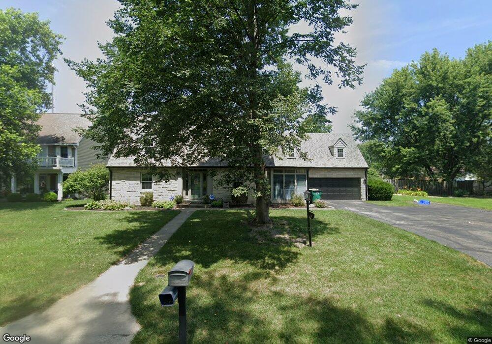
1010 E Adams Dr Franklin, IN 46131
Estimated Value: $418,000 - $546,000
3
Beds
3
Baths
2,936
Sq Ft
$166/Sq Ft
Est. Value
About This Home
This home is located at 1010 E Adams Dr, Franklin, IN 46131 and is currently estimated at $487,636, approximately $166 per square foot. 1010 E Adams Dr is a home located in Johnson County with nearby schools including Webb Elementary School, Franklin Community Middle School, and Custer Baker Intermediate School.
Ownership History
Date
Name
Owned For
Owner Type
Purchase Details
Closed on
Apr 7, 2016
Sold by
David Michael L and David Elizabeth P
Bought by
Willard Jessup and Willard Elizabeth
Current Estimated Value
Home Financials for this Owner
Home Financials are based on the most recent Mortgage that was taken out on this home.
Original Mortgage
$243,000
Outstanding Balance
$193,049
Interest Rate
3.68%
Mortgage Type
New Conventional
Estimated Equity
$315,393
Create a Home Valuation Report for This Property
The Home Valuation Report is an in-depth analysis detailing your home's value as well as a comparison with similar homes in the area
Home Values in the Area
Average Home Value in this Area
Purchase History
| Date | Buyer | Sale Price | Title Company |
|---|---|---|---|
| Willard Jessup | -- | None Available |
Source: Public Records
Mortgage History
| Date | Status | Borrower | Loan Amount |
|---|---|---|---|
| Open | Willard Jessup | $243,000 |
Source: Public Records
Tax History
| Year | Tax Paid | Tax Assessment Tax Assessment Total Assessment is a certain percentage of the fair market value that is determined by local assessors to be the total taxable value of land and additions on the property. | Land | Improvement |
|---|---|---|---|---|
| 2025 | $4,068 | $461,500 | $44,700 | $416,800 |
| 2024 | $4,068 | $364,800 | $44,700 | $320,100 |
| 2023 | $4,092 | $356,000 | $44,700 | $311,300 |
| 2022 | $3,843 | $337,200 | $32,500 | $304,700 |
| 2021 | $3,483 | $306,000 | $32,500 | $273,500 |
| 2020 | $3,494 | $306,800 | $32,500 | $274,300 |
| 2019 | $3,060 | $269,200 | $32,500 | $236,700 |
| 2018 | $2,625 | $259,100 | $32,500 | $226,600 |
| 2017 | $2,530 | $241,400 | $32,500 | $208,900 |
| 2016 | $2,469 | $227,600 | $32,500 | $195,100 |
| 2014 | $2,078 | $210,000 | $32,500 | $177,500 |
| 2013 | $2,078 | $196,200 | $32,500 | $163,700 |
Source: Public Records
Map
Nearby Homes
- 1110 Hillview Dr
- 1102 E Jefferson St
- 41 Middleton Dr
- 1240 Hillview Dr
- 750 Hurricane St
- 17 Morning Dr
- 801 Hurricane St
- 21 S Dawn Dr
- 698 Yandes St
- 601 Duane St
- 227 E Jefferson St
- 159 E King St
- 0 W 900 Hwy Unit 202537998
- 178 S Water St Unit F
- 76 E Wayne St Unit B
- 198 W King St
- 1083 Beechtree Ln
- 1908 Porter Dr
- 1185 Beechtree Ln
- 1682 Millpond Ln
- 1006 E Adams Dr
- 1080 E Adams Dr
- 310 North Dr
- 325 N Forsythe St
- 1015 E Adams Dr
- 250 N Forsythe St
- 1051 E Adams Dr
- 320 North Dr
- 1000 E Adams Dr
- 149 N Forsythe St
- 1091 E Adams Dr
- 330 North Dr
- 1101 Hillview Dr
- 1100 E Adams Dr
- 1006 E King St
- 1050 E King St
- 1010 E King St
- 1101 E Adams Dr
- 248 N Forsythe St
- 240 N Forsythe St
Your Personal Tour Guide
Ask me questions while you tour the home.