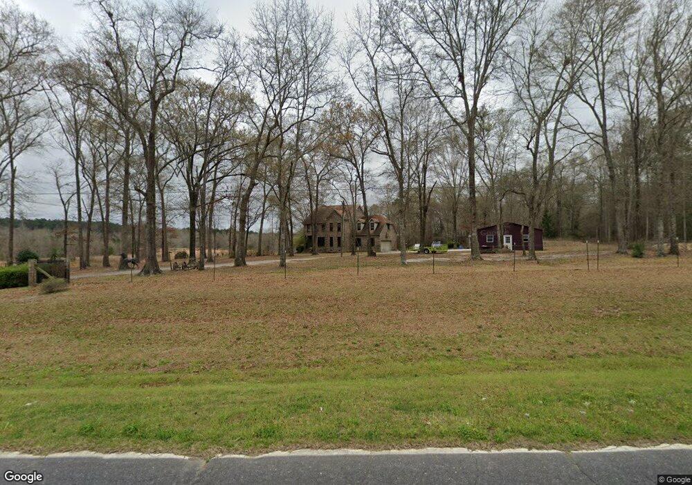
1010 Frank Cook Rd Cochran, GA 31014
Estimated Value: $305,000 - $495,000
4
Beds
4
Baths
2,668
Sq Ft
$153/Sq Ft
Est. Value
About This Home
This home is located at 1010 Frank Cook Rd, Cochran, GA 31014 and is currently estimated at $408,718, approximately $153 per square foot. 1010 Frank Cook Rd is a home located in Bleckley County with nearby schools including Bleckley County Primary School, Bleckley County Elementary School, and Bleckley Middle School.
Ownership History
Date
Name
Owned For
Owner Type
Purchase Details
Closed on
Jul 30, 2020
Sold by
Reagan Jeffery L
Bought by
Reagan Tina R
Current Estimated Value
Purchase Details
Closed on
Feb 28, 2006
Sold by
Stephan Peter D
Bought by
Reagan Jeffery L
Home Financials for this Owner
Home Financials are based on the most recent Mortgage that was taken out on this home.
Original Mortgage
$247,920
Interest Rate
6.19%
Mortgage Type
VA
Purchase Details
Closed on
Dec 31, 2003
Sold by
Smith Thomas A and Smith Kathy W
Bought by
Stephan Peter D and Karen Sue
Create a Home Valuation Report for This Property
The Home Valuation Report is an in-depth analysis detailing your home's value as well as a comparison with similar homes in the area
Home Values in the Area
Average Home Value in this Area
Purchase History
| Date | Buyer | Sale Price | Title Company |
|---|---|---|---|
| Reagan Tina R | -- | -- | |
| Reagan Jeffery L | $240,000 | -- | |
| Stephan Peter D | $235,000 | -- |
Source: Public Records
Mortgage History
| Date | Status | Borrower | Loan Amount |
|---|---|---|---|
| Previous Owner | Reagan Jeffery L | $247,920 |
Source: Public Records
Tax History Compared to Growth
Tax History
| Year | Tax Paid | Tax Assessment Tax Assessment Total Assessment is a certain percentage of the fair market value that is determined by local assessors to be the total taxable value of land and additions on the property. | Land | Improvement |
|---|---|---|---|---|
| 2024 | $3,697 | $140,200 | $13,680 | $126,520 |
| 2023 | $3,835 | $140,200 | $13,680 | $126,520 |
| 2022 | $3,359 | $125,440 | $13,680 | $111,760 |
| 2021 | $2,724 | $95,560 | $10,920 | $84,640 |
| 2020 | $2,724 | $95,560 | $10,920 | $84,640 |
| 2019 | $2,696 | $94,441 | $13,336 | $81,105 |
| 2018 | $2,778 | $94,441 | $13,336 | $81,105 |
| 2017 | $2,717 | $94,441 | $13,336 | $81,105 |
| 2016 | $2,719 | $94,441 | $13,336 | $81,105 |
| 2015 | -- | $94,441 | $13,336 | $81,105 |
| 2014 | -- | $94,441 | $13,336 | $81,105 |
| 2013 | -- | $94,441 | $13,336 | $81,105 |
Source: Public Records
Map
Nearby Homes
- 205 Smith Sapp Rd
- 0 Cheek Rd
- 191 Cheek Rd
- 0 Rock Hill Rd
- 176 Pineland Estates Rd
- 319 Country Club Rd
- 166 Pebble Hills Rd
- 178 Country Club Cir
- 0 Jones Rd
- 187 Osprey Rd
- 238 Wood Oak Cir
- 288 Frank Cook Rd
- 0 Wood Oak Cir Unit 233873
- 0 Wood Oak Cir Unit 9278951
- 0 Jordan Place
- Lots Crest Dr
- LAND Crest Dr
- 150 Wood Oak Cir
- 124 Pine Hill Dr
- LOT 46 Woodland Trail Rd
- 965 Frank Cook Rd
- 253 Roddy Rd
- 283 Roddy Rd
- 1042 Frank Cook Rd
- 277 Roddy Rd
- 1067 Frank Cook Rd
- 299 Roddy Rd
- 3856 Roddy Hwy
- 1075 Frank Cook Rd
- 1087 Frank Cook Rd
- 923 Frank Cook Rd
- 3810 Roddy Hwy
- 161 Roddy Rd
- 183 Herman Floyd Rd
- 3760 Roddy Hwy
- 276 Roddy Rd
- 857 Frank Cook Rd
- 239 Herman Floyd Rd
- 162 Roddy Rd
- 249 Purser Braddy Rd