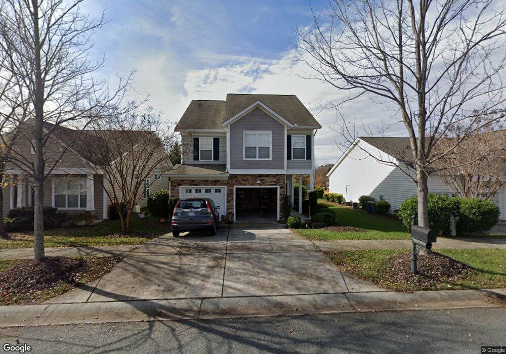
1010 Kensrowe Ln Matthews, NC 28104
Estimated Value: $451,000 - $466,000
3
Beds
3
Baths
1,955
Sq Ft
$236/Sq Ft
Est. Value
About This Home
This home is located at 1010 Kensrowe Ln, Matthews, NC 28104 and is currently estimated at $462,117, approximately $236 per square foot. 1010 Kensrowe Ln is a home located in Union County with nearby schools including Indian Trail Elementary School, Sun Valley Middle School, and Sun Valley High School.
Ownership History
Date
Name
Owned For
Owner Type
Purchase Details
Closed on
Nov 14, 2013
Sold by
Cronin Daniel J
Bought by
Cronin Daniel J and Adamo Joseph A
Current Estimated Value
Purchase Details
Closed on
May 24, 2013
Sold by
Meinders Gina and Meinders Paul
Bought by
Cronin Daniel J
Home Financials for this Owner
Home Financials are based on the most recent Mortgage that was taken out on this home.
Original Mortgage
$159,600
Outstanding Balance
$112,114
Interest Rate
3.44%
Mortgage Type
New Conventional
Estimated Equity
$350,003
Purchase Details
Closed on
Jul 25, 2005
Sold by
Westfield Homes Of The Carolinas Llc
Bought by
Clark Gina W
Home Financials for this Owner
Home Financials are based on the most recent Mortgage that was taken out on this home.
Original Mortgage
$121,130
Interest Rate
5%
Mortgage Type
Fannie Mae Freddie Mac
Create a Home Valuation Report for This Property
The Home Valuation Report is an in-depth analysis detailing your home's value as well as a comparison with similar homes in the area
Purchase History
| Date | Buyer | Sale Price | Title Company |
|---|---|---|---|
| Cronin Daniel J | -- | None Available | |
| Cronin Daniel J | $199,500 | None Available | |
| Clark Gina W | $181,500 | -- |
Source: Public Records
Mortgage History
| Date | Status | Borrower | Loan Amount |
|---|---|---|---|
| Open | Cronin Daniel J | $159,600 | |
| Previous Owner | Clark Gina W | $121,130 |
Source: Public Records
Tax History
| Year | Tax Paid | Tax Assessment Tax Assessment Total Assessment is a certain percentage of the fair market value that is determined by local assessors to be the total taxable value of land and additions on the property. | Land | Improvement |
|---|---|---|---|---|
| 2025 | $3,174 | $464,200 | $0 | $0 |
| 2024 | $2,634 | $299,300 | $62,000 | $237,300 |
| 2023 | $2,527 | $299,300 | $62,000 | $237,300 |
| 2022 | $2,506 | $299,300 | $62,000 | $237,300 |
| 2021 | $2,504 | $299,300 | $62,000 | $237,300 |
| 2020 | $2,206 | $215,800 | $45,000 | $170,800 |
| 2019 | $2,196 | $215,800 | $45,000 | $170,800 |
| 2018 | $2,196 | $215,800 | $45,000 | $170,800 |
| 2017 | $2,258 | $215,800 | $45,000 | $170,800 |
| 2016 | $2,273 | $215,800 | $45,000 | $170,800 |
| 2015 | $2,296 | $215,800 | $45,000 | $170,800 |
| 2014 | $1,498 | $211,590 | $50,000 | $161,590 |
Source: Public Records
Map
Nearby Homes
- 1038 Kensrowe Ln
- 1441 Hammond Dr
- 1046 Serel Dr
- 1348 Millbank Dr
- 5054 Stonehill Ln
- 6008 Brookfield Ct
- 1103 Clover Ln
- 4148 Cedar Point Ave
- 3306 Savannah Hills Dr
- 1009 Murandy Ln
- 4210 Wallbrook Dr
- 2080 Gable Way Ln
- 220 Sugar Maple Ln
- 636 Deodar Cedar Dr
- 621 Deodar Cedar Dr
- 612 Deodar Cedar Dr
- 632 Deodar Cedar Dr
- 707 Yellow Poplar Ln
- 102 River Birch Ln
- 406 Sugar Maple Ln
- 1018 Kensrowe Ln
- 1024 Kensrowe Ln
- 1357 Millbank Dr
- 1357 Millbank Dr Unit 108
- 1365 Millbank Dr
- 1028 Kensrowe Ln
- 1013 Kensrowe Ln
- 1017 Kensrowe Ln
- 1023 Kensrowe Ln
- 1009 Kensrowe Ln
- 1373 Millbank Dr
- 1003 Kensrowe Ln
- 1316 Millbank Dr
- 1316 Millbank Dr Unit 139
- 1308 Millbank Dr
- 1031 Kensrowe Ln
- 1032 Kensrowe Ln
- 1324 Millbank Dr
- 1300 Millbank Dr
- 1223 Millbank Dr
Your Personal Tour Guide
Ask me questions while you tour the home.