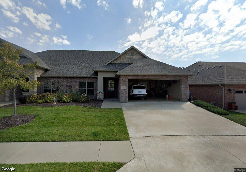
1010 Marcassin Dr Columbia, MO 65201
Old Hawthorne NeighborhoodEstimated Value: $449,873 - $617,000
3
Beds
3
Baths
2,113
Sq Ft
$252/Sq Ft
Est. Value
About This Home
This home is located at 1010 Marcassin Dr, Columbia, MO 65201 and is currently estimated at $531,624, approximately $251 per square foot. 1010 Marcassin Dr is a home located in Boone County with nearby schools including Cedar Ridge Elementary School, Oakland Middle School, and Muriel W. Battle High School.
Ownership History
Date
Name
Owned For
Owner Type
Purchase Details
Closed on
May 4, 2022
Sold by
Schooley Michael L and Schoole Cynthia
Bought by
Schooley Michael L
Current Estimated Value
Purchase Details
Closed on
Feb 5, 2018
Sold by
Schooley Michel L and Schooley Cynthia S
Bought by
The Michael L Schooley Cynthia S Schoole
Purchase Details
Closed on
Dec 6, 2016
Sold by
Lifestyle Homes Inc
Bought by
Schooley Michael L and Schooley Cynthia S
Home Financials for this Owner
Home Financials are based on the most recent Mortgage that was taken out on this home.
Original Mortgage
$246,000
Interest Rate
3.47%
Mortgage Type
New Conventional
Create a Home Valuation Report for This Property
The Home Valuation Report is an in-depth analysis detailing your home's value as well as a comparison with similar homes in the area
Home Values in the Area
Average Home Value in this Area
Purchase History
| Date | Buyer | Sale Price | Title Company |
|---|---|---|---|
| Schooley Michael L | -- | None Listed On Document | |
| The Michael L Schooley Cynthia S Schoole | -- | None Available | |
| Schooley Michael L | -- | Central Title Co | |
| Lifestyle Homes Inc | -- | Boone Central Title Co |
Source: Public Records
Mortgage History
| Date | Status | Borrower | Loan Amount |
|---|---|---|---|
| Previous Owner | Schooley Michael L | $246,000 |
Source: Public Records
Tax History
| Year | Tax Paid | Tax Assessment Tax Assessment Total Assessment is a certain percentage of the fair market value that is determined by local assessors to be the total taxable value of land and additions on the property. | Land | Improvement |
|---|---|---|---|---|
| 2025 | $3,732 | $63,308 | $8,740 | $54,568 |
| 2024 | $3,730 | $55,290 | $8,740 | $46,550 |
| 2023 | $3,699 | $55,290 | $8,740 | $46,550 |
| 2022 | $3,695 | $55,290 | $8,740 | $46,550 |
| 2021 | $3,702 | $55,290 | $8,740 | $46,550 |
| 2020 | $3,940 | $55,290 | $8,740 | $46,550 |
| 2019 | $3,940 | $55,290 | $8,740 | $46,550 |
| 2018 | $3,968 | $0 | $0 | $0 |
| 2017 | $3,920 | $55,290 | $12,635 | $42,655 |
| 2016 | $2,479 | $35,036 | $12,635 | $22,401 |
| 2015 | $2,277 | $35,036 | $12,635 | $22,401 |
| 2014 | -- | $35,036 | $12,635 | $22,401 |
Source: Public Records
Map
Nearby Homes
- 5947 Screaming Eagle Ln
- 5959 Screaming Eagle Ln
- 1210 Marcassin Dr
- 801 Sunstone Ln
- 5624 Lightpost Dr
- LOT 216 Lightpost Ct
- LOT 310 Overbrook Ct
- 5602 Lightpost Ct
- 1205 Shallow Ridge Cir
- LOT 115 Old Hawthorne Dr
- LOT 120 Old Hawthorne Dr
- LOT 124 Old Hawthorne Dr
- LOT 122 Old Hawthorne Dr
- LOT 134 Old Hawthorne Dr
- LOT 133 Old Hawthorne Dr
- LOT 130 Old Hawthorne Dr
- LOT 126 Old Hawthorne Dr
- LOT 127 Old Hawthorne Dr
- LOT 116 Old Hawthorne Dr
- LOT 118 Old Hawthorne Dr
- 1012 Marcassin Dr
- 1014 Marcassin Dr
- 1004 Marcassin Dr
- 1100 Marcassin Dr
- 1011 Marcassin Dr
- 1009 Marcassin Dr
- 1013 Marcassin Dr
- 1000 Marcassin Dr
- 1102 Marcassin Dr
- 1007 Marcassin Dr
- 1017 Caymus Ct
- 1015 Marcassin Dr
- 1005 Marcassin Dr
- 1101 Caymus Ct
- 1101 Marcassin Dr
- 1009 Caymus Ct
- 1003 Marcassin Dr
- 1104 Marcassin Dr
- LOT 933 Caymus Ct
- 1103 Marcassin Dr
Your Personal Tour Guide
Ask me questions while you tour the home.