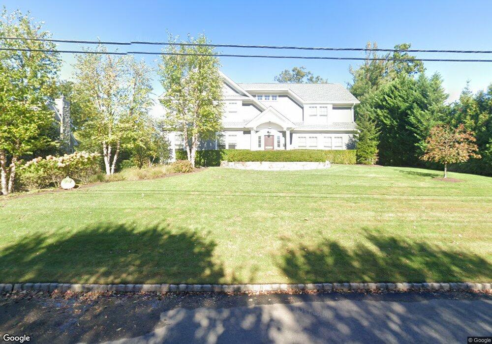
1010 Minisink Way Westfield, NJ 07090
Estimated Value: $2,263,457 - $2,419,000
--
Bed
--
Bath
4,314
Sq Ft
$541/Sq Ft
Est. Value
About This Home
This home is located at 1010 Minisink Way, Westfield, NJ 07090 and is currently estimated at $2,334,864, approximately $541 per square foot. 1010 Minisink Way is a home located in Union County with nearby schools including Franklin Elementary School, Roosevelt Intermediate School, and Westfield Senior High School.
Ownership History
Date
Name
Owned For
Owner Type
Purchase Details
Closed on
Jul 26, 2016
Sold by
John Kelly
Bought by
Katt Brian and Katt Tracy
Current Estimated Value
Home Financials for this Owner
Home Financials are based on the most recent Mortgage that was taken out on this home.
Original Mortgage
$900,000
Outstanding Balance
$717,399
Interest Rate
3.45%
Estimated Equity
$1,617,465
Purchase Details
Closed on
Sep 17, 2007
Sold by
Jennis Esther L
Bought by
Kelly John and Kelly Mary
Create a Home Valuation Report for This Property
The Home Valuation Report is an in-depth analysis detailing your home's value as well as a comparison with similar homes in the area
Home Values in the Area
Average Home Value in this Area
Purchase History
| Date | Buyer | Sale Price | Title Company |
|---|---|---|---|
| Katt Brian | -- | -- | |
| Kelly John | $1,180,000 | Stewart Title Guaranty Compa |
Source: Public Records
Mortgage History
| Date | Status | Borrower | Loan Amount |
|---|---|---|---|
| Open | Katt Brian | $900,000 | |
| Closed | Katt Brian | -- |
Source: Public Records
Tax History Compared to Growth
Tax History
| Year | Tax Paid | Tax Assessment Tax Assessment Total Assessment is a certain percentage of the fair market value that is determined by local assessors to be the total taxable value of land and additions on the property. | Land | Improvement |
|---|---|---|---|---|
| 2025 | $34,052 | $1,512,100 | $792,500 | $719,600 |
| 2024 | $33,357 | $1,512,100 | $792,500 | $719,600 |
| 2023 | $33,357 | $1,512,100 | $792,500 | $719,600 |
| 2022 | $32,661 | $1,512,100 | $792,500 | $719,600 |
| 2021 | $32,707 | $1,512,100 | $792,500 | $719,600 |
| 2020 | $32,631 | $1,512,100 | $792,500 | $719,600 |
| 2019 | $32,510 | $1,512,100 | $792,500 | $719,600 |
| 2018 | $23,057 | $248,000 | $136,100 | $111,900 |
| 2017 | $22,930 | $248,000 | $136,100 | $111,900 |
| 2016 | $20,830 | $230,700 | $136,100 | $94,600 |
| 2015 | $20,415 | $230,700 | $136,100 | $94,600 |
| 2014 | $24,020 | $280,700 | $136,100 | $144,600 |
Source: Public Records
Map
Nearby Homes
- 113 Barchester Way
- 1163 Lawrence Ave
- 2588 Liberty Ave
- 122 Stanmore Place
- 740 Lawrence Ave
- 232 Beechwood Ct
- 143 Stanmore Place
- 414 Roberts Ln
- 11 Mountainview Dr
- 1463 Dunn Pkwy
- 1503 Woodacres Dr
- 559 Lawrence Ave
- 819 Standish Ave
- 2406 Park Place
- 2398 Hamlette Place
- 26 Riga Ct Unit 3A
- 16 Riga Ct Unit 2B
- 869 Standish Ave
- 7 Riga Ct
- 869 Ternay Ave
- 1020 Minisink Way
- 1000 Minisink Way
- 1011 Wyandotte Trail
- 1001 Wyandotte Trail
- 1011 Minisink Way
- 1021 Wyandotte Trail
- 1001 Minisink Way
- 1030 Minisink Way
- 1021 Minisink Way
- 1031 Wyandotte Trail
- 965 Minisink Way
- 1031 Minisink Way
- 950 Minisink Way
- 151 Hamilton Ave
- 153 Hamilton Ave
- 953 Wyandotte Trail
- 955 Minisink Way
- 1041 Minisink Way
- 1010 Wyandotte Trail
- 145 Hamilton Ave